Adding focal plane solid models
The combination of focal mechanism diagrams and depth data is intended to convey a full three-dimensional understanding of earthquake distributions. However, it is difficult for an observer to determine whether a particular nodal plane is shared by neighboring seismic events or whether a plane’s orientation is precisely parallel to an underlying map feature, for example. To aid visualization and analysis, solid models of nodal planes are here added to the beach balls (Figure 9).
Figure 9a. Nodal planes

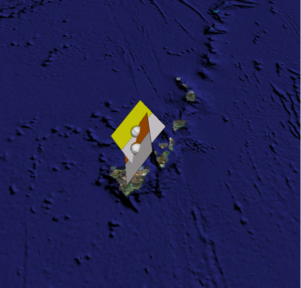
Addition of nodal plane solid models aids visualization of the spatial relationships of neighboring focal mechanisms. It is clear that both hypocenters lie on a common nodal plane.
View of data from the Kiholo Bay event, Hawaii, 2006 (data from USGS NEIC and Havard/LDEO).
Figure 9b. Nodal planes - alternate view
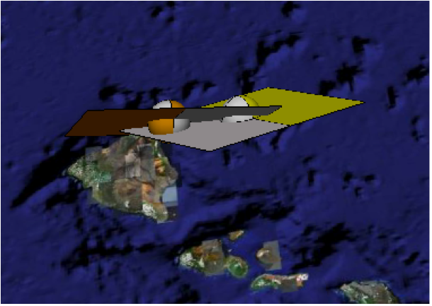
Another View of the same data from the Kiholo Bay event, Hawaii, 2006 (data from USGS NEIC and Havard/LDEO)
Figure 9c. Fault plane versus auxiliary plane

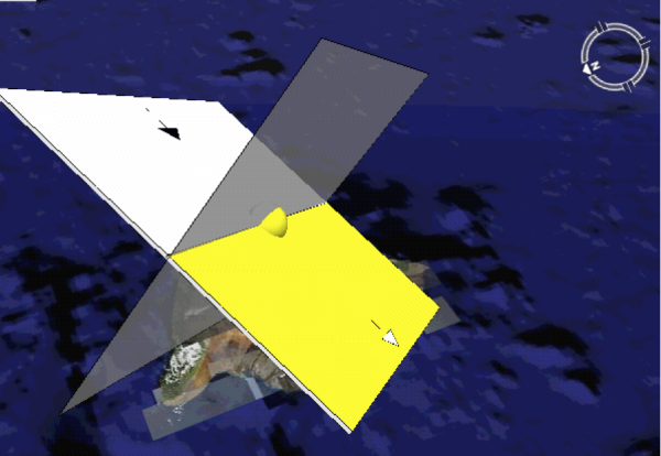
Solid models for the fault plane (arrows indicate sense of double-couple shear) and the auxiliary plane (semi-transparent). Beach ball is visible at center.
The planes are colored where they bound contractional first motions (T quadrants) and are white where adjacent to dilatational (P) quadrants of the associated beach balls. Default versions of the models are included in the download file with the file names such as NP_Black. dae, NP_Blue.dae, etc. Variants with small arrows marking fault slip directions are labeled NParo_Black.dae, NParo_Blue.dae, etc.
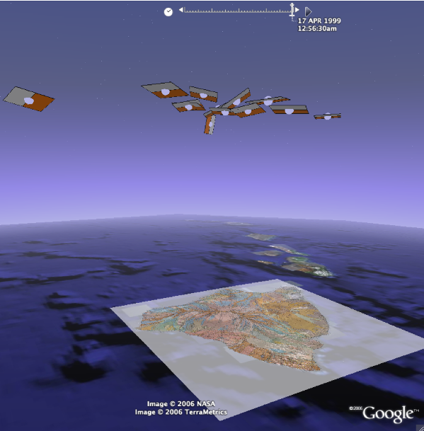
The example illustrated in Figure 9 represents two different focal mechanism solutions for the 2006 Kiholo Bay earthquake. The same approach could be taken to representing aftershocks and neighboring historic events. In Figure 10, multiple nodal planes for historic earthquakes in the Hawaiian eastern rift zone reveal the presence of a low angle décollement surface. Click here for a movie version of this image [Kiholo Bay movie]
Figure 10. Hawaiian historic data
Nodal plane solid models for historic earthquakes (1970 - present, as reported by the USGS NEIC) in the eastern rift zone of Hawaii’s main island reveal the presence of a gently northwest-dipping décollement. Foci are bumped out by 50 km.