Introduction
To the heart of the Hellenic chain in Continental Greece, the Mesohellenic basin (MHB) is a major sedimentary basin of the Tethyan orogenic belt (Fig. 1A and 1B). This basin extends from Albania to northern Greece, at the boundary between the two main structural zones of the Hellenides : to the east, the internal zones, that were submitted to obduction in the Jurassic, and, to the west, the external zones which were only tectonized during the Cenozoic. Today, the MHB is a hilly landscape including sandstones, siltstones and conglomerates, at a present elevation of 700 m (in the south) to more than 1000 m (in the north), surrounded by the Pindos mountains to the W and the Pelagonian domain to the E.
The MHB is of importance because of its: (i) large size and a thick sedimentary pile (about 4,5 km of vertical thickness for c.a. 20 Ma) pointing to major orogenic processes ; ii) detailed sedimentary record, dominated by various submarine gravity siliciclastic deposits; (iii) lower Cenozoic age, which is a poorly known period of the Internal Hellenic chain ; iv) original geodynamic location and evolution (in the middle part of the orogenic belt and on the upper tectonic unit).
There are various interpretations as regarding to the processes at origin of the MHB, which would be either a retroarc foreland basin [Doutsos 1994], a strike-slip half graben ([Zelilidis et al., 2002], a large piggy-back basin [Ferriere et al., 2004], or mostly a pull-apart basin [Vamvaka et al., 2006]. In this article, we will present and discuss the successive interpretations of the MHB, focusing on its evolution (nature and changes of depositional setting) and on the related possible controls (eustacy, tectonics) in the perspective of the large scale geodynamics of this part of the Hellenides (subduction, collision).
Figure 1A. Location of the Mesohellenic basin (MHB).
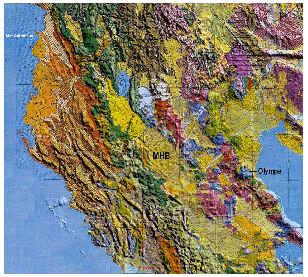
Location of the Mesohellenic basin (MHB) as the southern part of The Albano-Thessalian basin. The Tertiary basins in the eastern internal domain are represented in yellow color (geologic map superimposed on the MNT GTOPO_30, modified after Qirjaku Kaleshi [2000].
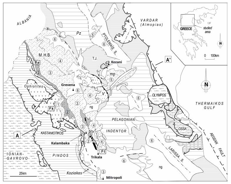
Figure 1B. Simplified geological map of the Mesohellenic Basin (MHB)
Simplified geological map of the Mesohellenic Basin (MHB) in northern continental Greece (modified after Ferriere et al., 2004). 1 to 4 : main Formations of the MHB, 1: Krania and Rizoma (Late Eocene), 2: Eptachorion (Latest Eocene ?- Oligocene p.p), 3: Taliaros-Pentalofon (Late Oligocene-Early Miocene), 4: Tsotyli-Ondrias-Orlias (Early to Middle Miocene) ; 5: Ptolemais basin (Late Miocene-Pliocene, mp), 6: recent deposits. Abr. Pz: Paleozoic, TJ: Triassic and Jurassic, ng : Neogen., S: Synclines ; Fe, Fk, and Ft: faulted-flexures of Eptachorion (Fe) Krania (Fk), and Theopetra-Theotokos (Ft). AA’: cross-section (Fig. 2). Bold lines: major tectonic contacts,with rectangular boxes: late Jurassic thrusts, with white triangles: main Tertiary thrusts. Lines with black triangles: tertiary back-thrusts or main reverse series. Dashed lines: normal faults.