- Home
- Journal
- 2017 -- 50, 51
- 2016 -- 49, 50
- 2015 -- 48
- 2014 -- 46, 47
- 2013 -- 44, 45
- 2012 -- 40, 41, 42, 43
- 2011 -- 37, 38, 39
- 2010 -- 35, 36
- 2009 -- 31, 32, 33, 34
- 2008 -- 28, 29, 30
- 2007 -- 25, 26, 27
- 2006 -- 21, 22, 23, 24
- 2005 -- 18, 19, 20
- 2004 -- 14, 15, 16, 17
- 2003 -- 10, 11, 12, 13
- 2002 -- 6, 7, 8, 9
- 2001 -- 3, 4, 5
- 2000 -- 1, 2
- Editorial Board
- Policies
2012 Issues
Edited by: Gordon S. Lister
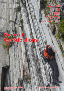
General contributions during 2012. Front cover shows mylonites in the Stellihorn shear zone, by the Mattmarksee, in the western part of the Lepontine culmination in the Swiss Alps (Clemens Augenstein for scale).
Edited by:
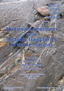
Superimposed rock fabrics can be marked by the growth of successive mineral assemblages, and thus testify as to the relative displacement of tectonic units throughout different structural levels within active zones of the lithosphere. Relicts of these deformation and growth episodes survive as mosaic-like domains with different and diachronous textures and mineral equilibria. Such apparent complexity of the meso- and micro-structure constitutes the geologic record of axial orogenic zones of the crust and may be decrypted by analysing deformation heterogeneities from map to granular scale. In naturally deformed rocks this heterogeneity may depend on pre-existing structures, on compositional variations, on the onset of localised processes of reaction softening or hardening or on the localised catalysing effects of deformation.
The memory of a single rock in a poly-deformed terrane depends on the interplay of factors such as the physical conditions of metamorphism, deformation history, diffusion and fluid infiltration. Usage of the petro-structural memory of crustal and mantle rocks leads to reinterpretation of the metamorphic structure of nappe belts of axial orogenic zones in more realistic and physical terms. Contributions include field and laboratory analysis on natural tectonic systems at various scales.
Edited by: Gordon S. Lister
Wide ranging contributions on relevant topics pertaining to the geology of Greece.
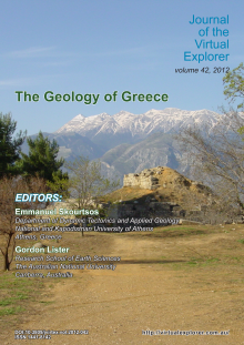
The front cover photograph (provided by Dr Manolis Skourtsos) is symbolic in that it shows the tectonic window of Mount Taygetos in the southern Peleponnese from the ruins of ancient Sparta. In the foreground there is a pyramidal structure made of large well curved stones located at the archaeological site of Menelaion, near the modern city of Sparta. This Mycenaean settlement is attributed to the Homeric Sparta, in the kingdom of Menelaus. Mt Taygetos in the background is built mainly of metaclastic rocks followed by Mesozoic and Tertiary aged marbles belonging to the deepest geotectonic unit of the External Hellenides, the Plattenkalk or Crete-Mani Unit.
Edited by:
Oroclines are secondary bends or buckles of an originally more linear orogen. They have been documented on all continents and affecting Archean to present day orogenic belts. In order to understand the tectonic and paleogeographic significance of a buckled orogen, it is necessary to first palinspastically restore the oroclines affecting the orogen. There remains, however, a lack of consensus regarding the processes responsible for orocline formation, and hence over their paleogeographic significance. Ongoing debates concern: (1) the three dimensional geometry of oroclines (are they thin-skinned, ending down against mid-crustal detachments, or do they involve the entire lithosphere?); (2) how orocline formation is accommodated in adjacent lithosphere; and, (3) if oroclines form in response to orogen-normal stresses imposed by either rollback or indentation, or if they represent buckles attributable to orogen-parallel compression. Contributions to this special issue on oroclines include comprehensive geological and geophysical studies of bent orogens from Australia, South American and Europe, all aimed at resolving the tectonic and paleogeographic questions posed by oroclines.
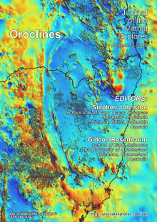
Cover Image: A map showing the total magnetic intensity across the southern New England Orogen (after Milligan et al., 2010) of eastern Australia nicely images the oroclines that characterize the orogen. The convex to the north bend imaged immediately east of the north arrow constitutes the Texas orocline, which is continuous with and coupled to the convex to the south Coffs Harbour orocline farther to the east. To the south, the orogen describes two additional oroclines including the convex to the south Manning orocline in the west, and the more easterly (and less obvious) Hastings-Nambucca orocline. See papers by Glen & Roberts and Rosenbaum in this issue.


