Introduction
It is not an exaggeration to say that the discipline of Geology of Urban Areas, today widely accepted in the scientific community, was begun in large part because of the innovative and creative work of professor Renato Funiciello, who unveiled the relationships between geology and urban development, bounding linkages across disciplines, which involve engineering, architecture, archaeology, urban planning, civil protection and more. Renato Funiciello (1939-2009) had a precise idea of the role that geology has and can play as a social discipline. Geology was, for Funiciello, the center of a continuum where there is no distinction between exact sciences, natural sciences and social sciences. This is because, for Renato Funiciello, planning and management of a modern society made up of complex systems like those of urban areas are not possible without the complete reading of the relationships between natural and human environment in space and time.
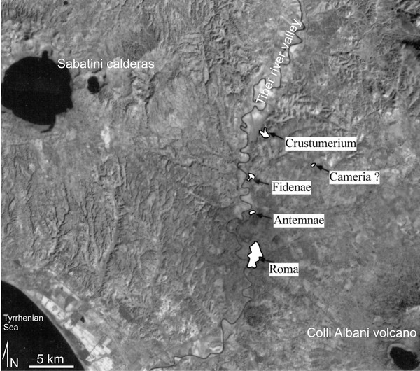
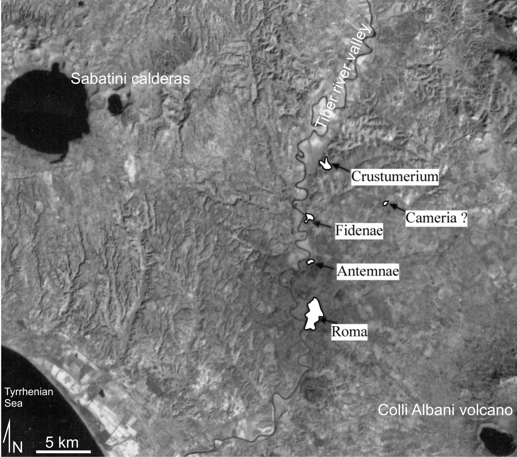
Figure 1. Location of archaic pre-Roman villages along the Tiber river valley at the beginning of the II millenium B.C.E.
Rome, a city much loved by Funiciello, has been the place to discover and unveil those relationships. For anyone who has had the great pleasure, it was an exciting discovery to listen Renato Funiciello depicting the relationships between the development of the city and the geological history, ranging from the description of the first geological map of a urban area prepared by Brocchi for Rome in 1820, to the disputes between Neptunists and Plutonists for the interpretation of volcaniclastic deposits, to the urban stratification linked to earthquakes, floods of the Tiber, and landslides, to the current plans for the underground transport network.
Syntheses of this vision and knowledge are contained in two monumental monographs devoted to Rome and its municipalities (Funiciello, 1995; Funciello et al., 2008), prototype and model for any study of urban areas. Developing this type of systemic approach, where the Geology of Urban Areas becomes a driving force for multidisciplinary interaction, with the aim to serve society, is the legacy of Renato Funiciello.
The geology of the Roman area is one of the most studied for the excellent exposures of the sedimentary succession, and the interconnections with the 3,000 years of history of the city. The characteristics of the environment have played a major role in promoting the excellence of Roma as a political, economic and administrative power, the so called Caput Mundi.
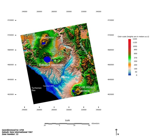
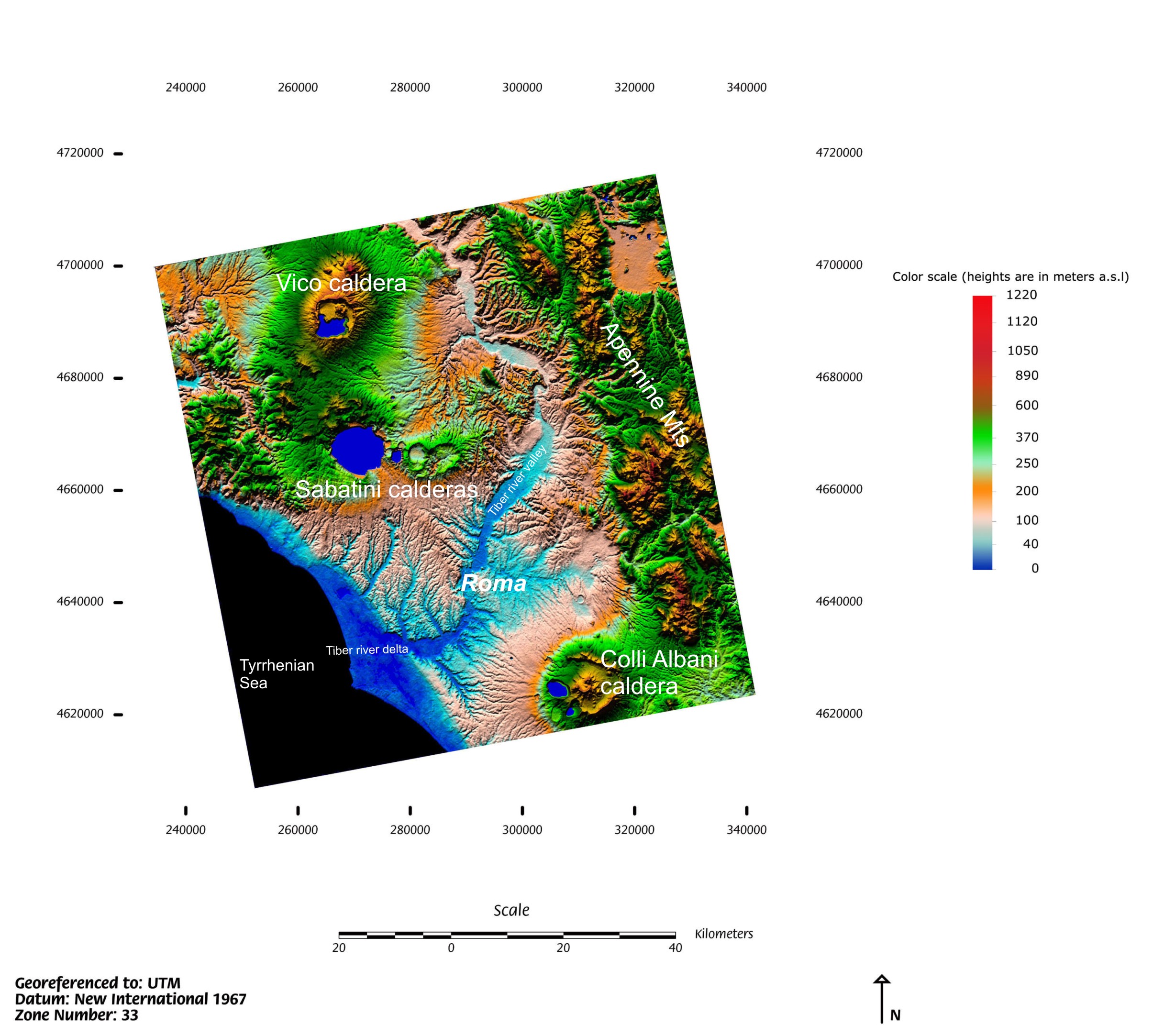
Aside from the anthropological and ethnological factors, the positive geological and geomorphological settings have favoured the settlement of several arcaic villages along the left bank of the Tiber River since the beginning of third millennium B.C. These ancient villages constituted the proto-Roma and were built in very close succession and space from north to south from the arcaic site of Crustumerium, Fidenae, Antemnae and finally to the site of Roma (Fig. 1). The sites were strategically located, at the northwestern edge of the Colli Albani volcano ignimbrite plateau (Fig. 2), where tuffs are cut through by the nearby Tiber river fluvial network, leaving isolated tuffaceous cliffs dominating the alluvial plain. Such setting was also favourable for the abundance of spring waters and the large availability of building stones, which promoted a quick technological development of building and infrastructures to the growing town. The strategic location along with the good microclimate also had the capability to avoid the negative influence of the malaric plains distributed along the Tyrrhenian coastline in the past times.
One of those proto-historic villages prevailed progressively over the others, extending its power over the entire Latium region, and later over Italy, Europe and the Mediterranean: Roma.