General setting
Approximately 40 percent of Italy’s surface is occupied by mountains. These are mostly everywhere fringed by hills which occupy another 40 percent of the total surface. The remaining 20 percent is made up by plains and mostly by the Po plain. The latter, as well as most of the minor plains, are intermountain and/or coastal plains genetically related to the nearby mountains. A SRTM image of Italy is shown in Fig. 1.
Figure 1. Shaded relief and colored elevation map of Italy
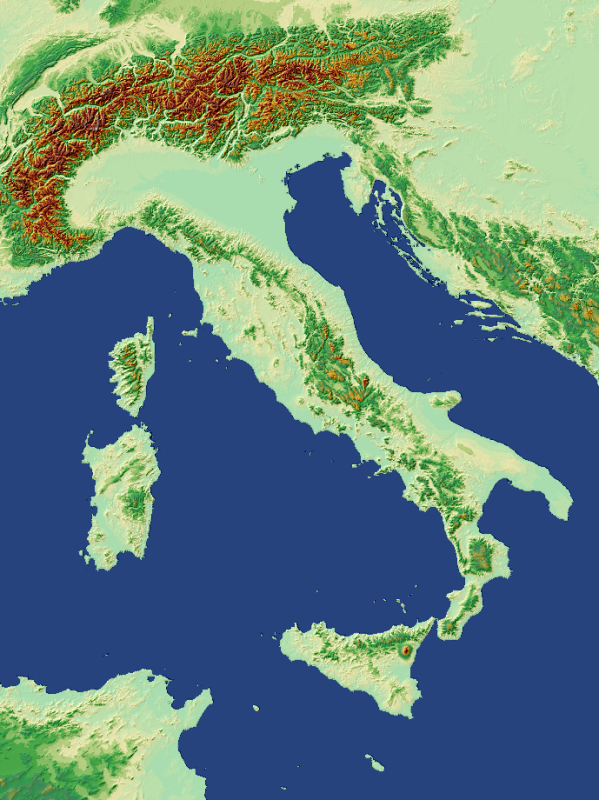 |
Shaded relief and colored elevation map of Italy generated from NASA SRTM, 90 m resolution.
Following the classification of Hammond (1964), Guzzetti and Reichenbach (1994) made a quantitative analysis of a 230 m DEM, which resulted in the image of Fig. 2. In the Apennines, just the backbone is classified as upland, while the whole Alpine region virtually belongs to the third type of terrain physiography. The dichotomy mainly reflects the different lithologies prevailing in the two chains.
As a matter of fact, only over the Alps (except for two small areas of the Central Apennine – see ahead) the highest relief class is widely attained, since the Alpine region features both competent rocks and relevant exhumation surface uplift and denudation rates, reaching and at places outpacing 1 mm/y (Bernet et al., 2001; Schlunegger, Hinderer, 200; Hinderer, 2001; Wittmann et al., 2007).
Figure 2. Map of Italian topography
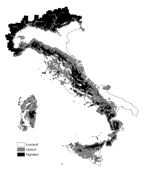
Map of Italian topography based on four variables: elevation, slope curvature, frequency of slope reversal and elevation/relief ratio. Reprinted from Geomorphology, Vol. 11, Guzzetti, Reichenbach, (1994), Towards a definition of topographic divisions for Italy, 57-74. Copyright with permission from Elsevier.
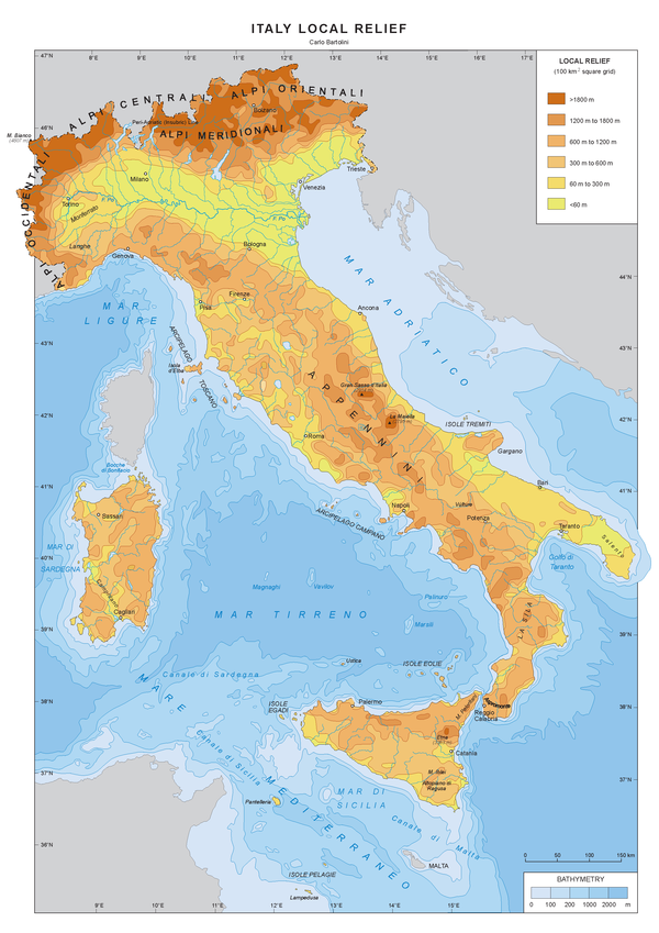
It should be noticed that the average dimension of the glacial throughs, a characteristic feature of the relief in the Alpine region, is well suited to the chosen grid scale. This is not the case in peninsular Italy, which features a rather minute relief that cannot be accurately evidenced with such a relatively large grid scale of local relief analysis.
Beside the Po plain, low relief areas are scatterd all over peninsular Italy in intermountain and coastal plains. The low relief Salento peninsula is a litho-structurally controlled erosion surface.
Local relief, analyzed at the 100 km2 grid scale (Fig. 3), appears to be mostly influenced by rock competence and secondarily by present rock uplift rates.
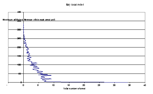
Figure 4. Frequency distribution (25 m interval classes) of local relief
Six-hundred ninety unit areas – over a total of 3536 – feature a relief ≤ of 75 m.