Relating nodal planes and surfaces to first arrivals
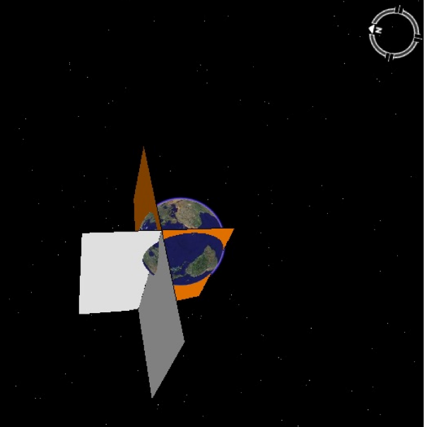
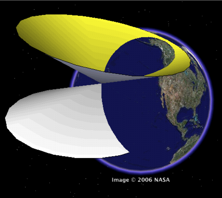
While experimenting with solid models of nodal planes and biconic surfaces, the author discover the truly remarkable capacity of Google Earth to represent very large objects. Figure 12a shows two nodal planes with <x> <y> <z> scale tags (Table 4) set to extend across the diameter of the Earth. The planes slice the Earth into regions of compressional (“up”) and dilatational (“down”) first arrivals. These models are extremely useful for pedagogy as they relates the zones of distinct first arrivals to the orientation of the focal mechanism diagram, and they may also have research applications in checking on the consistency of regional geoseismic data, especially for complex cases of non-double-couple solutions (Figure 12b). Click here for a movie version [Nodal planes movie]
Figure 12a. Global scale nodal planes
Nodal plane solid models are here magnified to a global scale. Beach ball lies at the center of the line of intersection of the nodal planes but is not visible in this view. This visualization is extremely useful for illustrating the relationship between the quadrants of the geophysical beach ball (not visible in this view) and the regions of the earth surface that record “up” versus “down” first motions.
Figure 12b. Global scale nodal surface

Bi-cone solid model of non-DC nodal surface here magnified to a global scale. This visualization is useful for illustrating the relationship between the regions of the geophysical basket ball (at apex – not visible) that receive distinct first motions.