Specifying event location and altitude
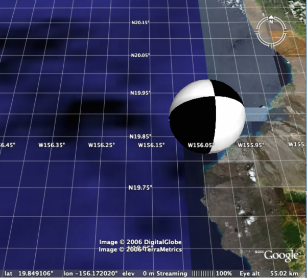
The location and altitude of a model may be changed using the Google Earth interface of (Figure 5) or by dragging the model’s center point in real-time edit mode. However, changes made at run time are not recorded in an existing source KML document. An alternative approach is to open the KML document in a text editor and paste in the code shown in Table 3.
Table 3: Specification of Model Location in KML
<?xml version='1.0' encoding='UTF-8'?>
<kml xmlns='http://earth.google.com/kml/2.1'>
<Placemark>
<Model>
<altitudeMode>absolute</altitudeMode>
<Location>
<longitude>-156.059</longitude>
<latitude>19.842</latitude>
<altitude>1000</altitude>
</Location>
<Link>
<href>http://users.wpi.edu/~declan/models/BB_Black.dae</href>
</Link>
</Model>
</Placemark>
</kml>
After the KML document is saved in the text editor, the version simultaneously open in Google Earth may be “reverted.” In the example shown in Figure 7, the altitude value is in meters so the altitude of the beach ball’s center is 1 km above sea level.
Note that both in the interface of Figure 5 and the code of Table 3, the altitude mode must be chosen as either “absolute” or “relative to ground”. For focal mechanism data, absolute elevation is appropriate.