Two general types of queries, spatial and aspatial, can be performed with GIS. Aspatial queries are questions about the attrib¬utes of features like how much metallic minerals are present at any specific location whereas, on the other hand, estimation of metallic minerals in any particular district is a spatial query. The location of the minerals will be reported and could be presented in the map form. Many queries can be applied to the data but few exemplary queries along with their results have been summarized in Table 3.
Table 3: Selected exemplary queries along with their results in the form of maps.
Table 3. Selected exemplary queries along with their results in the form of maps
| Sr. No. | Query | SQL Query | Result |
|---|---|---|---|
| 1. | Show all OGDCL oil and gas wells drilled in 2004 with target depth less than 3300 ft. | ( [Target_dep] < 3300) and ([Spud_dt] = 2004 ) and ([Operator] = "OGDCL" ) | Result of this query has been displayed in Figure 2 |
| 2. | Show all earthquakes with magnitude greater than or equal to 5 having epicenter at depth greater than or equal to 100 km. | ( [Mag.] >= 5) and ([Dep_km] >= 100 ) | Result of this query has been displayed in Figure 3. |
Figure 2. Result of query No. 01
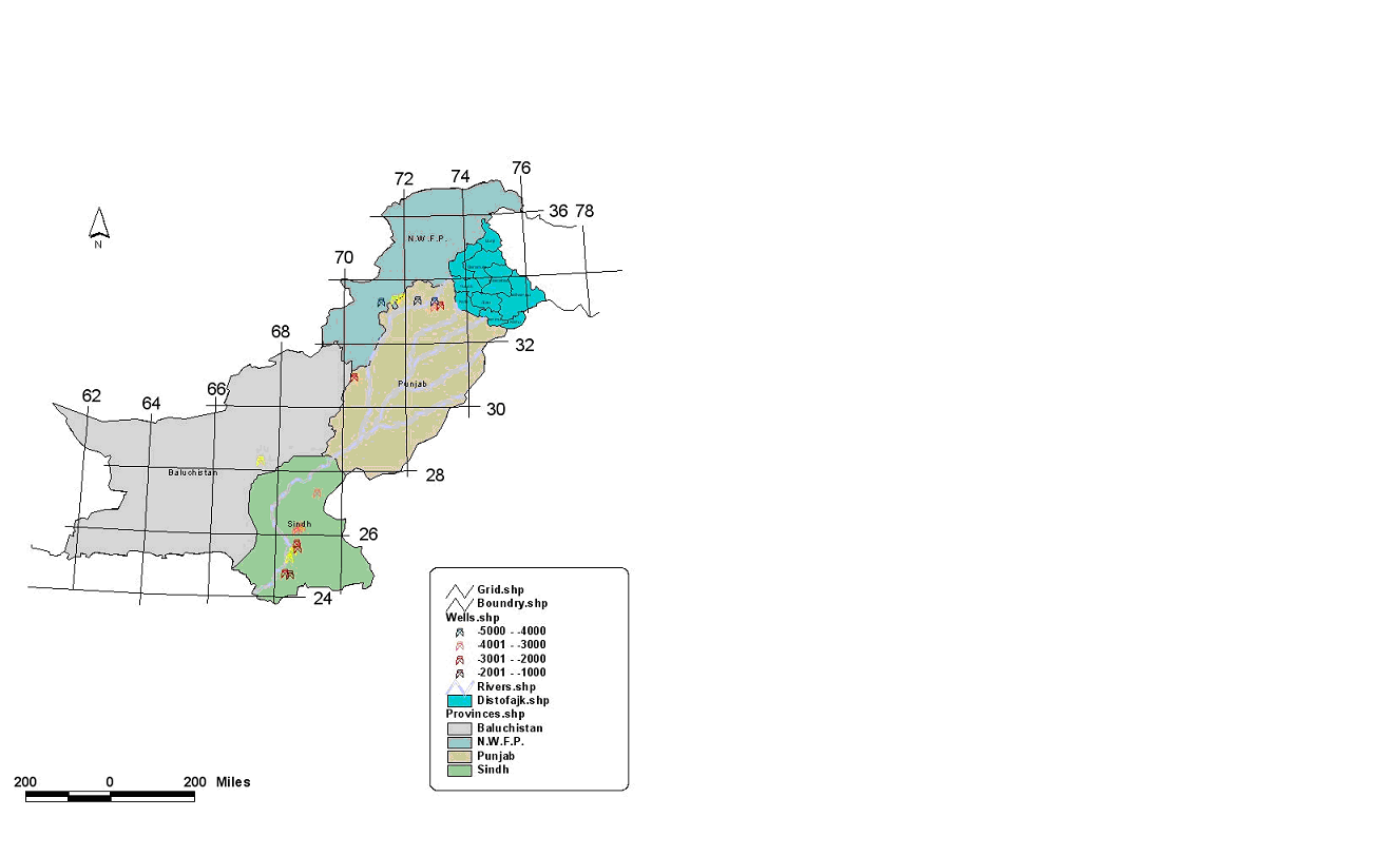
Result of query No. 01 showing all oil and gas wells belonging to OGDCL having their target depth less than 3300 ft.
Figure 3. Result of query No. 02
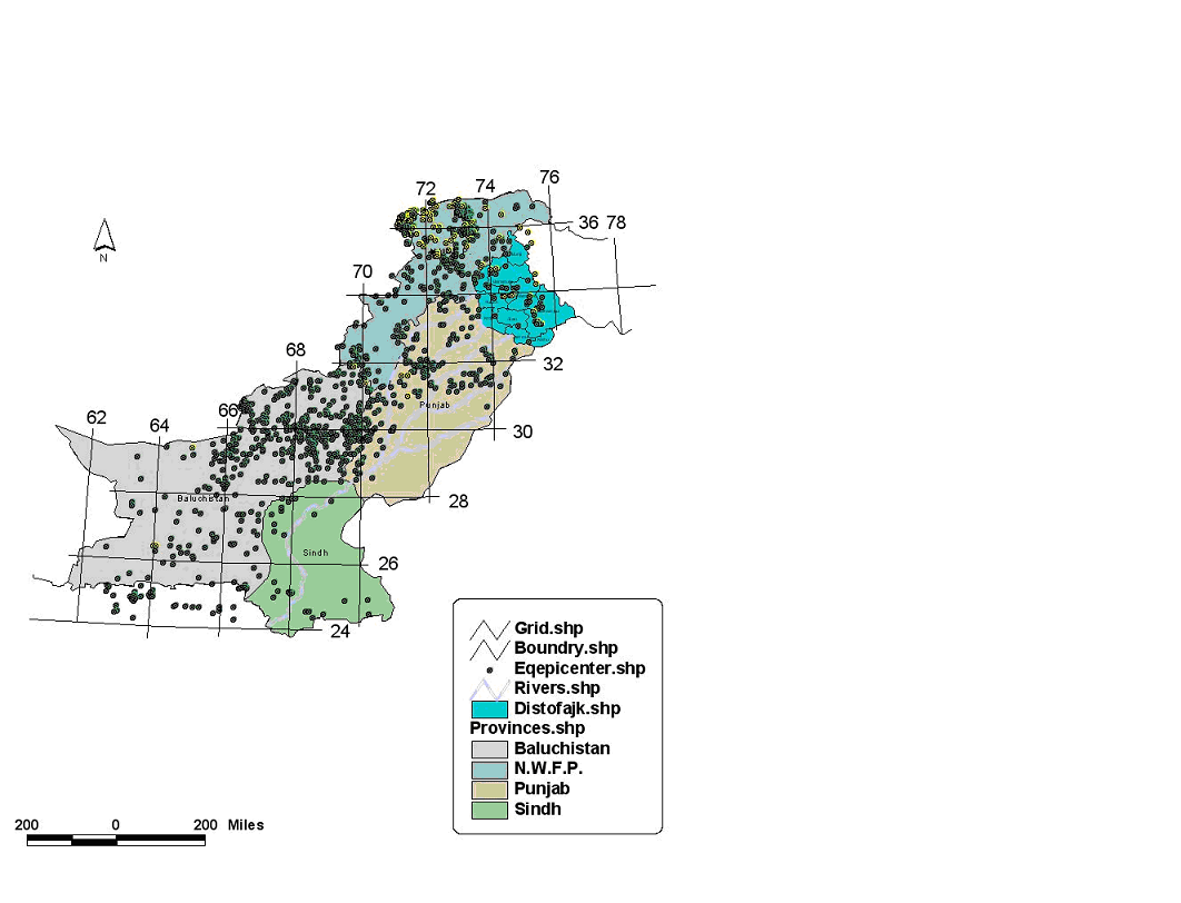
Result of query No. 02 showing past major earthquakes with magnitude greater than or equal to 5 having their epicenter at depth greater than or equal to 100 km.