Chak Naurang and Joya Mair area lie in the Potwar Plateau sub-basin, which is the northern most structural feature of Indus Basin, bounded by Main Boundary Thrust and Kala Chitta Range in the north and Salt Range to the south. The rocks of Miocene – Pliocene age known as Nagri Formation and Chinji Formation are exposed in the core of the structure and its flanks. A prominent thrust cum tear fault Chak Naurang-Wari fault is passing through the study area (Shami, 1986). There is general disharmony between the younger molasses sequences and the lower older sequences due to thrust tectonics, which are playing a dominant role in the Potwar region. Thus Joya Mair is not an exception to this disharmony and the Chinji Formation in the core of the surface structure must have been brought up by thrusting. The lithologically territories are laying unconformably over Paleozoic and the whole Mesozoic section is absent in and around the area. The Sakesar Limestone and Chorgali Formation of Eocene age are the primary reservoir objective while Permian and Cambrian sandstone are secondary objectives. The Eocene, Paleocene and Permian shales are supposed to be the potential source and cap rocks. The sedimentary sequence ranging from Precambrian to Recent is exposed in the Salt Range and the Potwar Plateau (Table 1).
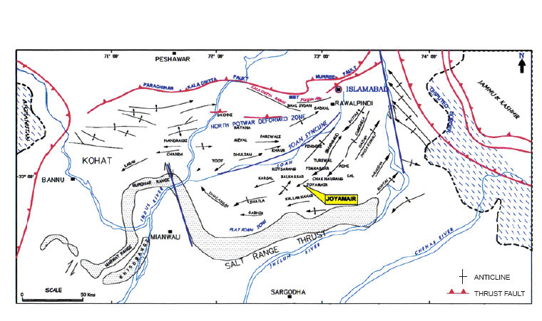
Figure 7. Table 1
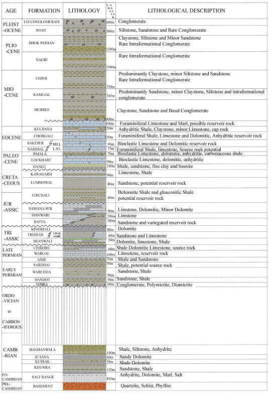
Generalized stratigraphy of Salt Range - Potwar Foreland Basin (After Shami and Baig, 2002).