Stop G.
The contact between Thin Platy Limestone Beds and Thick White Limestone Beds runs essentially along the northern edge of the temenos (see Figures FT-2 and FT-28), which is the trace of the Temenos fault. Along the southern margin of the temenos are low outcrops of Thick White Limestone Beds. One of these outcrop areas appears to be the site of a tiny ancient quarry, for it seems obvious that joint-bounded blocks of the thick-bedded limestone were removed. Within the temenos area, bedrock is gently dipping, and the stratigraphic level is very close to the depositional contact between Thin Platy Limestone Beds (below) and Thick White Limestone Beds (above). [Section VII-D2 of the companion paper provides descriptions of “Active Faulting within the St. Elijah Klippe”].
The summit of Agios Elias is the rounded hill immediately north of the temenos (Figure FT-29); this is the top of the St. Elijah klippe. The ash altar is on top of this hill. The hill is underlain by Thin Platy Limestone Beds, which weathers and erodes to a smooth, rubbly, grassy hill. Yet in places there are the linear scree bands that mark the traces of active normal faults. One of these is the Altar fault.
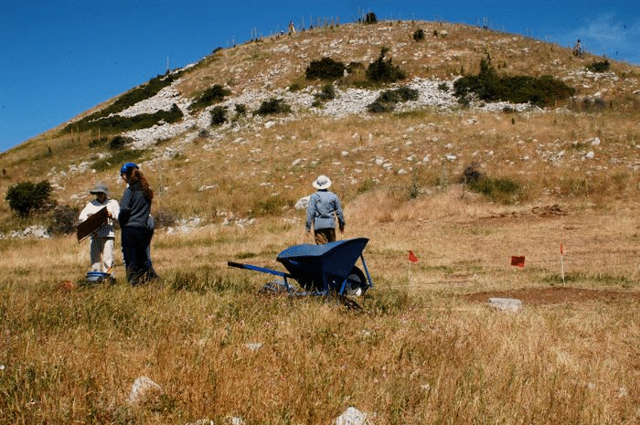
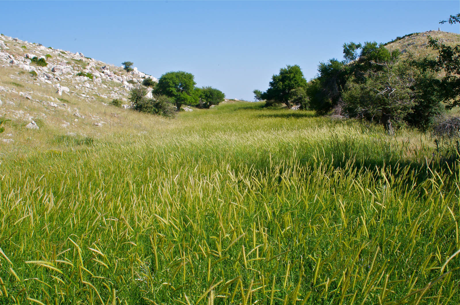
Figure FT29. Temenos bordered by active Temenos fault.
Northwest-directed photograph of ash altar hill. Flat foreground is part of the temenos. Flagged rectangle of dirt is archaeological trench. Limestone scree band marks part of the trace of the Temenos fault. Survey instrument on summit is set up close to the ash altar itself. Bedrock underlying ash altar hill is Thin Platy Limestone Beds.
It is satisfying to walk just beyond the eastern edge of the temenos, where the column bases described by Pausanias are still in place (Figure FT-30). Standing between these column bases and looking east, you see a framing of several distinctive steep-sided hilltops, including the spire-like hilltop on which sits the Chapel of St. George. Beyond is the Megalopolis basin.
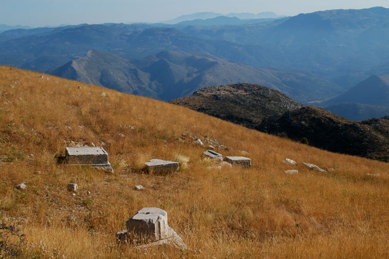
Figure FT30. Column bases at top of Agios Elias.

Northerly view from eastern edge of temenos showing column bases. On clear days, views of the Peloponessus from the upper sanctuary are grand.
A walk to the top of the ash altar is in order, for on clear days there are breathtaking views of much of the Peloponessus. The Temple of Apollo at Bassai is only ~5 km away, and can be seen off to the west.
It is useful to look at the trace of the Grassline fault from the vantage of the ash altar summit. It is clear that the trace of the fault, marked by scree bands, hugs the base of the north-south trending ridge west of the stadium(?) (see Figure FT-31). The field east of the stadium(?) is marked by alignments of limestone blocks, resembling imperfect traces of ancient walls or seating.
Finally, from the top of Agios Elias, you can look northward and see the hippodrome area, the processional way, and even the location of the bath (Figure FT-32). The scale of the geographic relationships of the upper and lower sanctuary is difficult to grasp, except by walking down to the hippodrome from the ash altar. Along the way you will go in and out of several of the rock formations, which in this part of the mountain are faulted. For someone accustomed to hiking, this excursion can be accomplished leisurely in 45 minutes or less. I recommend it, providing that you do not have to hike back up to return to your vehicles.
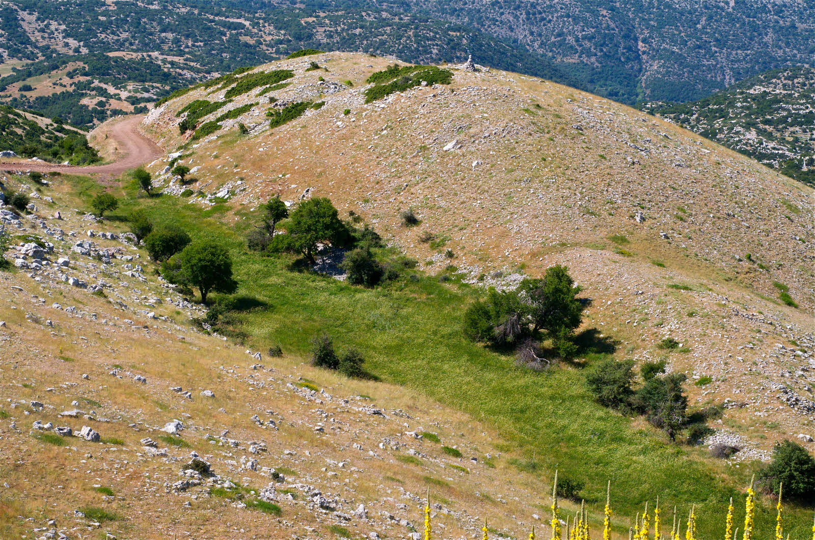
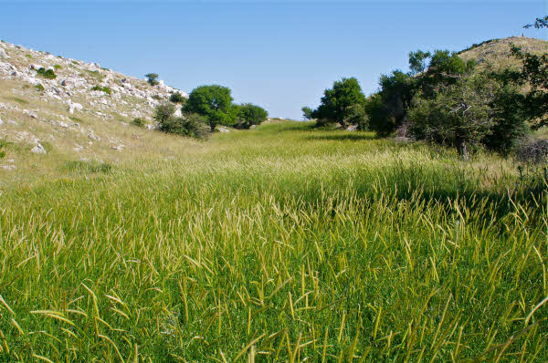
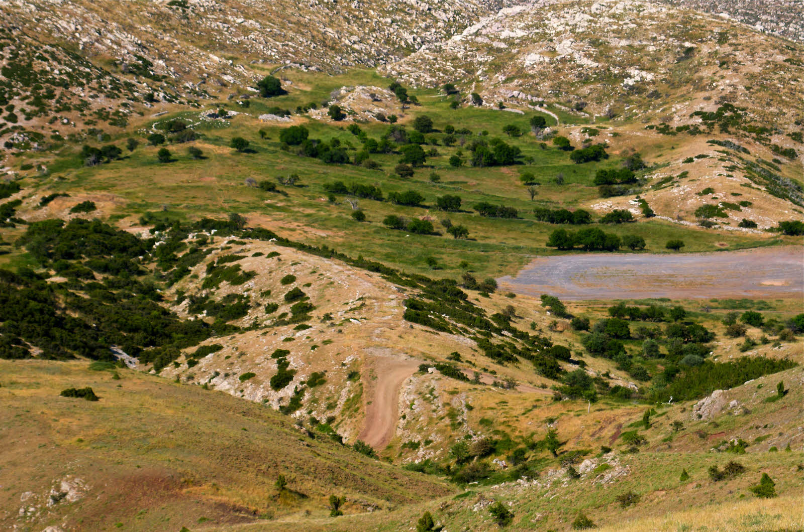
Figure FT31. Grassy Fault Trace

A. Southwest-directed view of Grassy fault trace. Hill on right is footwall Thin Platy Limestone Beds. Rock on right of grassy strip is Thick White Limestone Beds.
B. South-directed view of grassy strip along the trace of the Grassy fault. The flatness and softness of this straight-line rectangular strip invites the interpretation that this may have been the site of an early stadium. David Romano, personal communication, 2004.
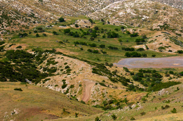
Figure FT32. View from ash altar to lower sanctuary.
North-directed view down a part of the steep northern slope of the St. Elijah klippe, from ash altar hill to the lower sanctuary and beyond. The trace of the road approximately follows the trace of the Lykaion thrust fault, cutting above it and below it from place to place. The white limestone in the vicinity of the road belongs to Flysch Transition Beds, which occupies the top of the Pan thrust sheet. Above it are the red-purple and brown rocks of the Chert Series Beds and First Flysch Beds in the overlying Zeus thrust sheet. The processional way is in the left center middle ground, and marked by Flysch Transition Beds. The hippodrome is nestled between the processional way and another ridge to the east. Note the cinder track, part of the hippodrome area. Limestone in the background is underlain by Thick White Limestone Beds. The baths are visible in upper left, near the interface between the flat ground and the limestone-bedrock hills.