Stop F.
Stop F is located at yet another fork in the road (see Figure FT-1). Find a place to stop near the fork, and then walk around and look around to gain a sense for the geology in the northwestern part of the map area (see Figure FT-2). For example, to the north and northwest are tree- and brush-covered ridges with bold expressions of Thick White Limestone Beds (Figure FT-20). Yet in the vicinity of Stop F the bedrock is Flysch Transition Beds, consisting of interbedded limestone, sandstone, siltstone, and mudstone. Folding is particularly evident in the Flysch Transition Beds. Locally there is a one-to-one relationship between N-S-trending (narrow) ridges and N-S-trending (tight) anticlines (FT-21). In between are low areas (synclines) marked by terraced agricultural fields. These are unusual examples of structural control of farm fields. [Section VI-F of the companion paper provides descriptions of the “Flysch Transition Beds”].
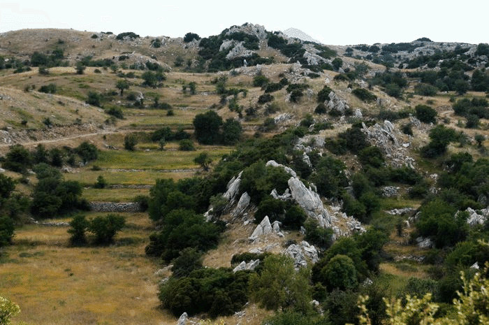
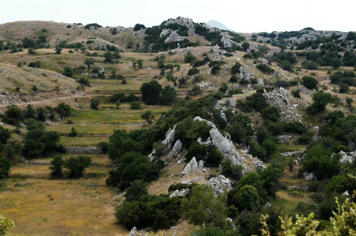
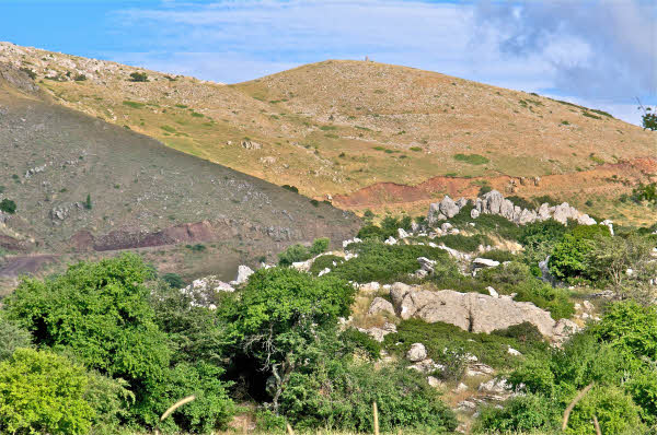
Figure FT20. Characteristic landscape of Thick White Limestone Beds.

Northwest-directed photographs of broad expanses of Thick White Limestone Beds. The bedrock is ragged and difficult to negotiate in places, especially where vegetation is thick. By comparison, the landscape underlain by Flysch Transition Beds (in foreground) is smooth and broadly rolling.
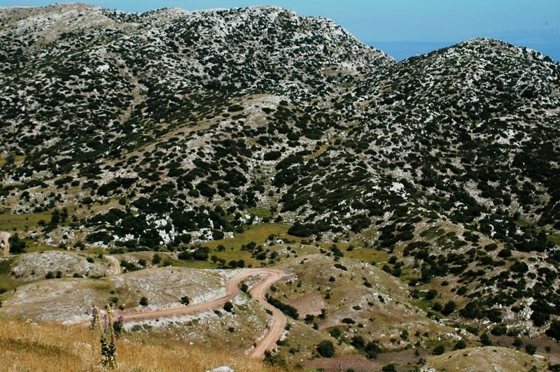
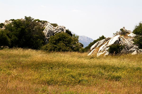
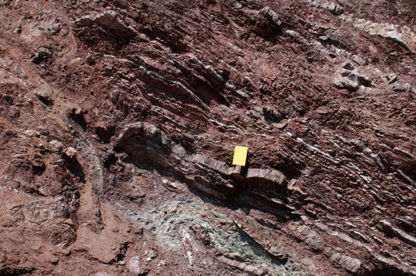
Figure FT21. View of coordinated array of folds and fields.
South-directed photographs of folded Flysch Transition Beds. Note that the prominent limestone ridge is an upright anticline defined by resistant limestone. The terraced areas on either side of the anticlinal ridge are traces of synclines.
Now return to your vehicle(s).
Proceeding from Stop E to Stop F.
Along this stretch of road you will pass upward through the uppermost part of the Pan thrust sheet and cross the Lykaion thrust fault, thus entering the overlying Zeus thrust sheet. You start out in Flysch Transition Beds located in the upper part of the Pan thrust sheet (see Figures FT-1, 2). The Flysch Transition Beds are easy to recognize, marked by abundant limestone bedrock in roadcuts (Figure FT-22). You will see these outcrops for the first ~0.4 km of the drive toward Stop F. You might pause at the 0.4 km mark and get out to look at the horse pasturing area, the broad field off to the south-southwest. If you have time, it is a pleasant experience to walk this pasture field, and check out the beautiful fold structures in Thick White Limestone Beds at the far southerly end of the filed (Figure FT-23).
Figure FT22. Exposures of Flysch Transition Beds.
Outcrop expression of Flysch Transition Beds along road. The limestone beds bear a similarity to those of the Thin Platy Limestone Beds, but there are significant differences, including the abundance of interbedded mudstones and siltstones.
Figure FT23. Folds in Thick White Limestone Beds south of horse pasture.

South-directed photo of southernmost part of the horse pasture field. Note folds in limestone beds, which belong to Thick White Limestone Beds.
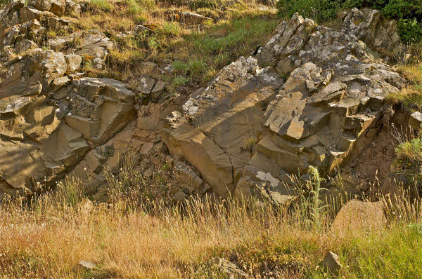
The part of the road you are ascending is pictured in Figure FT-23. Limestone outcrops of the Flysch Transition Beds are in the foreground and in the left middle ground. Upward and southward along the road, the Flysch Transition Beds formation gives way to the Chert Series Beds (see Figure FT-24). Specifically, at the ~0.7 km mark on the drive from Stop E to Stop F, the character of bedrock abruptly changes, where the road crosses the Lykaion thrust fault. The bedrock shifts from limestone to highly sheared and folded Chert Series Beds, which occupy the lowermost part of the Zeus thrust sheet (Figure FT-25). In particular there are excellent displays of ribbon cherts (replete with penetrative jointing) that locally are intensely folded. Between ribbons is sheared red mudstone, which locally contains rootless isoclinal folds, revealing that the Chert Series Beds is partly transposed.
Figure FT24. View of Agios Elias and trace of Lykaion thrust fault.

A. East-directed view of road ascending Agios Elios. In the foreground and left middle ground are limestone outcrops representing the Flysch Transition Beds. Along the road, the change from limestone to red mudstones and chert layers signals crossing the Lykaion thrust fault. Above the thrust is the St. Elijah klippe.
B. Closer east-directed view of road ascending Agios Elios. In the right foreground and middle ground are limestone outcrops representing the Flysch Transition Beds. These are part of the Pan thrust sheet. The red-purple beds in the left middle ground are Chert Series Beds within the Zeus thrust sheet. The brown-weathering rock further up the road (right middle ground) belongs to the First Flysch Beds. Weathered limestone on high hill in middle/right background belongs to Thin Platy Limestone Beds. White limestone on upper left is Thick White Limestone Beds.
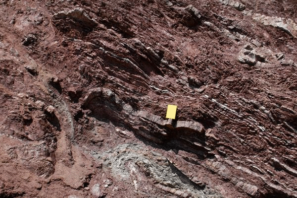
Figure FT25. Outcrop character of Chert Series Beds.
Photograph of roadcut exposure of thrust-faulted and folded beds of limestone, mudstone, and ribbon cherts within the Chert Series Beds. This exposure is in the immediate hanging wall of the Lykaion thrust fault.
As the road continues to climb, it will pass through the Chert Series Beds into First Flysch Beds, composed of massive brown sandstone (Figure FT-26). In the midst of the sandstone outcrops there is an interval of red mudstone, the middle member of the First Flysch Beds. Then there is a return to outcrops of massive brown sandstone as the road continues to climb.
Figure FT26. Outcrop character of First Flysch Beds.
Photograph of typical outcrop of brown sandstone, the dominant lithology within the First Flysch Beds.
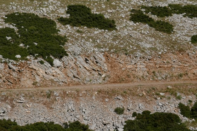
Continuing up the stratigraphic section within the St. Elijah klippe, the next change in formation is the appearance of Thin Platy Limestone Beds (see Figures FT-1, 2). It occurs at the 0.9 km mark, at the beginning of the sharp hairpin bend in the road, i.e., where the direction of travel up the mountain changes from south to north. The roadcut exposures of Thin Platy Limestone Beds display thin beds of limestone, concordant layers and lenses of chert, closely spaced jointing, and tight overturned folding (Figure FT-27).
Figure FT27. Outcrop expression of Thin Platy Limestone Beds.
East-directed photography of roadcut and hillslope exposures of Thin Platy Limestone Beds. The roadcut reveals thin bedding and the presence of white chert layers. The abrupt change in orientation from moderately steeply dipping to gently dipping reflects faulting. Hillslope above the roadcut displays the typical weathered landscape of Thin Platy Limestone Beds.
The next geological change along the road is the appearance of Thick White Limestone Beds (see Figures FT-1, 2). This occurs as the road crosses Grassline fault, the location of which is easy to spot at approximately the 1.1 km mark from Station F (see Figure 38, accompanying manuscript). The trace of the fault coincides with the deep ravine whose head is right at the road, on the right side. The northward trace of Grassline fault is expressed nicely in the landscape, where the smooth narrow field which may be a stadium(?) is evident on the left (see Figure 38).
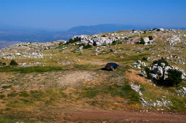
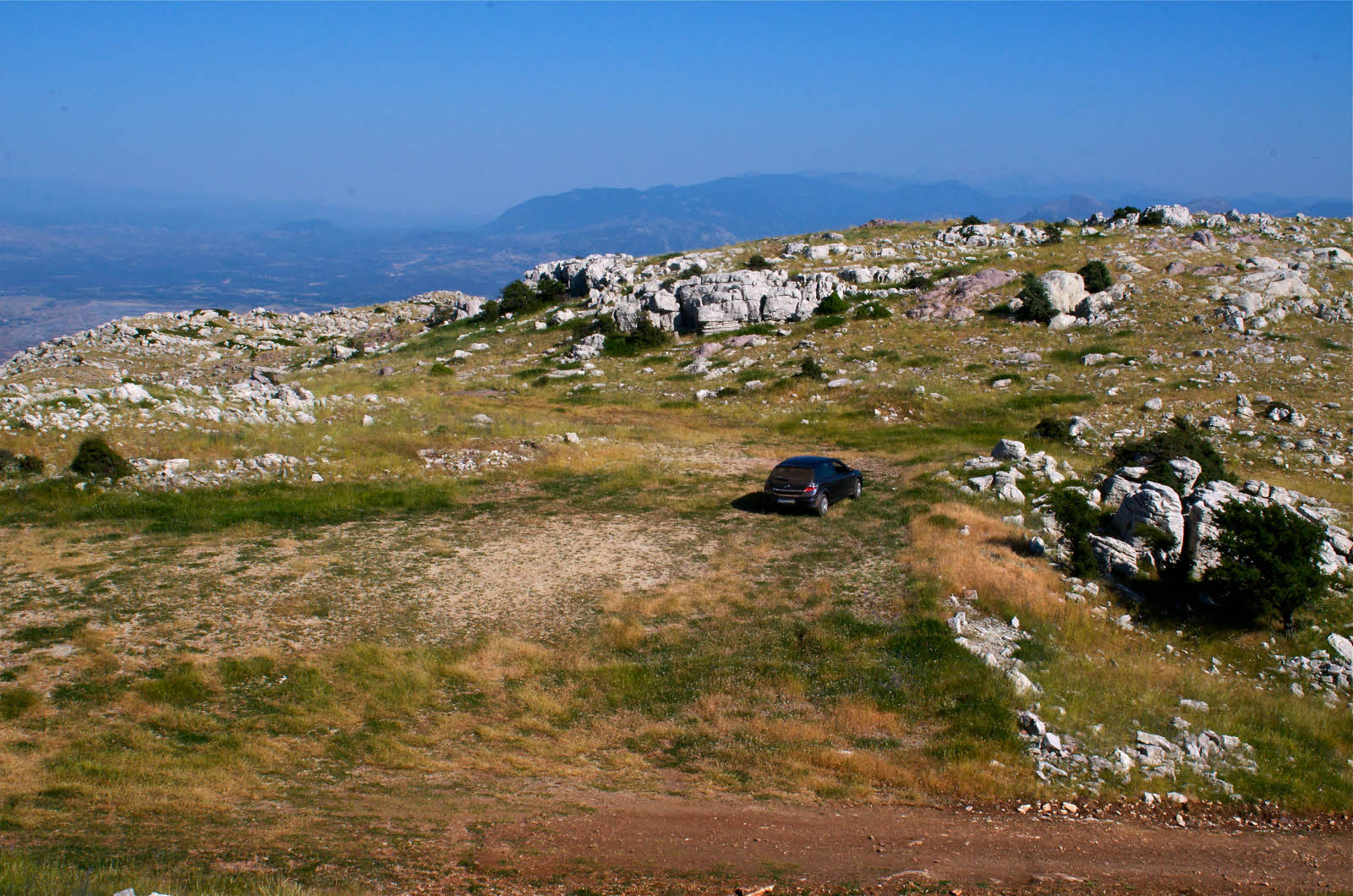
Finally, take the road to the end, to the ~1.4 km mark, and park at Stop G (see Figures FT-1, 2), which is in the flat area of the temenos, now used as a parking area by those visiting the mountaintop (Figure FT-28).
Figure FT28. Temenos area.
Southeast-directed photograph of temenos area of upper sanctuary. The featureless flat grassy area is part of the temenos. The bold limestone outcrops belong to the Thick White Limestone Beds. Photograph taken from the slope of the ash altar hill.