Shake maps and community feedback
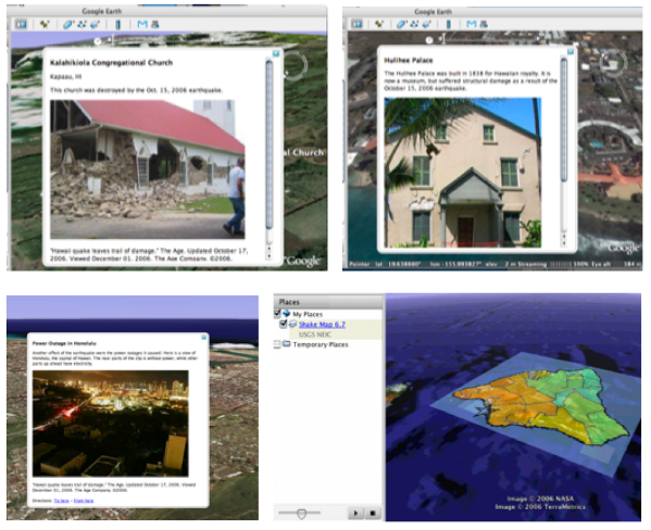
THE USGS currently invites community feedback in the form of “Did you feel it” questionnaires. Given the ubiquitous availability of camera-cell phones, it should be possible to invite community contributions of geo-referenced damage photographs for inclusion in Google Earth tours. De Paor & Williams (2006) created such a tour manually (Figure 14).
Figure 14. Hawaiian damage report
De Paor & Williams (2006) included damage reports and images in Google Earth placemarks, making it easy to view damage in relation to shake maps and moment tensor solutions.
Damage reports and images were placed in Google Earth place marks and a shake map was overlain on the terrain using KML <groundoverlay> tags. The resultant KML file permits theoretical analyses such as focal mechanisms and centroid moment tensors to be viewed in conjunction with damage data. Such analyses may improve future forecasts and analyses of earthquake hazards.