Itinerary 2: From Hozoviotíssas Monastery to Egiali
This itinerary is geologically more monotonous compared with the diversity of rock types in the peninsula northwest of Katapola (Itinerary 1). The rocks are predominantly marbles, with some exposures of folded flysch rocks. The structures, however, are interesting and provide information on the larger-scale folding history of Amorgos. There is a good walking path from Hozoviotíssas monastery to Egiali (Figure 10), which makes this itinerary one of Amorgos’ finest walks.
Stop 2.1. Hozoviotíssas Monastery (N 36º49’56.3”, E 25º54’32.9”)
The monastery of Hozoviotíssas is situated on a sheer cliff 320 m above the sea level and is by far one of Amorgos’ biggest highlights. It was built in the end of the 11th century and is named after the town of Hozova, from which a precious icon of the Virgin was allegedly brought by monks. The monastery is normally opened for visitors during the mornings.
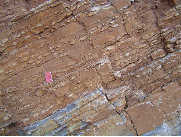
From the car park, you can see a steeply dipping normal fault that separates the flysch sequence from the marble unit. The fault is characterised by numerous SE-dipping polished fault planes that have SE-plunging striations on them. Fault-slip analysis of this outcrop and a few nearby outcrops yielded a SE-directed extension direction and a subvertical shortening axis indicating normal faulting. The kinematics derived from fault slip analysis is the same as the one derived from focal-plane solutions of the 1956 MS = 7.4 earthquake. We therefore assume that the fault planes are related to coseismic uplift of Amorgos, which also appears to control the morphology of the southeastern coastline of the island.
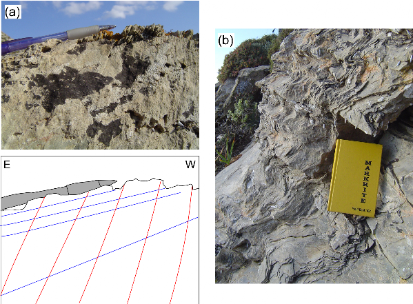
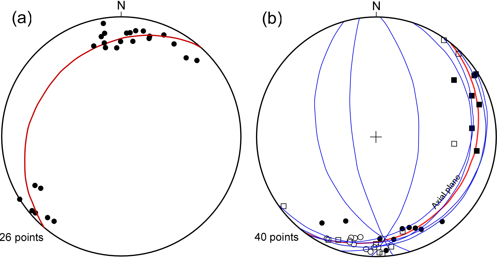
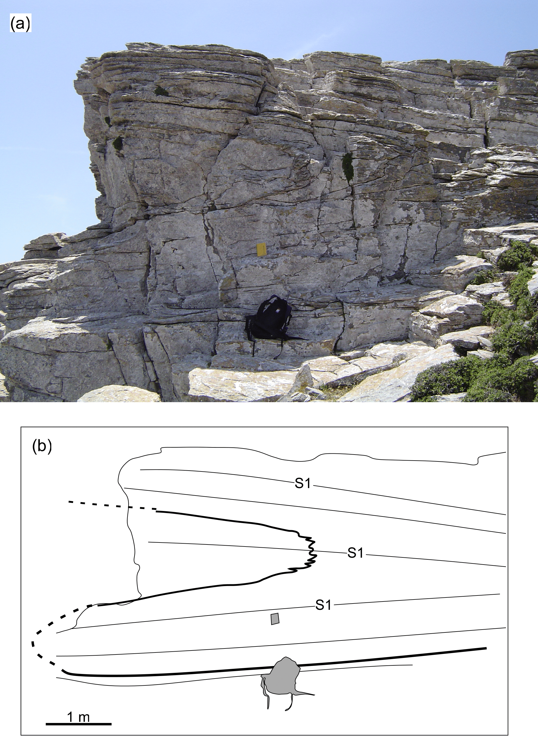
Follow the stairs that lead to the monastery and look at the numerous fold patterns in the marble (Figure 11). The folds appear in a layered marble lithology and are sub-horizontal recumbent to gently inclined folds. Fold axes show variable orientations but their geometric distribution generally coincides with a southeast-dipping axial plane (Figure 12b). Based on overprinting relationships in Potamos (Stop 2.5), this axial plane is considered to represent a late generation of folding, i.e. F2 or F3.
Figure 10. Map of the central part of the island showing the general geology (partly after Dürr, 1985) and the locations of Itinerary 2’s excursion stops.
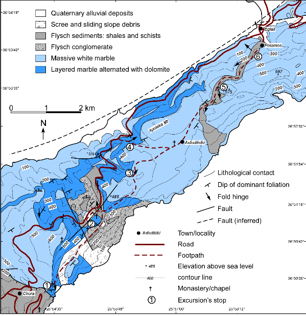
Figure 11. Fold structures in the area near the monastery of Hozoviotíssas (Stop 2.1).
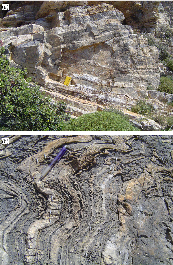
(a) A sub-horizontal recumbent fold; (b) A weak development of flat lying axial plane cleavage.
Figure 12. Stops 2.5, 2.6
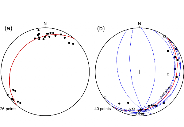
(a) F1 asymmetric folds showing geometric distribution around an axial plane (S1) that shallowly dipping towards the northwest (27º-310º). (b) F2 fold axes from Ronzas creek around Stop 2.4 (filled squares), Stops 2.5 and 2.6 (open squares), Hozoviotíssas monastery around Stop 2.1 (filled circles), and north of Hozoviotíssas monastery (open circles). The fold axes roughly coincide with a calculated S3 axial plane of 20º-127º (red girdle). The blue girdles indicate measured S1 foliations from the area around Stop 2.5.
Stop 2.2. F1 folds in the marble (N 36º51’06.8”, E 25º55’25.9”)
Take the footpath that starts at the northern gate of the monastery, and follow it northward. You will first pass scree and sliding slope debris, until reaching outcrops of deformed flysch conglomerates with kinematic indicators, such as S-C structures, that show top-to-the-SE sense of shear. The next stop is located near a small church approximately 200 meters west of the footpath.
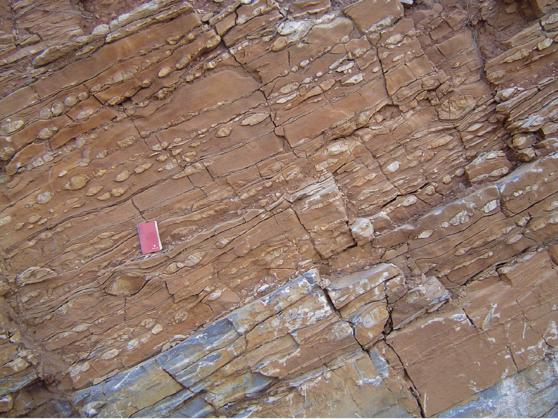
In this area the effect of the early generation of folding (F1) is responsible for repetitions of marble, flysch and flysch conglomerate layers. One of these F1 folds is recognised in the layered marble, showing S-shaped asymmetry when looking down plunge (Figure 13). Folding is responsible for the development of the dominant shallowly dipping foliation and is recognised in a series of asymmetric folds that generally show vergence towards the SE. These fold axes roughly coincides with an axial plane (S1) that shallowly dipping towards the NW (Figure 12a). The sense of overturning, towards the SE, is therefore indicative of thrusting during D1 deformation.
Figure 13. F1 isoclinal fold in the layered marble (Stop 2.2) showing Z shaped asymmetry when observed up plunge (i.e. the fold has an S shape down plunge).

Stop 2.3. Interference patterns (N 36º51’44.5”, E 25º56’08.4”)
Follow the footpath that runs from the dirt road junction to the southeastern slope of hill 485 (Figure 10). Keep walking parallel to the 400 m contour until reaching the saddle between this hill and the next hill to the north.
The small outcrop in the platy marble shows interference patterns of the two generations of folding (Figure 14). The S1 fabric is folded around F2 or F3 folds, and some typical type 1 interference patterns (Ramsay, 1967) are recognised.
Stop 2.4. Ronzas Creek (N 36º52’13.6”, E 25º56’12.8”)
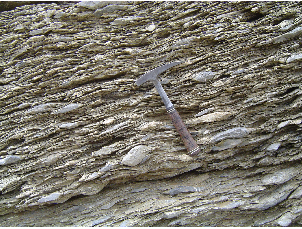
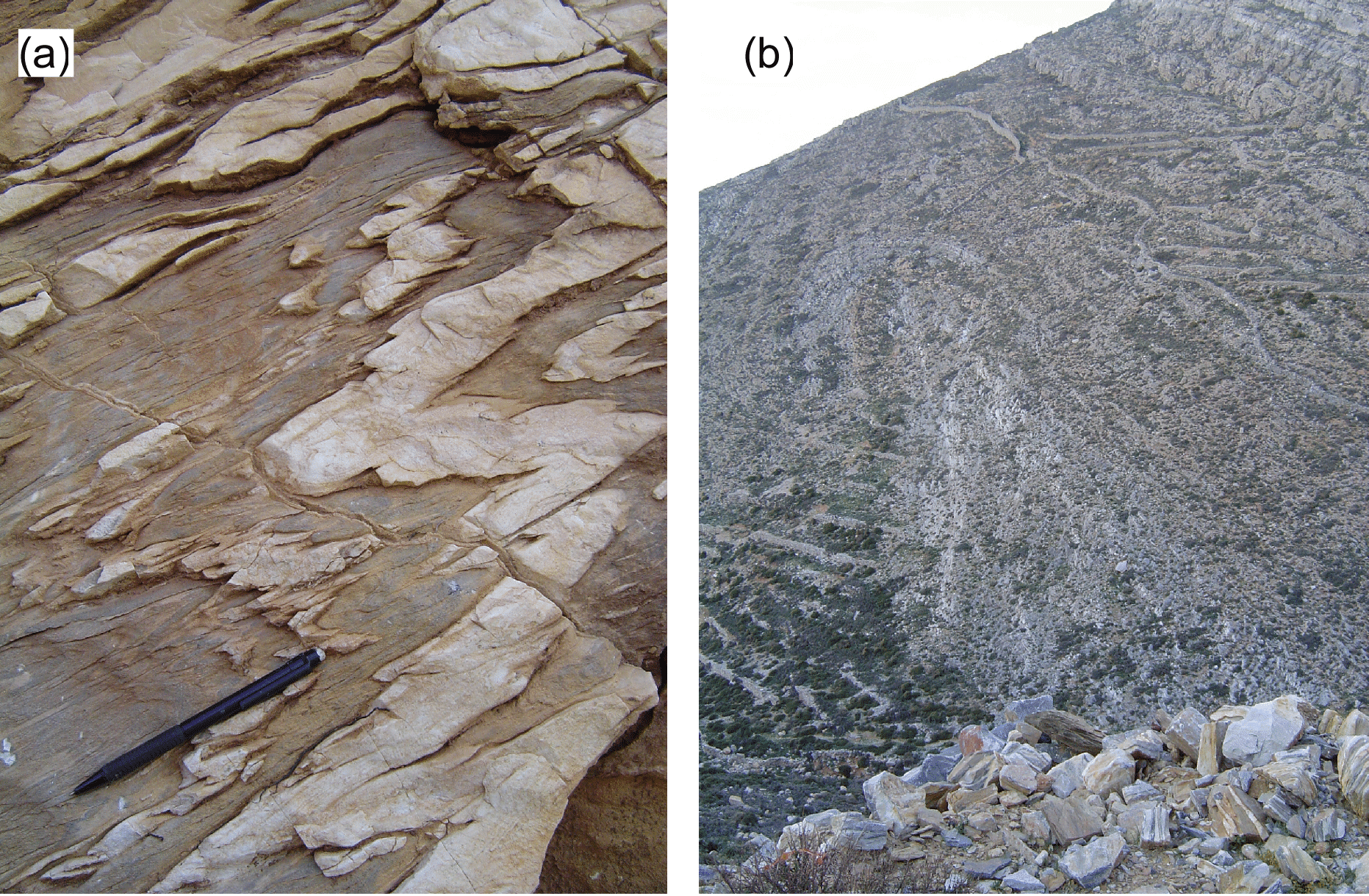
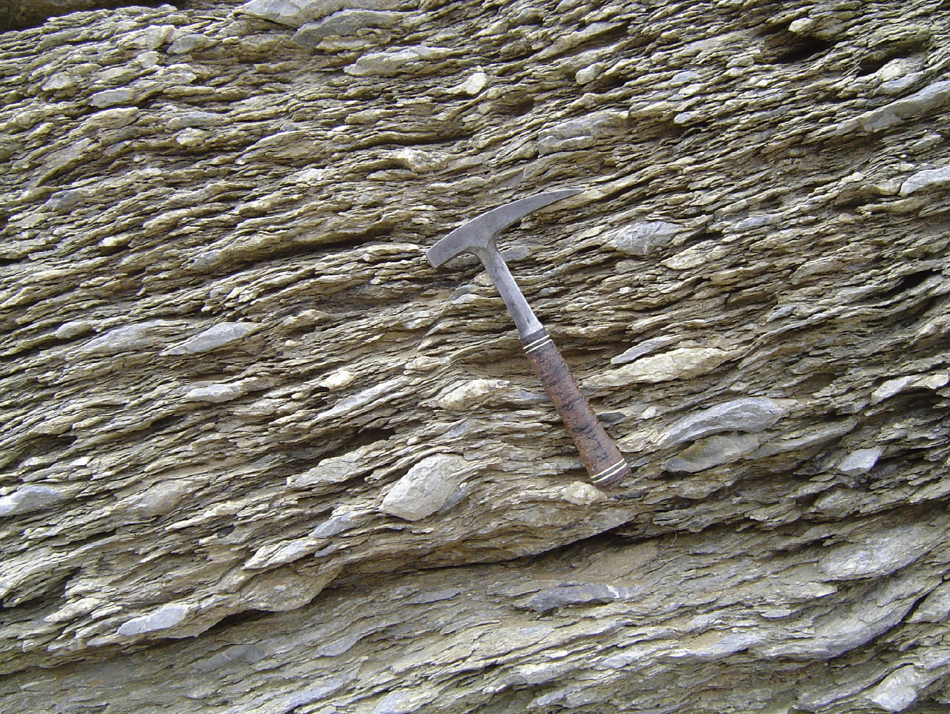
Keep walking north for approximately 1.3 km and turn left to a track that leads westward above Ronzas creek. Follow this track for another 1.2 km until reaching folds in the layered marble (Figure 15a). These fold axes mostly plunge to the NE, but like the folds in Stop 2.1, their fold orientation coincides with the second generation axial plane (Figure 12b). Looking northward over the northwestern slope of Mt Apolaka, a large-scale fold is recognised (Figure 15b).
Walking westward on the dirt road, you can see nice examples of boudinaged structures within the marble (Figure 16).
Figure 15. Folds around Ronzas creek (Stop 2.4).

(a) Meso-scale folds in the layered marble. (b) A large scale fold at the slope of Mt Apolaka.
Stop 2.5. F1/F2 overprinting relationships (N 36º53’05.1”, E 25º57’47.1”)
Walk back to the footpath on the crest, and continue northwestward pass the partly inhabited village of Asfodilídhi. The track will then enter a narrow band of flysch sediments. The next stop is located above the little chapel west of hill 575.
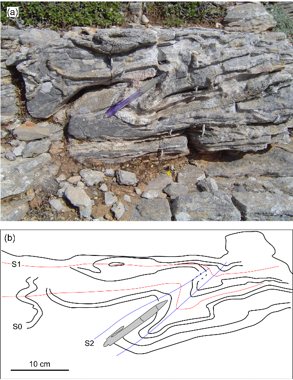
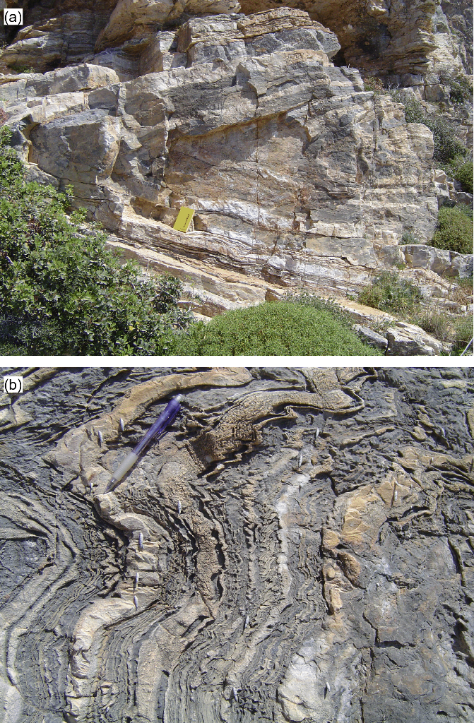
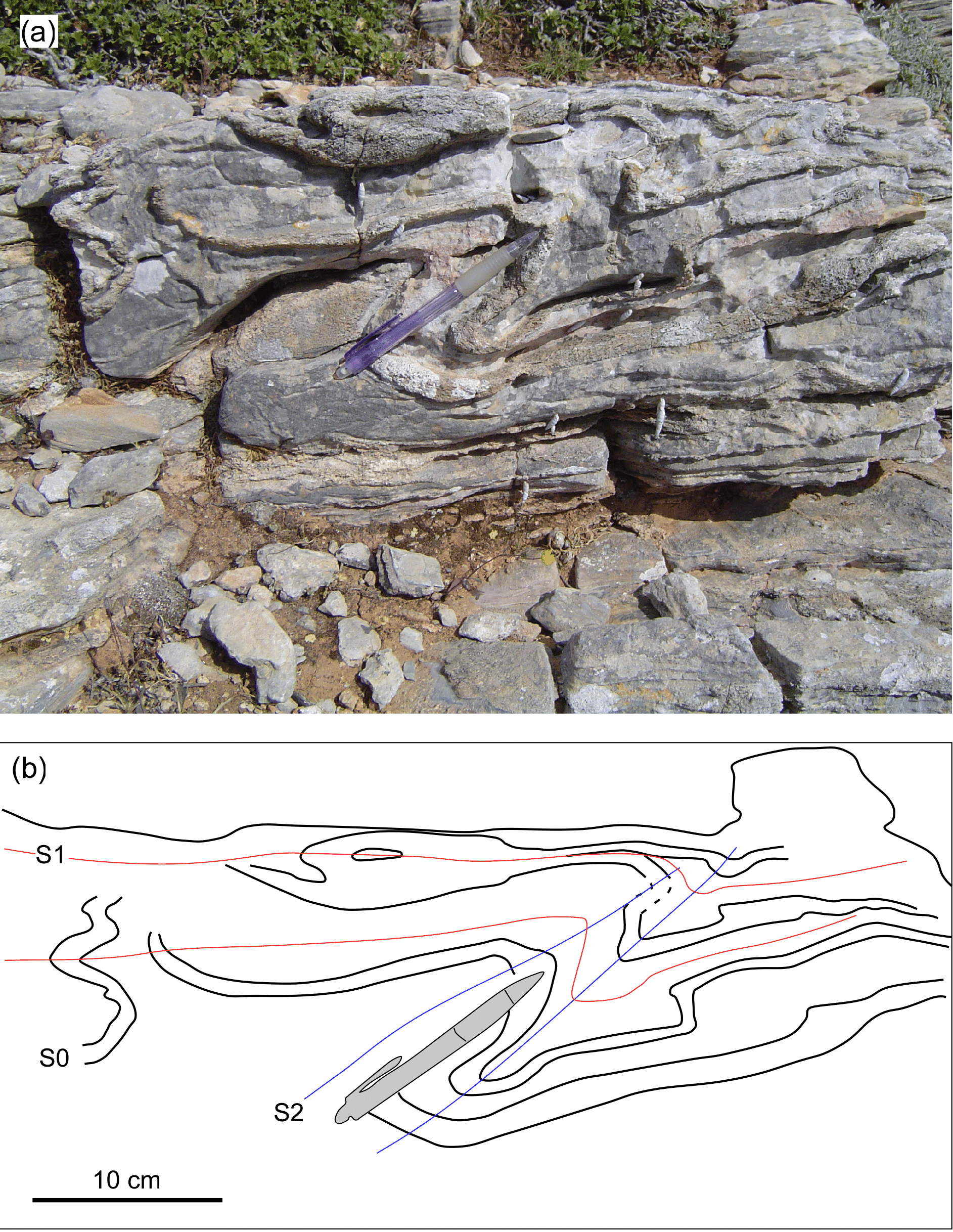
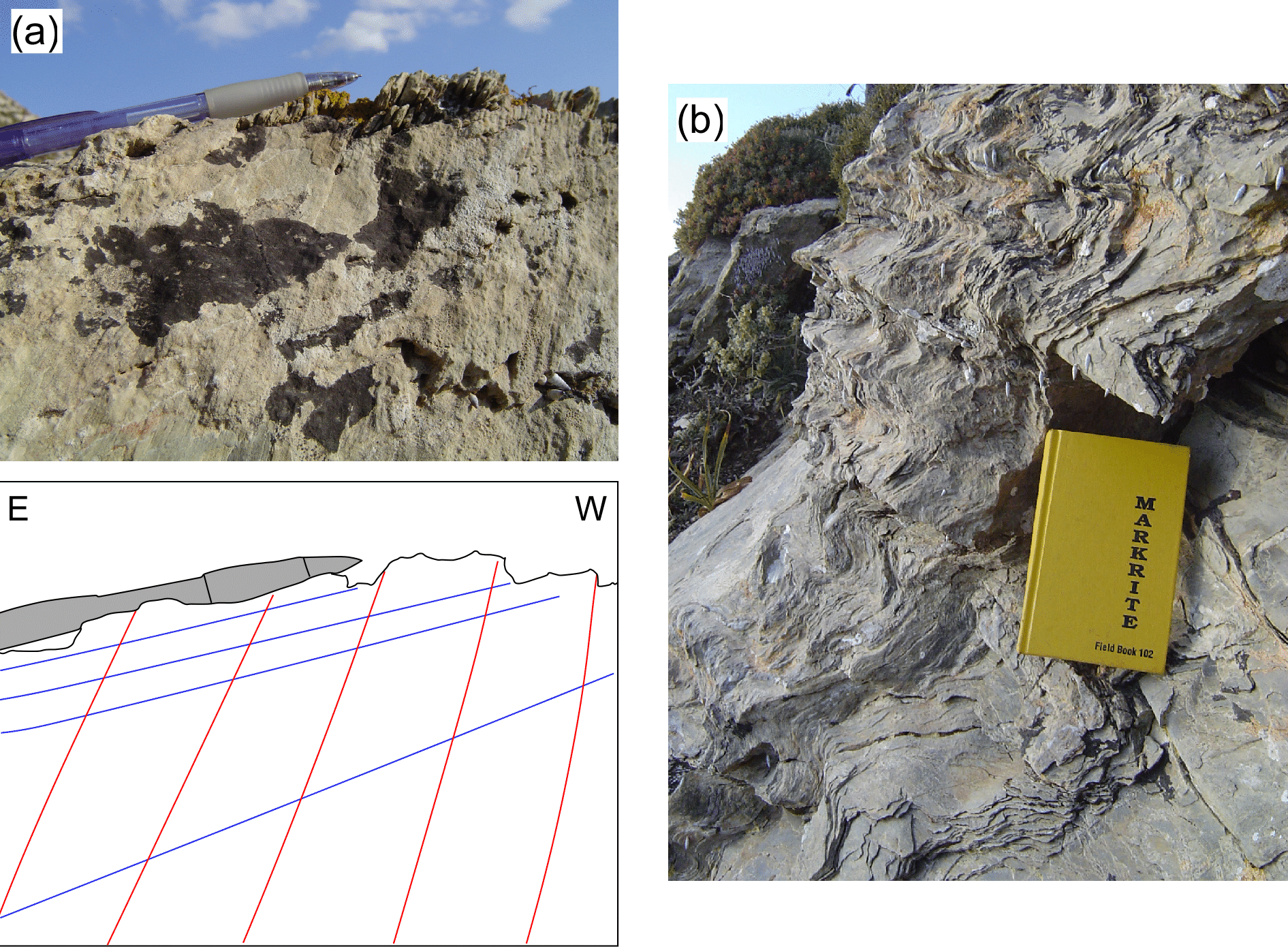
The flysch sediments in this locality show two fabrics (Figure 17a). The earlier (S1) foliations are generally steeply dipping and show variable orientations that intersect in a ß axis of 12º-175º (Figure 12b). Folding of the S1 fabric is also recognised, forming an axial plane cleavage parallel to S2 (Figure 17b). The sense of overturning on these F2 folds is towards the northwest.
Figure 17. Overprinting relationships between S1 and S2 fabrics in Stop 2.5.
(a) Penetrative S1 foliation that steeply dipping to the east, overprinted by shallowly southeast-dipping foliation. (b) Folding of S1 and development of S2 axial plane cleavage, which is parallel to the S2 fabric shown in (a)
Stop 2.6. Potamos
As you continue walking towards the village of Potamos, you can see many F2 folds that show vergence to the NW. A similar sense of movement is also recognised by asymmetric structures in the flysch (Figure 18).