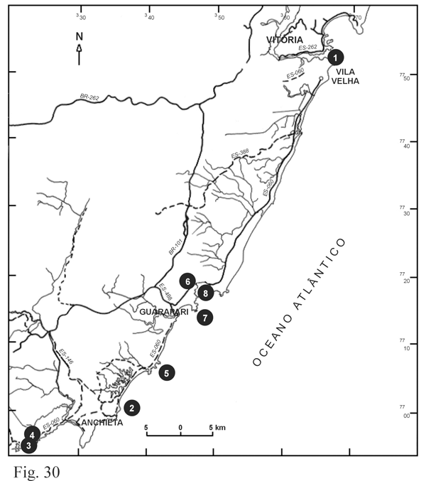
- The coast near Vitória and Guarapari
- Outcrop 1: Praia da Costa, in Vitória (UTM coordinates: 36630 – 775100)
- Outcrop 2: Ubu Beach in Anchieta (UTM coordinates: 33550 – 769900)
- Outcrop 3: Pau Grande Beach in Anchieta (UTM coordinates: 32500 – 769630)
- Outcrop 4: Small quarry close to Iriri town (UTM coordinates: 332850 – 7769700)
- Outcrop 5: Outcrops on the Enseada Azul Beach (UTM coordinates: 34150 – 770680)
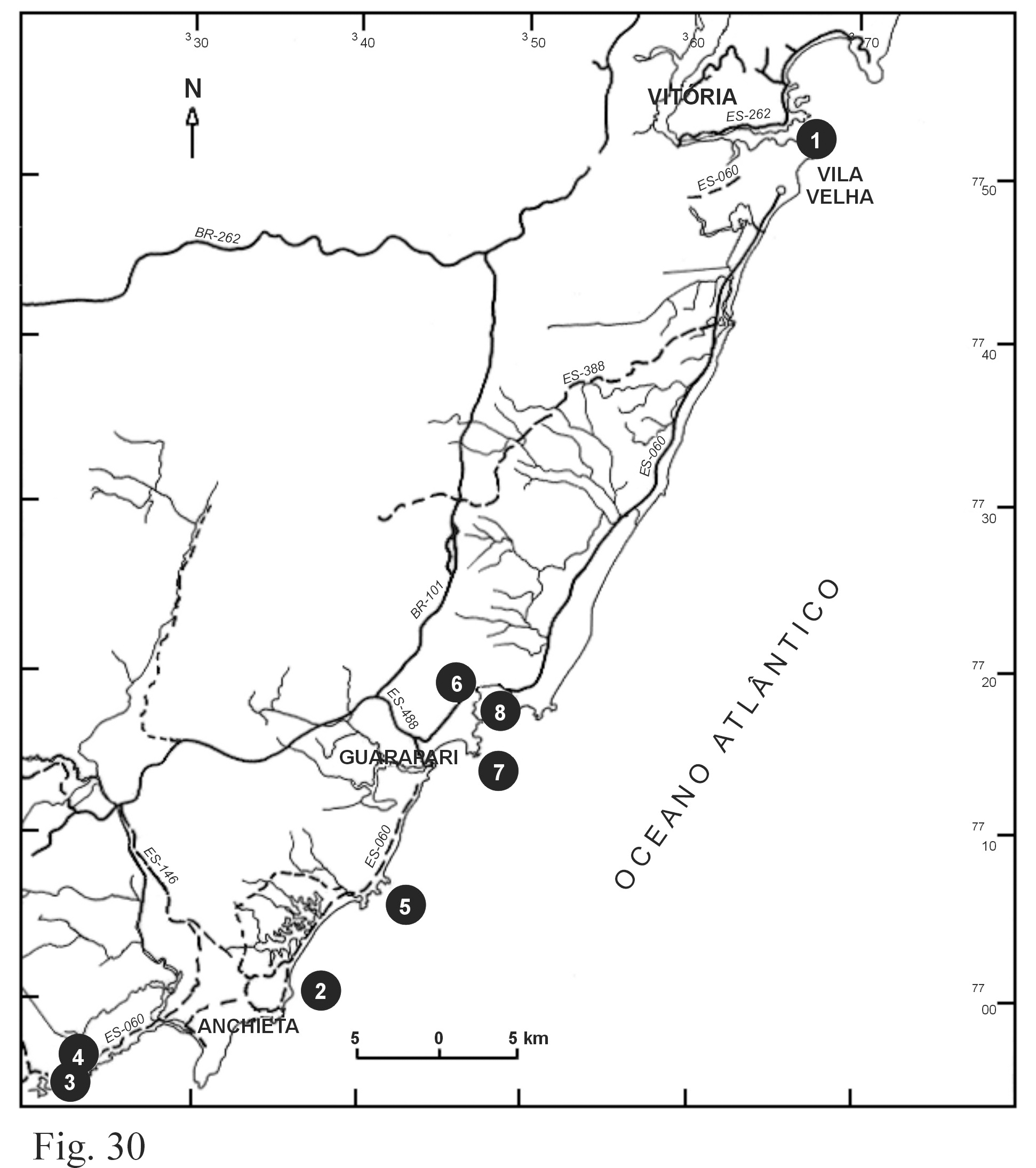
- The Guarapari coast and the cachoeiro de itapemirim region
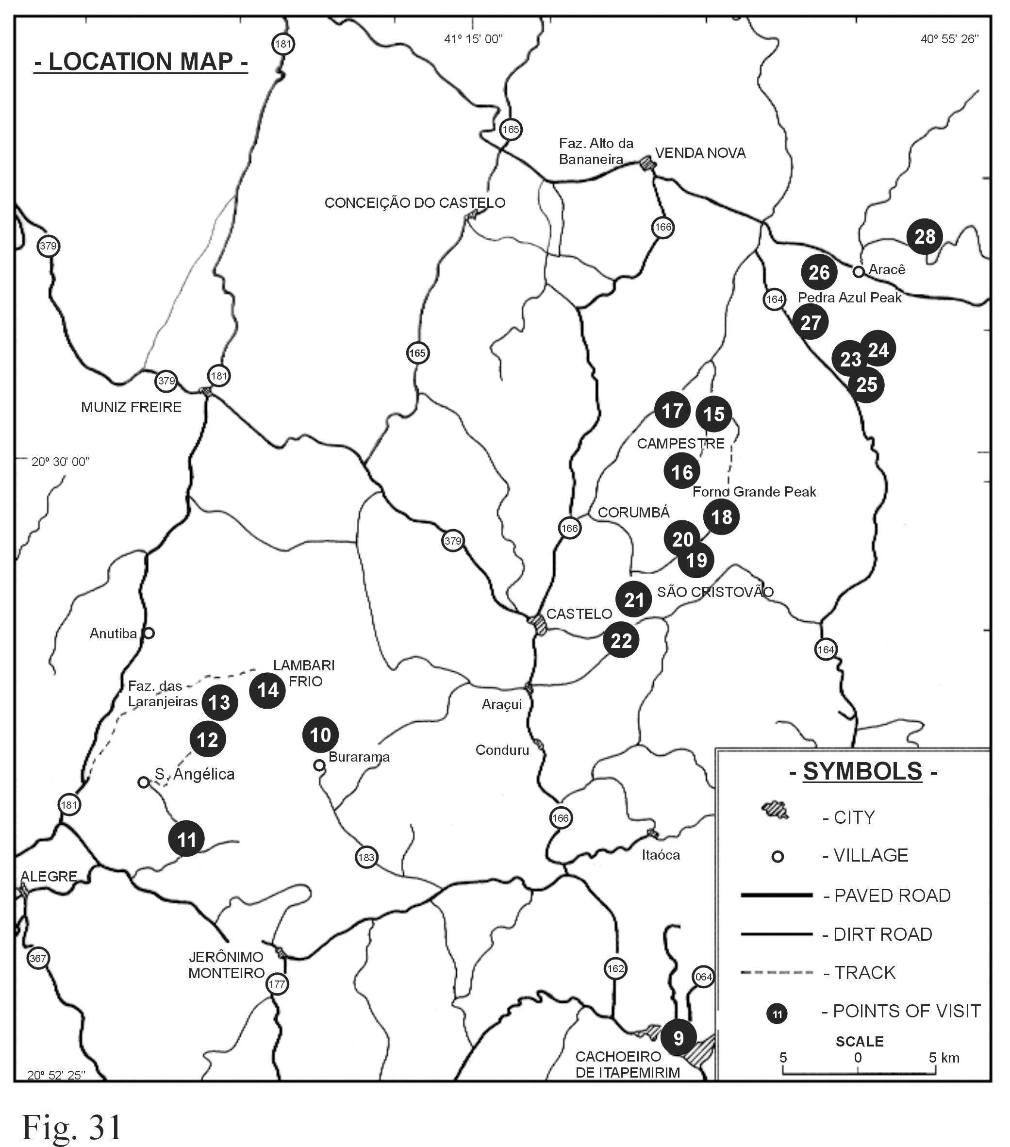
- G5 complex zoned plutons
- Santa Angelica - A frozen-in magma mixing
- Outcrop 10: Floresta valley, approximately 3 km northward of Burarama (UTM coordinates: 25506 – 771208)
- Outcrop 11: Selva de Pedra Quarry (UTM coordinates: 24604 – 770507)
- Outcrop 12: Bela Aurora Quarry and surroundings (UTM coordinates: 24500 – 771100)
- Outcrop 13: Pireneus Ridge (UTM coordinates: 24608 – 771502)
- Outcrop 14: Lambari Frio (UTM coordinates: 25400 – 771503)
- Castelo Complex - A frozen-in contact
- Outcrop 15: (UTM coordinates: 28050 – 773400)
- Outcrop 16: Córrego Santa Clara (UTM coordinates: 28020 – 773303)
- Outcrop 17: Alto do Caxixe Quente - 1 km away from the Santa Clara Church (UTM coordinates: 27909 – 773402)
- Outcrop 18: The hybrid zone at Forno Grande (UTM coordinates: 28200 – 773000)
- Outcrop 19: Fine-grained sphene granite of São Cristóvão (UTM coordinates: 27808 – 772401)
- Outcrop 20: Megaporphyritic granite (Granite I). Quarry in São Cristovão (UTM coordinates: 27805 – 772406)
- Outcrop 21: Boulder (blasted open) of a fine-grained diorite with irregular granitic schlieren (UTM coordinates: 27600 – 772203)
- Outcrop 22: Migmatite border zone of the Castelo Complex (UTM coordinates: 27600 – 772106)
- Pedra Azul - Mature Magmatism
- Outcrop 23: Border region of the pluton (UTM coordinates: 28903 – 774602)
- Outcrop 24: Mixed zone in the southern portion of the pluton (UTM coordinates: 28905 – 773900)
- Outcrop 25: Magmatic flow (UTM coordinates: 28903 – 773806)
- Outcrop 26: Mixed zone in the NW portion of the pluton (Pousada Pedra Azul Hotel) (UTM coordinates: 28800 – 774400)
- Outcrop 27: Enclave swarm in a mingled zone (UTM coordinates: 28740 – 774205)
- Outcrop 28: The ocellar texture of the syenogranite (UTM coordinates: 29003 – 774602)
In this appendix we describe key Outcrops in the region and provide enough information, so that this article can be used as a field guide:
Day 1 - Outcrops 1 to 5;
Day 2 - Outcrops 6 to 9;
Day 3 - Outcrops 10 to 14;
Day 4 - Outcrops 15 to 22;
Day 5 - Outcrops 23 to 28.
All Outcrops described here are illustrated in Figure 30 and 31 and are close to country roads which are depicted in topographic map sheets at the scale of 1: 50 000, published by IBGE and available from the following web page: http://mapas.ibge.gov.br.
