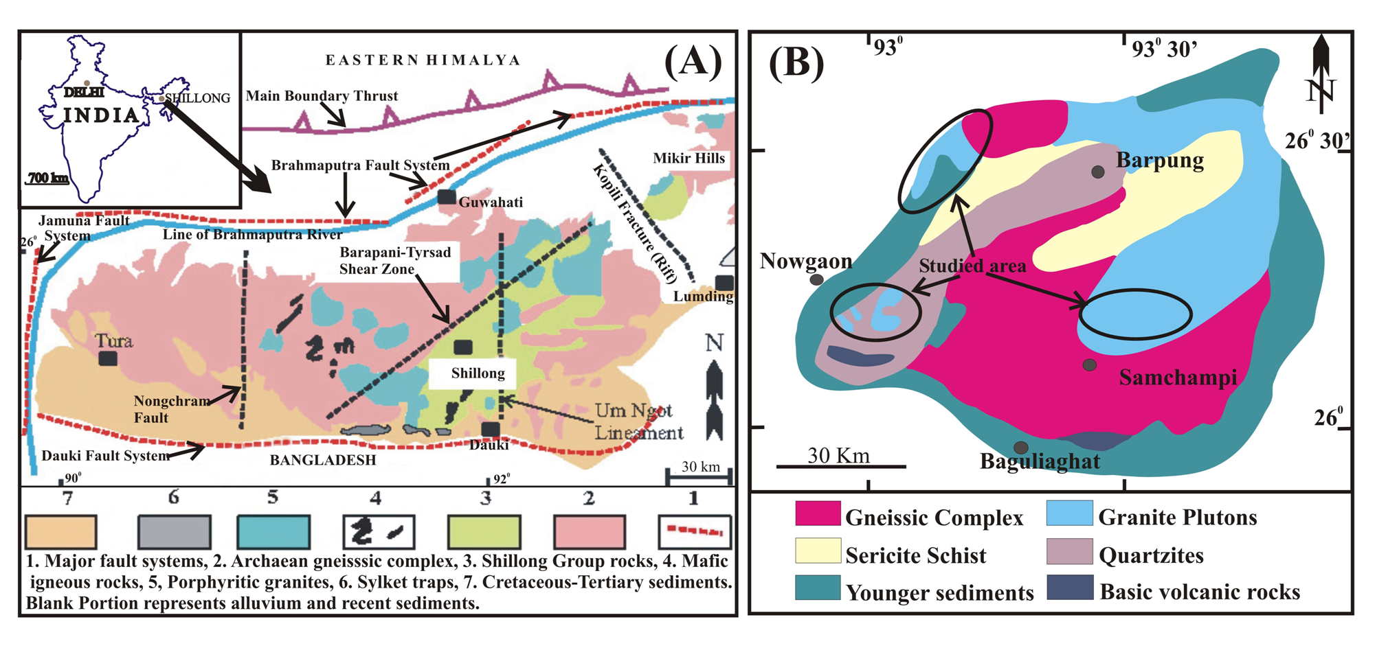
Regional Geology
Shillong plateau is separated from the peninsular India by Tertiary Ganges-Brahmaputra alluvium and Cretaceous Rajmahal Volcanics (Nandy, 1980). The plateau covers an area of about 40000 km2 within 25°20'N - 26°30'N latitude and 90°E - 93°50'E longitude (Fig. 1a). It is an E-W trending oblong horst block uplifted about 600 to 1800m above the Bangladesh plains in the south which is related to collision of the Indian and Tibetian plates during the Cenozoic (Bilham and England, 2001). The plateau is bounded and dissected by several E-W and N-S trending faults such as Dauki Fault in the south, Brahmaputra Fault in the north and Jamuna Fault in the east (Evans, 1964; Nandy, 1980). Many of these faults and lineaments were formed by the Kerguelen plume related doming during the Mesozoic (Gupta and Sen, 1988).
Figure 1. Regional geology of Shillong plateau

A. Regional geological and tectonic set-up of the Shillong Plateau (modified after Srivastava and Sinha, 2004). B. Simplified Geological map of Mikir Hills massif, Shillong plateau.
The plateau comprises of amphibolite–granulite facies basement gneisses unconformably overlain by the Shillong Group of greenschist facies intra-cratonic sandy and clayey rocks (Nandy, 2001). Granitoids occur as discordant plutons, cross-cut the Shillong Group of metasediments and basement gneisses. Granitoid plutons are more expansive in the east-central parts of the plateau (Ghosh et al., 2005). The mafic dykes and Sylhet Traps represent the youngest igneous activity within the plateau and cut across all the previous magmatic and metamorphic rock suites viz. gneisses and granitoids.
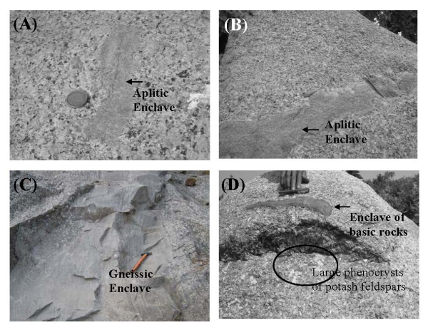
The same geological relationship and stratigraphy is present in the Mikir Hills massif (MHM) which has been described as an eastern extension of the Shillong plateau, extensive over an area of about 7000 km2 within 25.5° – 27° N latitude and 92.5° – 94° E longitude (Fig. 1b). A major N-S fracture zone viz. Kopili rift separates the Mikir Hills massif from the Shillong plateau proper. The granitoids of the Mikir Hills massif are un-deformed and occur as intrusives into the basement gneisses and contain enclaves of gneisses, aplites and basic rocks (Fig. 2). The un-deformed nature of the granitoids indicates that the plateau might have attained stability after the emplacements of the granitoids and no further orogenic movements have taken place.
Figure 2. Field photographs of granitoids
Field photographs of granitoids containing enclaves of gneisses, aplites and basic rocks.