Geological Setting
The Indian plate is a mosaic of five major nuclei viz. Aravalli-Bundelkhand, Bastar, Western Dharwar, Eastern Dharwar and Singhbhum along with southern granulite terrane (Naqvi and Rogers, 1987). Although stabilization of these nuclei has taken place at different times in the Archaean, a stable configuration of the Indian plate, consisting of all these cratonic blocks, was by and large complete by 2.5 Ga (Stein et al., 2004). The subsequent Paleoproterozoic evolution of the Indian landmass has generally been considered to be the fast accretion of island-arc systems and the formation of the accretionary orogens along the margins of these nuclei.
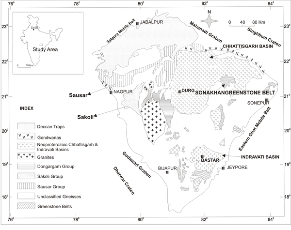
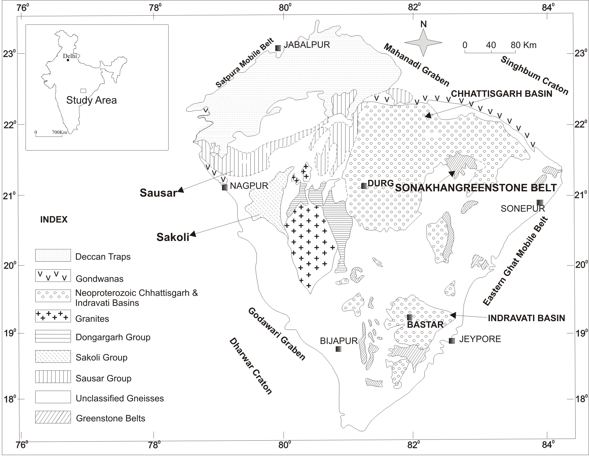
The Bastar craton of the central Indian shield is bounded by the Eastern Ghats, the Mahanadi and the Godavari rifts and the Son-Narmada lineament. It consists predominantly of gneisses and granitoids with supracrustal rocks viz. Dongargarh, Sakoli, Sukma, Bengpal and Bailadila Iron ore formations. These rocks are overlain by the undeformed Proterozoic basins, referred to as Purana basins (Crookshank, 1963; Naqvi and Rogers, 1987; Ramakrishnan, 1990; Prasad, 1990). In addition to these rocks, the craton contains greenstone belts, which occur as small isolated outcrops near Bastar, Jeypore, Bijapur, Sonepur and Sonakhan (Fig. 1). Bastar craton is the least studied terrain among the cratons of the Indian plate, and so also its greenstone belts. Details of the geological and geochemical studies of these greenstone belts are warranted to unravel the geological evolution of the Indian Precambrian shield. Although the petrological and the tectonic account of the Neoarchaean mafic rocks of the southern Bastar greenstone belt have been carried out by Srivastava et al. (2004), Srivastava and Singh (1999) and Srivastava and Verma (1998), no geochemical data are available for the Sonakhan greenstone which lies at the northeastern part of the Bastar craton.
Figure 1. Geological map of the Bastar craton
Geological map of the Bastar craton, central Indian shield (Ramakrishnan, 1990), showing locations of the Sonakhan and other greenstone belts. Inset: Map showing the location of the study area.
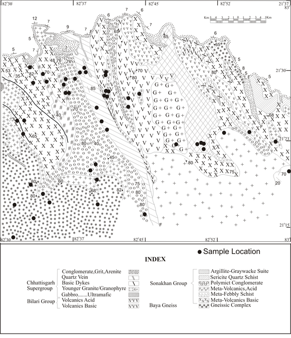
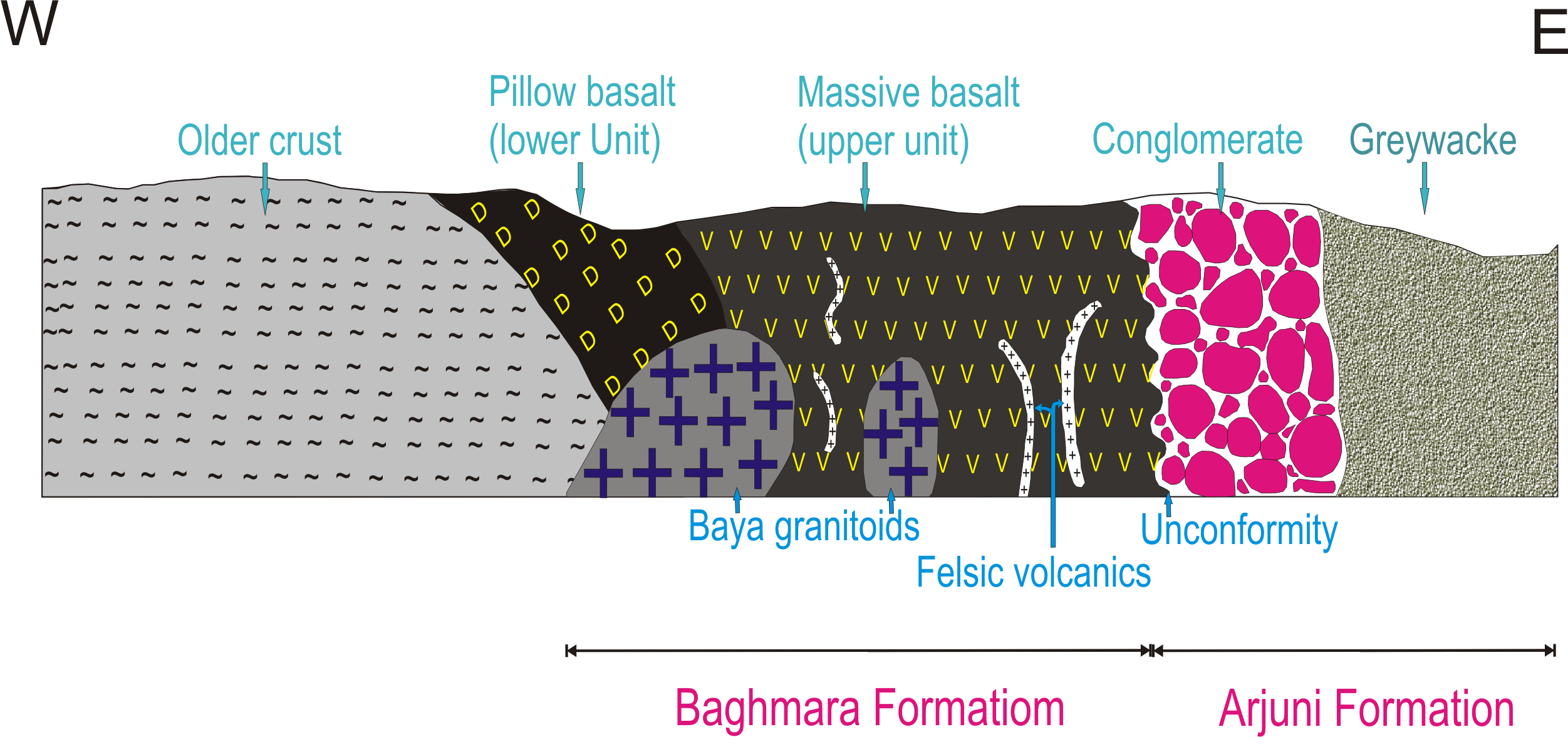
No radiometric age data are available for the Sonakhan greenstone belt. However, the Sonakhan greenstone belt has been considered equivalent to Neoarchaean to Paleoproterozoic greenstone belts of the southern Bastar craton (Das et al., 1990; Srivastava et al., 2009, 2004), based on similarities in geological and lithological makeup. This inference is further corroborated by the stratigraphic position as the greenstone belt underlies the Mesoproterozoic Chhattisgarh Supergroup (Das et al., 2009; Parthanabis-Deb et al., 2007). The Sonakhan granite-greenstone complex is a relatively small oblong belt with NNW-trending structural grain (Fig. 2). The lithostratigraphic succession of the Sonakhan belt was first worked out by Das et al. (1990). Later Saha et al. (2000) refined the lithostratigraphic succession of the greenstone which is given in Table 1. The Sonakhan Group comprises of (a) the lower Baghmara Formation consisting of dominantly metabasalt and subordinate felsic volcanics and (b) the upper Arjuni Formation consisting of greywacke and conglomerate.
Table 1. Stratigraphic succession of the Sonakhan Greenstone belt (Saha et al., 2000)
| Unit | Description | Intrusives | |
|---|---|---|---|
| Arjuni Formation | Thick succession of immature sandstone, polymict conglomerate, brown shale/mudstone | Granophyre bodies and dioritic dykes | |
| SONAKHAN | Unconformity | ||
| GROUP | Baghmara Formation | Pillowed metabasalt, massive basalt with minor banded iron formation, greywacke, black shale and chert | Dykes or sills of felsic porphy or diorite |
Figure 2. Geological map of the Sonakhan belt
Geological map of the Sonakhan belt (Das et al., 1990) showing important sample locations.
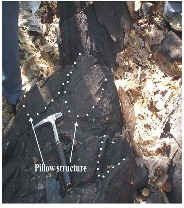
The suite of rocks belonging to the Baghmara Formation is dominated by massive through pillowed (Fig. 3), vesicular to amygdular basalt and constitute the lower unit of this formation, whereas the upper unit basalts are devoid of pillows. Minor rhyolite/felsic volcanics are associated with upper unit basalts. The Baya granitoids are intrusive into the Baghmara Formation (Fig. 4).
Figure 3. Baghmara Formation showing pillow structure
Field photograph of the lower unit basalts of the Baghmara Formation showing pillow structure near Jangla Pahar.
Figure 4. Schematic E-W cross section

Schematic E-W cross section showing relationships among different litho-units of the Sonakhan Greenstone belt.