Appendix A. Two-day fieldtrip in the Sesia magmatic system
The two-day fieldtrip will lead people across the Sesia magmatic system, starting from the deepest exposure of the crustal section and rising progressively up-section to the volcanic rocks at the surface. Stops are grouped in localities indicated by rectangles in Figure A1.
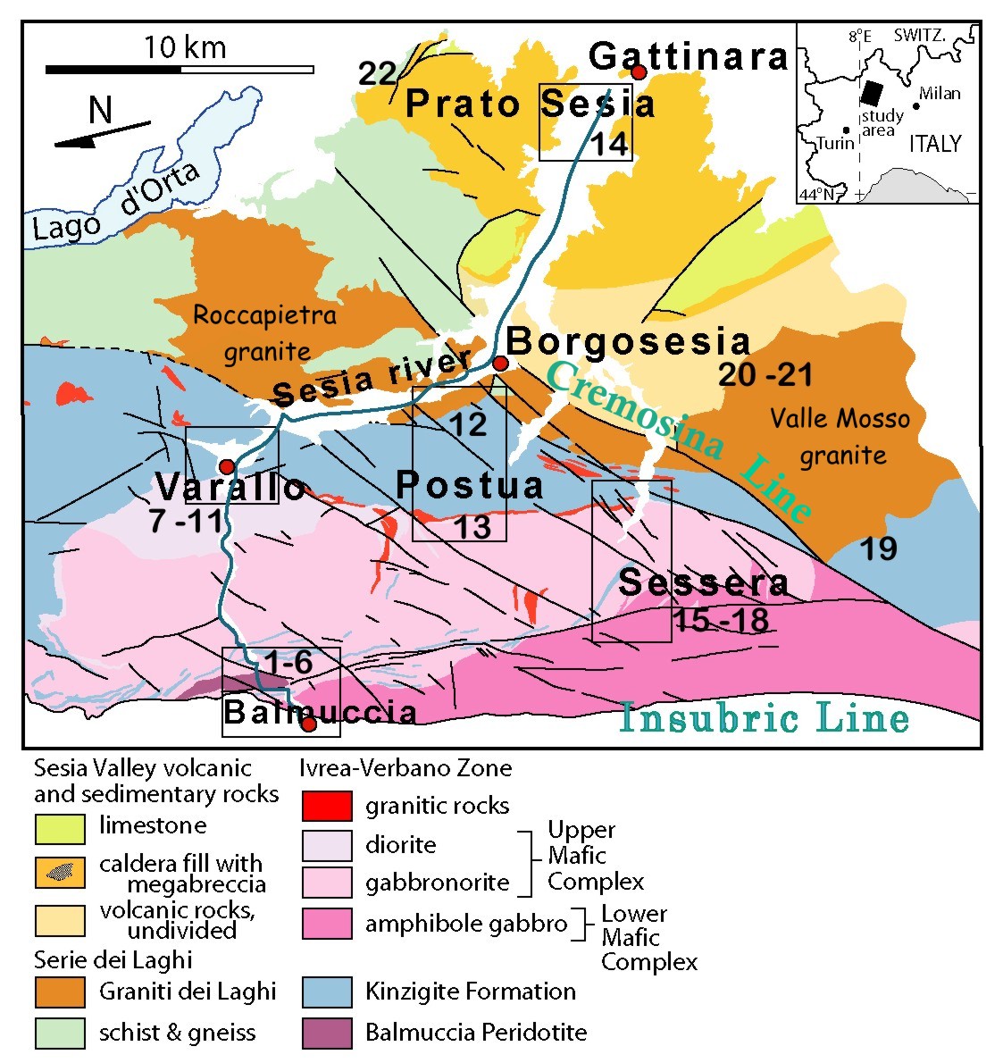
Figure A1. Map of the Sesia magmatic system
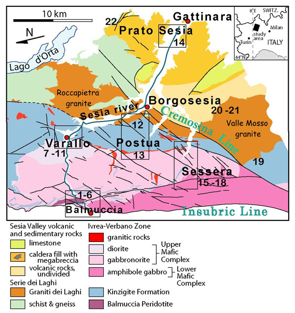
Geologic sketch map of the Sesia magmatic system, rotated about 100° anticlockwise to approximate the original setting before alpine tilting, modified from Quick et al. 2007. The Insubric Line, located at the bottom of the Figure, bounds the deepest exposure of the crustal section. Rectangles indicate multiple-stop localities as described in subsequent figures.
First day
The excursion begins with a traverse across the Mafic Complex in the Sesia River, starting at the Insubric line, followed by stops in the Balmuccia area and ending in the upper Mafic Complex in the vicinity of Varallo up to the roof contact with the Kinzigite Formation. The excursion continues, cross-cutting the Kinzigite Formation to see otho- and paragneisses in anatectic facies, and mingling of mafic and acidic magmas at the base of the large granitic pluton of Roccapietra. After crossing the Cremosina Line, the excursion ends in the area of Prato Sesia to see the best outcrops of megabreccia filling the caldera.
Stops in the Balmuccia area.
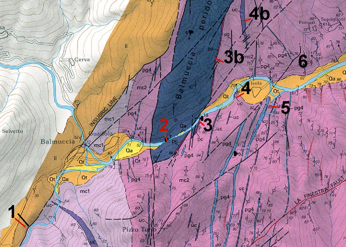
Figure A2. The Balmuccia area

The Balmuccia area cut out and modified from Quick et al., (2003), reported in Appendix B.
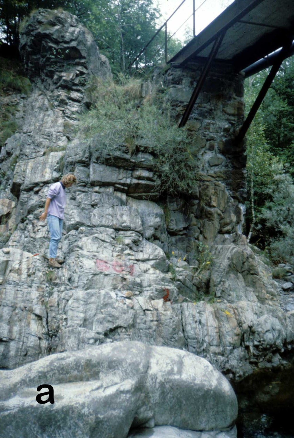
Stop 1) Mylonite of the Insubric Line. Leave the car at the locality “Dinelli” (N 45 48 25; E 8 7 26) and follow a short path to reach an old bridge over the Sesia river where the mylonites of the Insubric Line are well exposed (N 45 48 21.3; E 8 7 32.8). The geomorphology, in this segment of the Valley, is strongly controlled by the Insubric fault.
Stop 2) Balmuccia peridotite (N45 49 12.6 E8 09 11.5). Once thought to be the mantle basement above which the Mafic Complex was underplated at the crust-mantle boundary, this lens of mantle rocks was interfingered within the Kinzigite Formation before the Permian mafic intrusion. Even though it does not present a true petrologic Moho and is not directly involved in the igneous evolution of the Sesia magmatic system, it is worth a look because it is one of the best preserved mantle peridotites in the world. The peridotite suffered a number of partial melting events which are recorded by networks of Cr-diopside and Al-augite dikes and bands (Fig. A3)
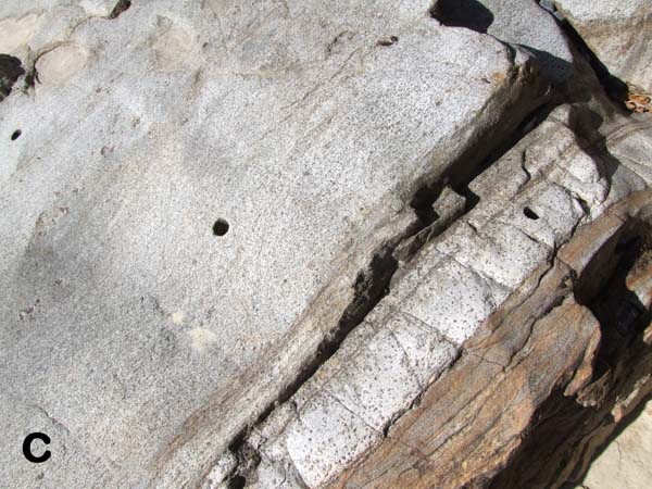
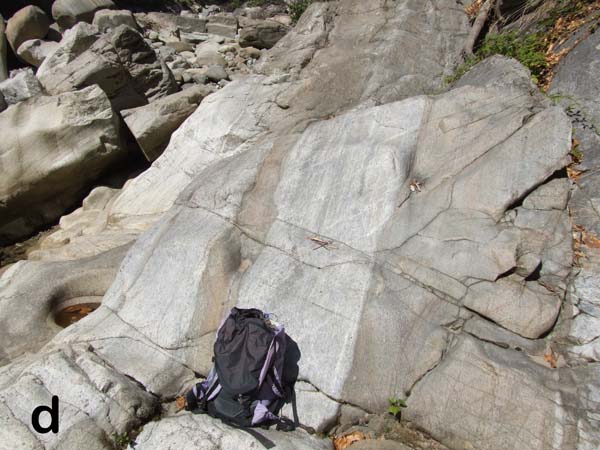
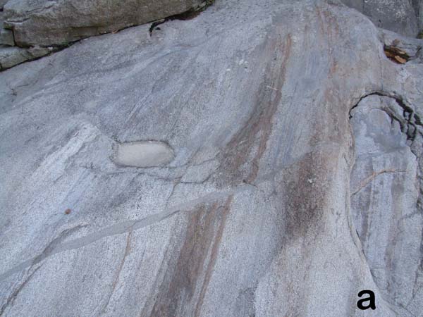
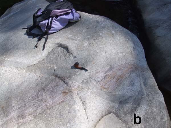
Figure A3. Advanced spinel foliation
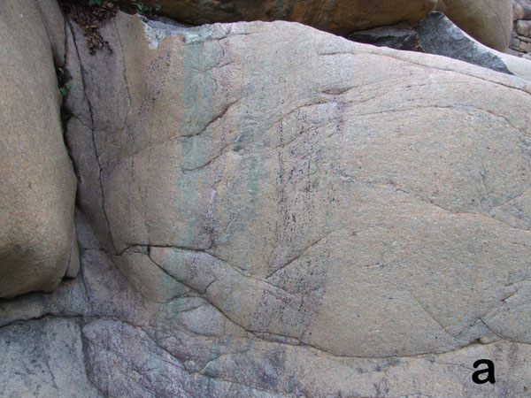
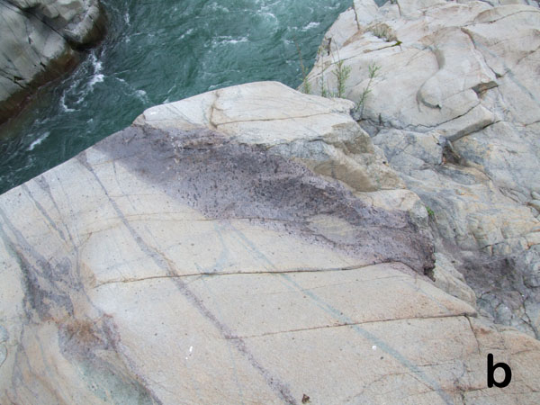
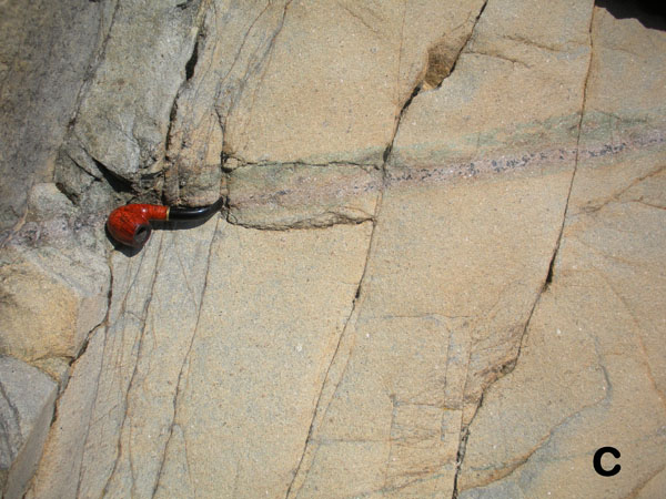
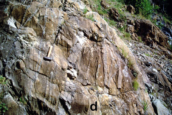
3a, b, c: Cr-diopside and Al-augite bands and dikes in the Balmuccia peridotite (Stop 2).; 3d, advanced spinel foliation and boudinage of Cr-diopside dykes in the border zone of the Balmuccia peridotite (Stop 3b).
Stop 3) Balmuccia Peridotite-Mafic Complex contact. Park the car at Isola (N45 49 35; E8 10 13), walk through the village towards the west and follow a path along the right bank of the Sesia river for about 15 minutes and then descend to the river, after the first outcrops of peridotite. (N45 49 24; E8 09 38) Along the river, exposure of the primary contact between mantle peridotite and a cumulus sequence of pyroxenite, pegmatoidal clinopyroxenite and finally gabbro. These rocks crystallized within the paragneiss bearing belt, at the boundary between the mantle lens and paragneisses of the Kinzigite Formation. Another exposure of the contact between strongly foliated mantle tectonite and of the cumulus sequence might be seen climbing the facing slope above the left-bank of the Sesia to a waterfall (Fig. A4, Stop 3b). We do not recommend this climb!! The climb may be dangerous!


Stop 4) Deformation of ultramafic cumulates (N45 49 31; E8 09 55). Coming back toward Isola, we stop on a large outcrop on the river, where gabbros show advanced stretching foliation, isoclinal folds and boudinage of ultramafic cumulates, which are common at this depth in the Mafic Complex. These high-T deformations are better exposed uphill on the opposite slope of the valley (Stop 4b), but this would require about 1 hour of hiking on a trail overgrown with thornbush and then a scramble on a steep slope to reach the locality where pictures reported in Figure 11 of the main text were shot.
Stop 5) Paragneiss septum (N45 49 24; E8 10 18). Follow a trail from Isola to the south toward the “croso della Gavala.” Within a few minutes, you will reach a bridge crossing the stream above a paragneiss septum. The rock is a metapelitic granulite with strongly parallel fabric and contains abundant garnet, quartz, plagioclase ± graphite, sillimanite and very rare biotite (Fig. A4b). The septum is in primary contact with foliated norite. At a distance of about 20 metes, it is possible to observe the entrance of an abandoned nickel mine, from which Fe/Ni sulphides in cumulus pyroxenite were mined up to WWII.
Stop 6) Gabbroic cumulates (approximatively N45 49 44.4 E8 10 33.6). Following the road to Sassiglioni, we can observe banded and foliated gabbroic cumulates at the deepest level of the upper Mafic Complex.
Stops in the Varallo area
Figure A5. The Varallo area
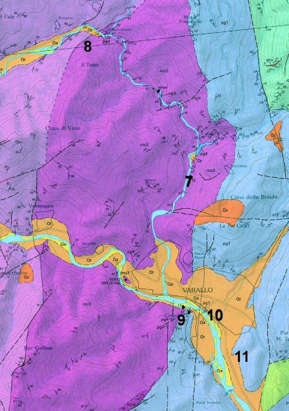
The Varallo area, cut out and modified from Quick et al., (2003), reported in Appendix B.
Stop 7) “Diorites” of the upper Mafic Complex(N45 49 28; E8 14 52). From Varallo, take the road to Val Mastallone until locality Aniceti where you may park beside the road. Exposed in the stream is a swarm of mafic enclaves in the “Diorites”. The enclaves are fine-grained, porphyritic gabbro with plagioclase phenocrysts. (Fig. A6a)
Figure A6. Enclaves, Aniceti
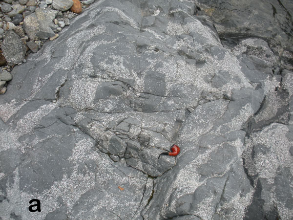
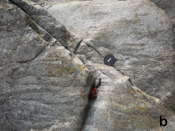
6a, swarm of faintly elongated enclaves at stop7.; 6b, more intense stretching of enclaves at deepest levels, in proximity to the transition between “diorites” and Main Gabbro, stop 8, (N45 51 11.6 E8 14 12.8)
Stop 8) Stretched mafic enclaves (N45 51 11 E8 14 17). In the stream at locality Bocciolaro, an example of mingled diorite and mafic enclaves crops out at the transition between Main gabbro and “Diorites”. More advanced stretching of mingled rocks (Fig. A6b) is visible about 100 meters upstream, at (N45 51 11.6 E8 14 12.8).
Stop 9) Mafic Complex – Kinzigite Formation contact (N45 48 38 E8 15 25). Take the bridge from Varallo to Crevola, and within 100 meters of crossing the bridge, you may enter a drive way on the right for a parking lot for tennis courts on the south bank of the Sesia River. Along the river there is one of the best exposures of the contact between Mafic Complex and the Kinzigite Formation. Amphibolite-facies migmatite, (Fig. A7) with chaotic deformation, is in primary contact with garnet-bearing diorite (following upstream about 200 meters).
Figure A7. Migmatite and Boudinage
7a Migmatite at Crevola, stop 9.; 7b,. Boudinage in metapelitic gneiss interlayered with calc-silicate bands, stop 10.
Stop 10) Boudinage in the Kinzigite Formation (N45 48 39; E8 15 35). Recross the bridge toward Varallo and park the car at the north side of the river. Under the bridge, rocks of the Kinzigite Formation contain boudinaged metapelites within ductile calc-silicates (Fig. A7b). Small granite bodies are boudinaged within calc-silicate (Fig. A8a) and crosscut the foliation, consistent with segregation of granitic melts during deformation.
Figure A8. Leucosome and boudinaged granite

8a, granitic leucosome cross-cutting calcsiliscate. 8b, Boudinaged granite in calc-silicate band.
Stop 11) Granite dike cutting the Kinzigite Formation (N45 47 46; E8 16 19). Along the road from Varallo to Borgosesia, the Kinzigite Formation is cross-cut by a dike of fine-grained granite (Fig. A9) that is similar, both petrologically and chemically, to microgranite mingled with granodiorite in the Roccapietra pluton.
The Agnona - Postua area
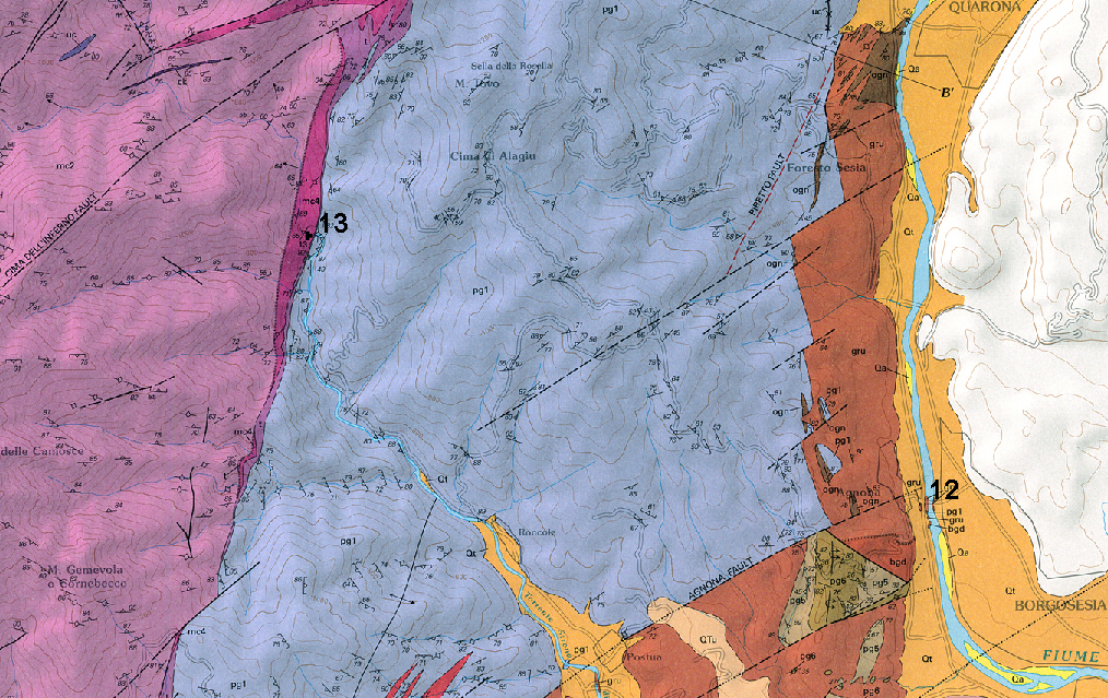
Figure A10. Agnona - Postua area
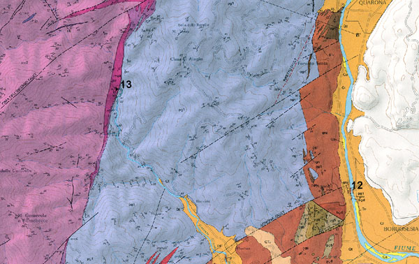
Stops in the Agnona - Postua area. (Cut out and modified from Quick et al., (2003), reported in Appendix B.)
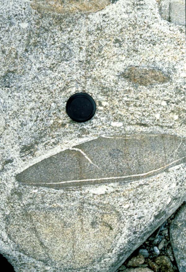
Figure A11. Granitoid with inclusions, Postua

Xenoliths-bearing granitoid at the contact between Mafic Complex and Kinzigite Formation, Val Strona di Postua, stop 13.
Stop 12) Deep levels of the Roccapietra Pluton (N45 43 24; E8 15 44). Following the road from Varallo to Borgosesia on the right bank of the Sesia, park the car immediately after having passed beneath an old bridge connecting Agnona and Borgosesia towns. This stop is within the deepest levels of the Roccapietra pluton, where mingled dioritic and granitic rocks, with locally abundant inclusions of the country rock, are exposed in a good outcrop on the river.
Stop 13) Roof of the Mafic Complex in Val Strona di Postua. This stop necessitates a deviation and a hike that collectively requires about half a day, and should be considered as a separate excursion, as it is hard to be included in the same, single day. After having reached the village of Postua (N45 42 47; E8 13 50) continue for about 5 km along a dirt road on the left bank of the stream. Formal permission is needed to use this road and can be obtained at the office of the municipality office in Postua (open only in the morning of working days!). Park the car in locality “ponte rosso” (N45 44 04; E8 12 03). Continue following a path upstream on the right bank for about 20 minutes, reaching the stream at the contact between Kinzigite Formation and the Mafic Complex (N45 44 35; E8 12 03) The contact is characterized by unfoliated granitoids, which contain a number of inclusions from the roof rocks (Fig. A11). Continuing up the river, inclusion-bearing granitoids grade into faintly foliated gabbros. A foliation defined by flattened, locally abundant large poikilitic amphibole is discordant to layering in the rocks indicating a sense of shear consistent with flow of the “gabbro glacier” beneath the melting roof rocks of the Kinzigite Formation.
The Prato Sesia area
Stop 14) Caldera Megabreccia. This area is located within the caldera fill, and exposes one of the better outcrops of megabreccia. From Borgosesia, follow the the Sesia River downstream, taking the left bank south of Serravalle. 3 kilometers after the bridge over the Sesia (immediately after “La Pipa”, at N45 39 31; E8 21 32) turn to the right following the indication “Spazzacamini”. After crossing the railway, continue along the dirt road, turn to the left at the crossing and continue for about 2 km. Park the car close to the bridge over a drainage canal (N45 39 10; E8 21 23). From here walk west to the bed of the Sesia (N45 39 09; E8 21 10) arriving within a few minutes to outcrops of megabreccia (Fig. 12). Outcrops on the river are reachable only when water levels are low in the river. If the stream conditions do not allow reaching the outcrop, an alternative may be a stop on the opposite side of the river, following the road on the right bank. South of Vintebbio, after “Regione Cave”, park the car at N45 39 07, E8 21 06, and descend to the river, where megablocks included in welded tuff are exposed,.
Figure A12. Megabreccia

At stop 14, megabreccia contains blocks of red, glassy rhyolite, beside other lithologies, wrapped in welded tuff of the caldera fill.
Second day, in the morning – the Val Sessera area
The second day of the field trip provides another transect across the Sesia magmatic system, starting from outcrops of the lower Mafic complex and paragneiss bearing belt in the Sessera Valley (Fig. A12). Subsequent stops are at the Valle Mosso granitic pluton and the contact between the Valle Mosso granite and volcanic rocks.
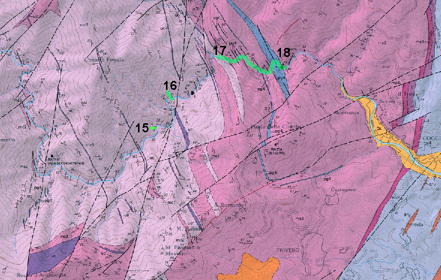
Figure A13. Val Sessera area
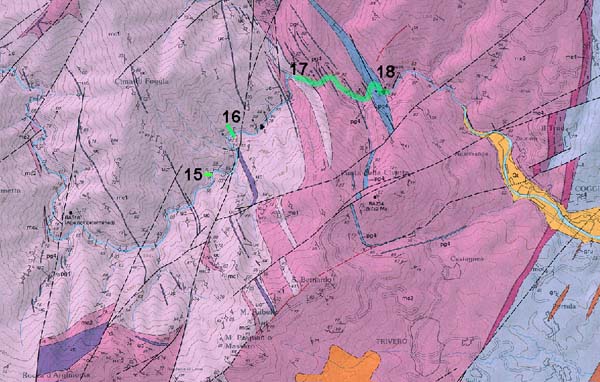
Stops in the lower Mafic Complex and paragneiss bearing belt along the Val Sessera. Cut out and modified from Quick et al., (2003), reported in Appendix B.
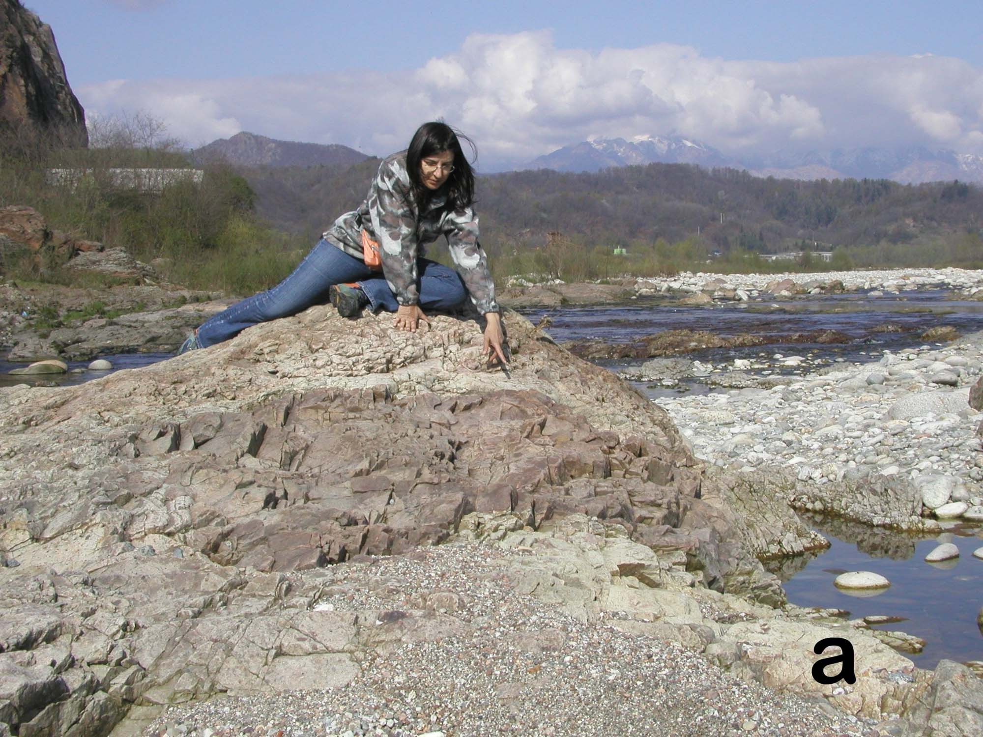
Stop 15) Synmagmatic deformation in gabbros. From Trivero, follow the asphalt road to Castagnea and then continue along a dirt road for about 7 km into the Sessera Valley. Park the car about 300 m before the only house in proximity to stop 15 (N 45 41 22; E8 7 30, locality “La Frera”), and descend to the stream to look at small synmagmatic normal faults cross-cutting recrystallized and foliated amphibole gabbro of the lower Mafic Complex (Fig. A13a), and other high-temperature deformation structures.
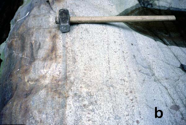
Figure A14. Lower Mafic Complex, Sessera Valley
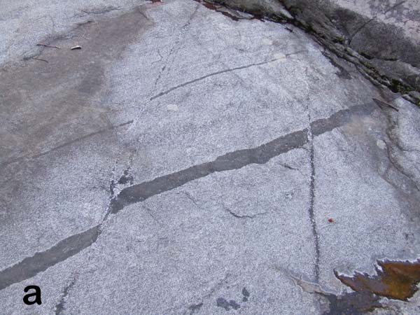

14a, at stop 15 Hypersolidus normal faults in amphibole gabbro. 14 b, at stop 16, hypersolidus normal fault cross-cutting a pyroxenite.
Stop 16) Synmagatic deformation in gabbros. (N45 41 38; E8 7 41) Some more features similar to stop 15 (Fig. 13b)
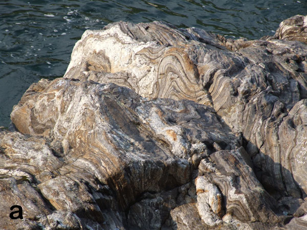
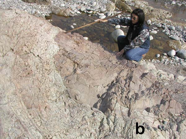
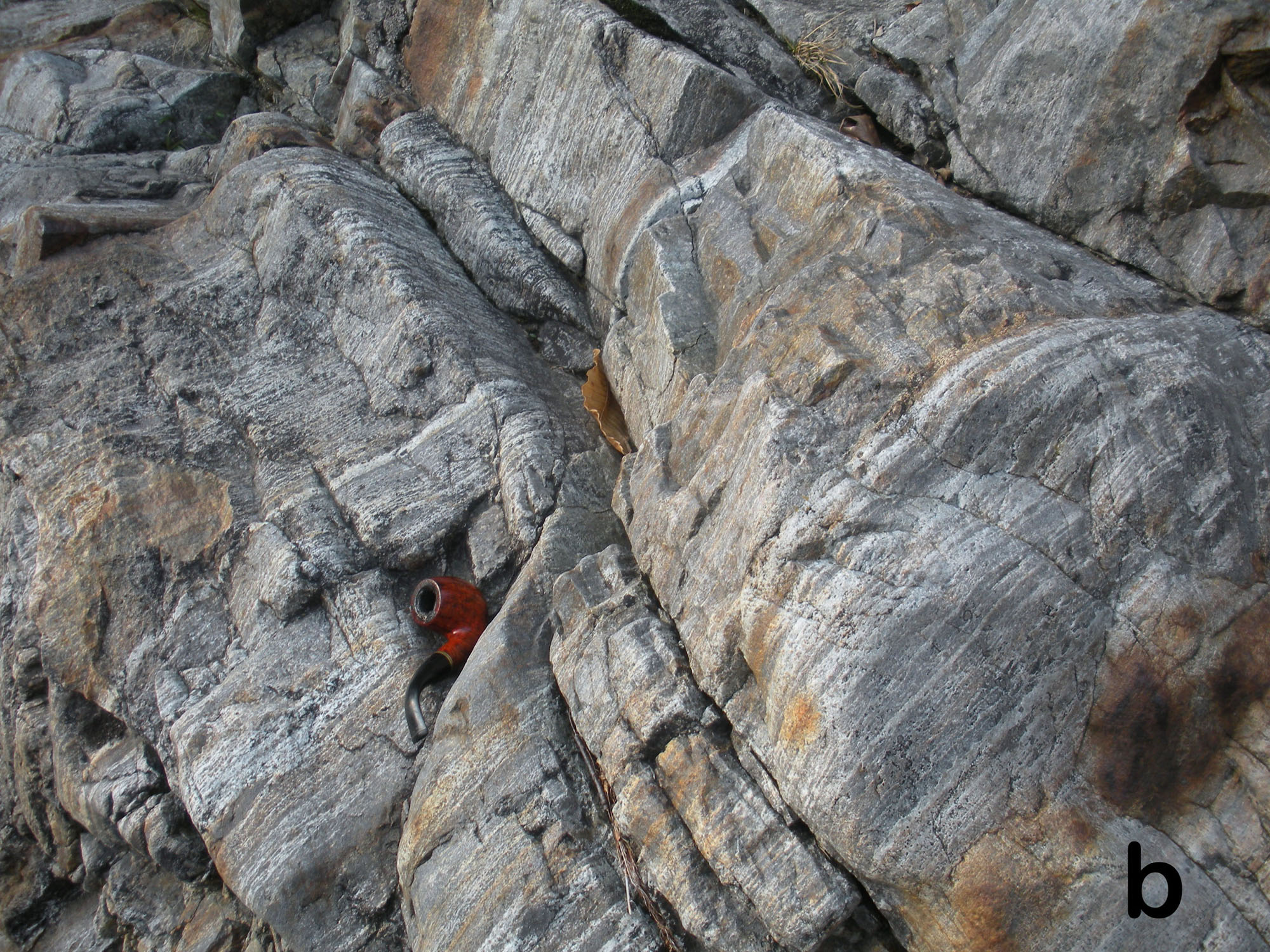
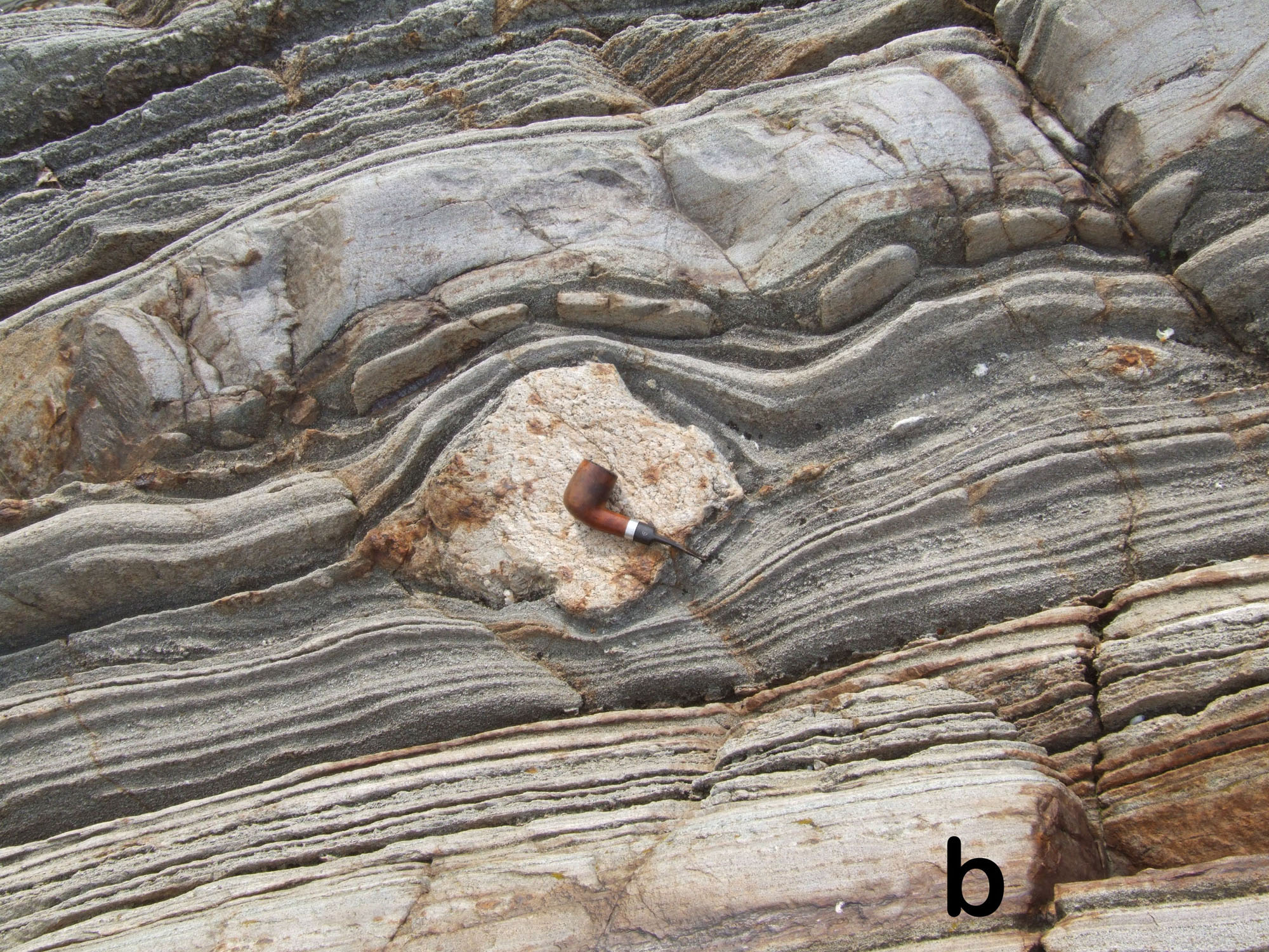
Stop 17 to 18) Traverse across a large paragneiss septum. This is a hike of about 1.3 km along the riverbed, which is feasible only if the water in the stream is low. Descend to the stream in proximity to the Piancone power station, underneath the confluence of the Sessera and Confienzo streams, and continue downstream. After the first outcrops of amphibole gabbro, noritic rocks become more abundant approaching the first paragneiss septum of the paragneiss bearing belt (N45 42 01; E 8 8 20). From here downward, the stream cross-cuts the paragneiss bearing belt, where norites, quartz-norites and charnockites are abundant and interlayered with restitic paragneiss septa and minor amphibole gabbros (Figs. A14 and A15).
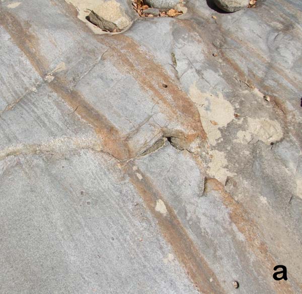
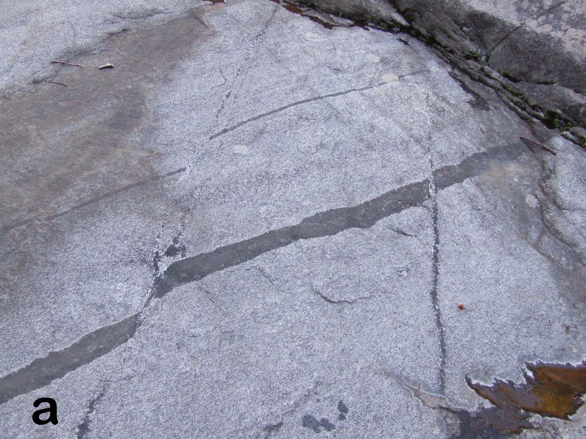
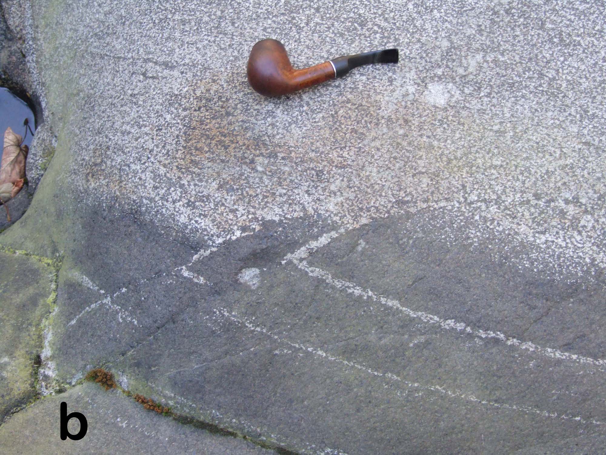
Figure A15. Bands of norite and amphibole gabbro; Restitic paragneiss
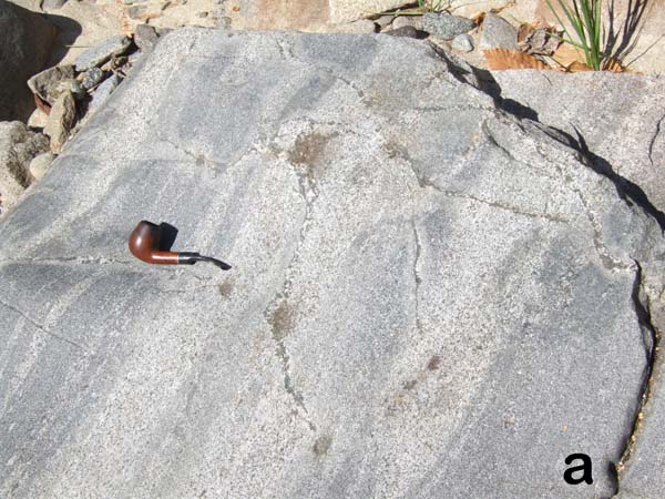
15a, Bands and norite and amphibole gabbro with a brittle crack filled by gabbro. 15b, band of restitic paragneiss, made of predominant garnet and plagioclase, with minor sillimanite and antiperthite, eventually corundum.
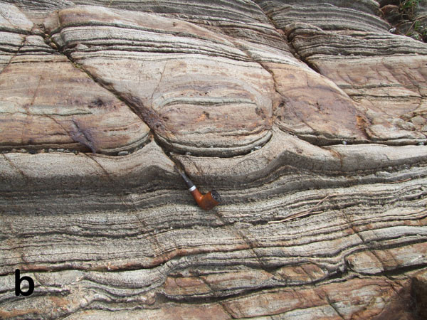
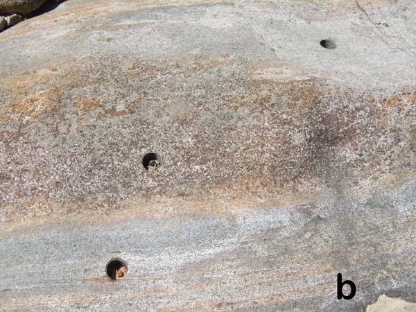
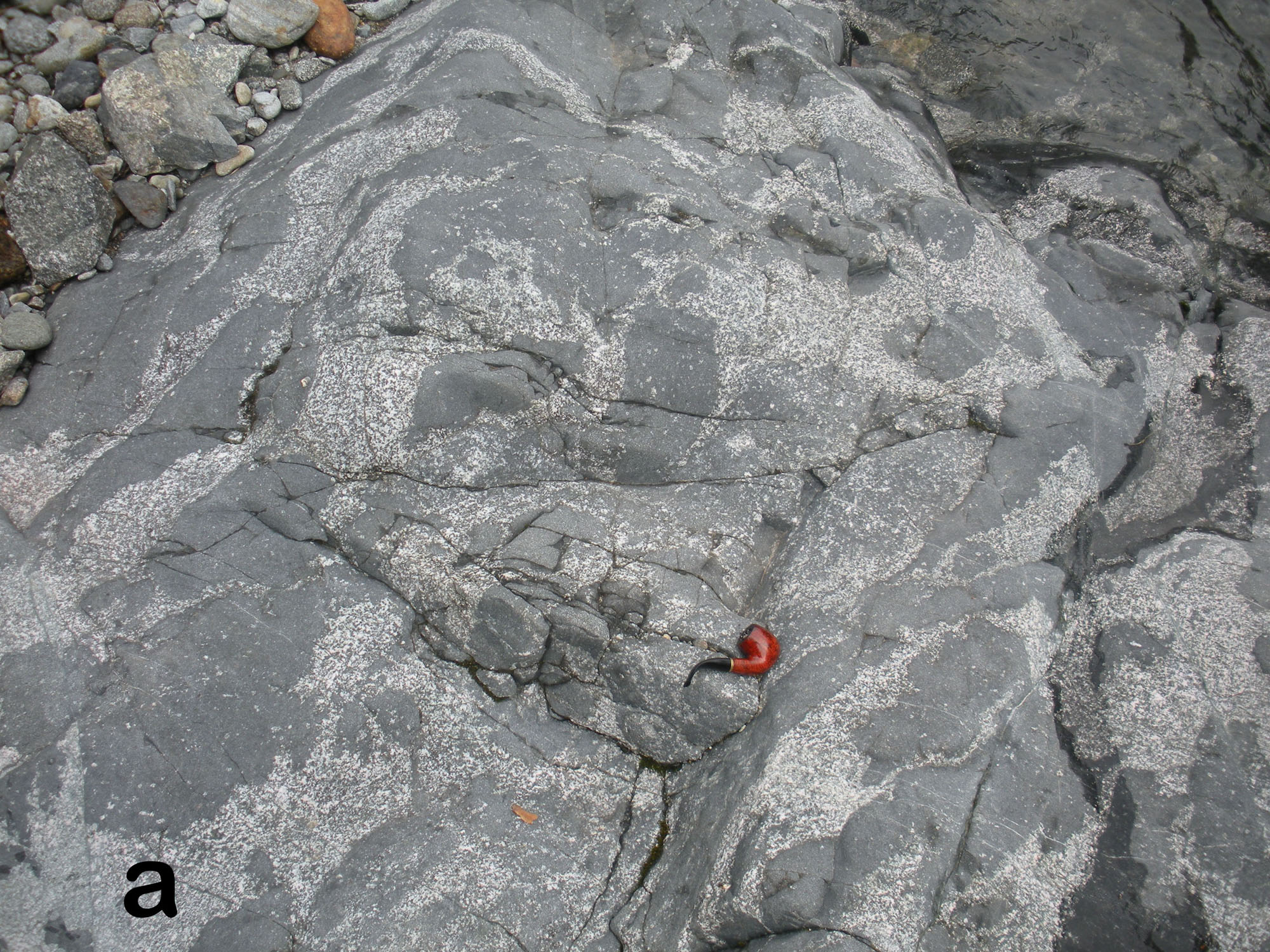
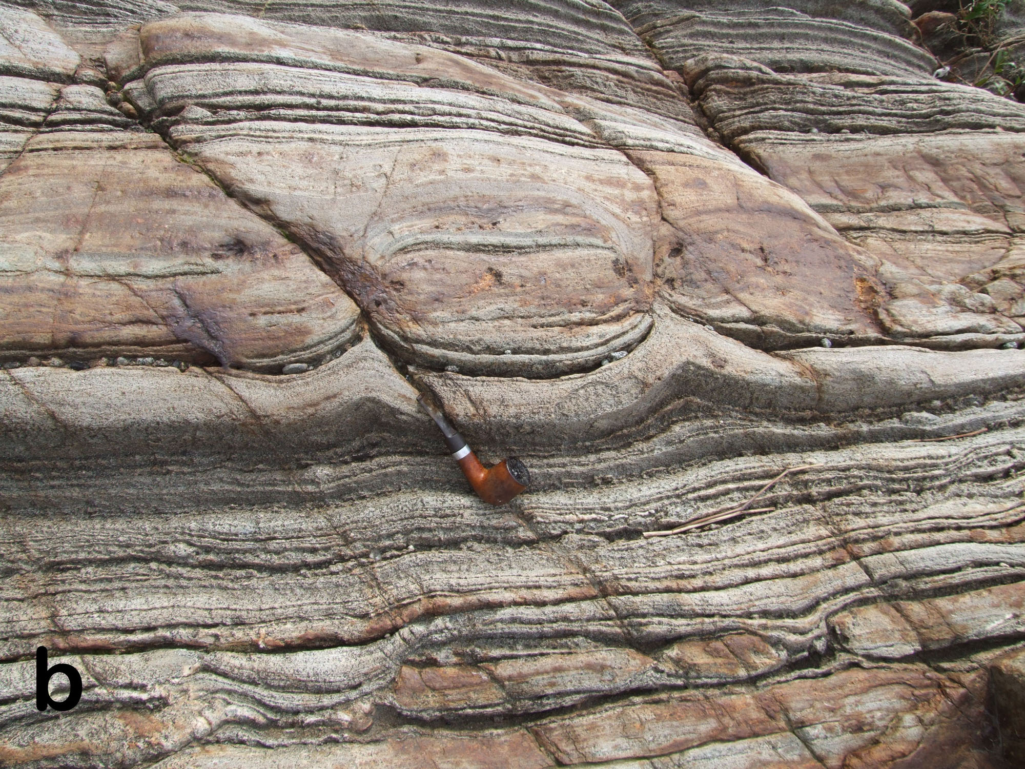
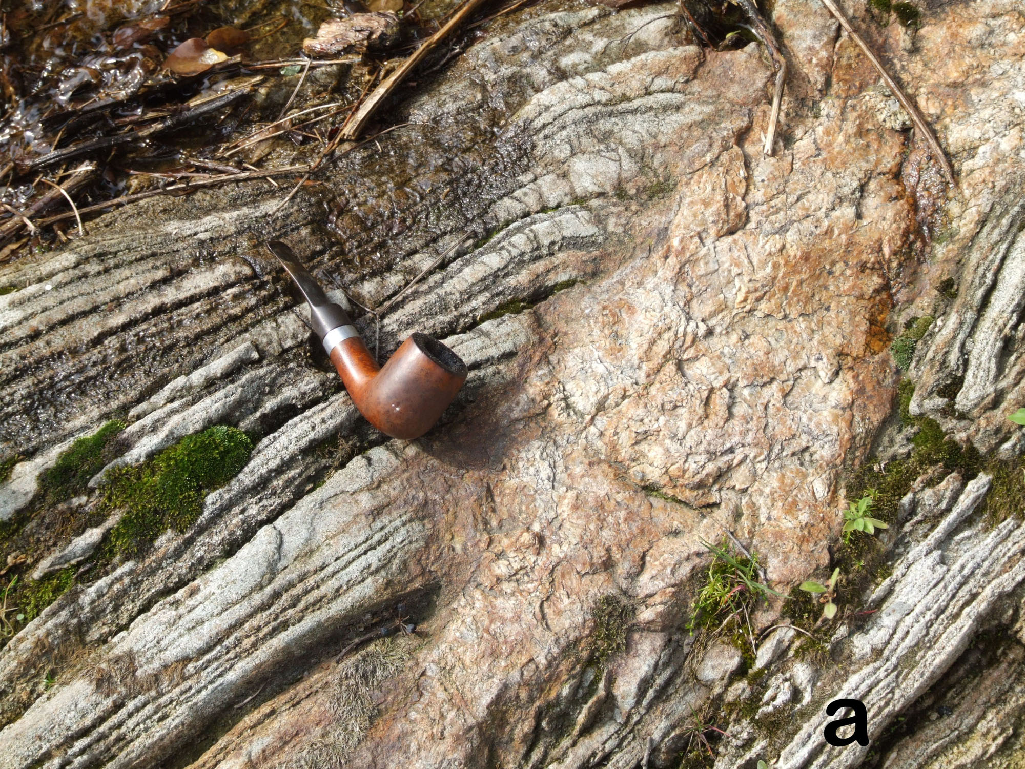
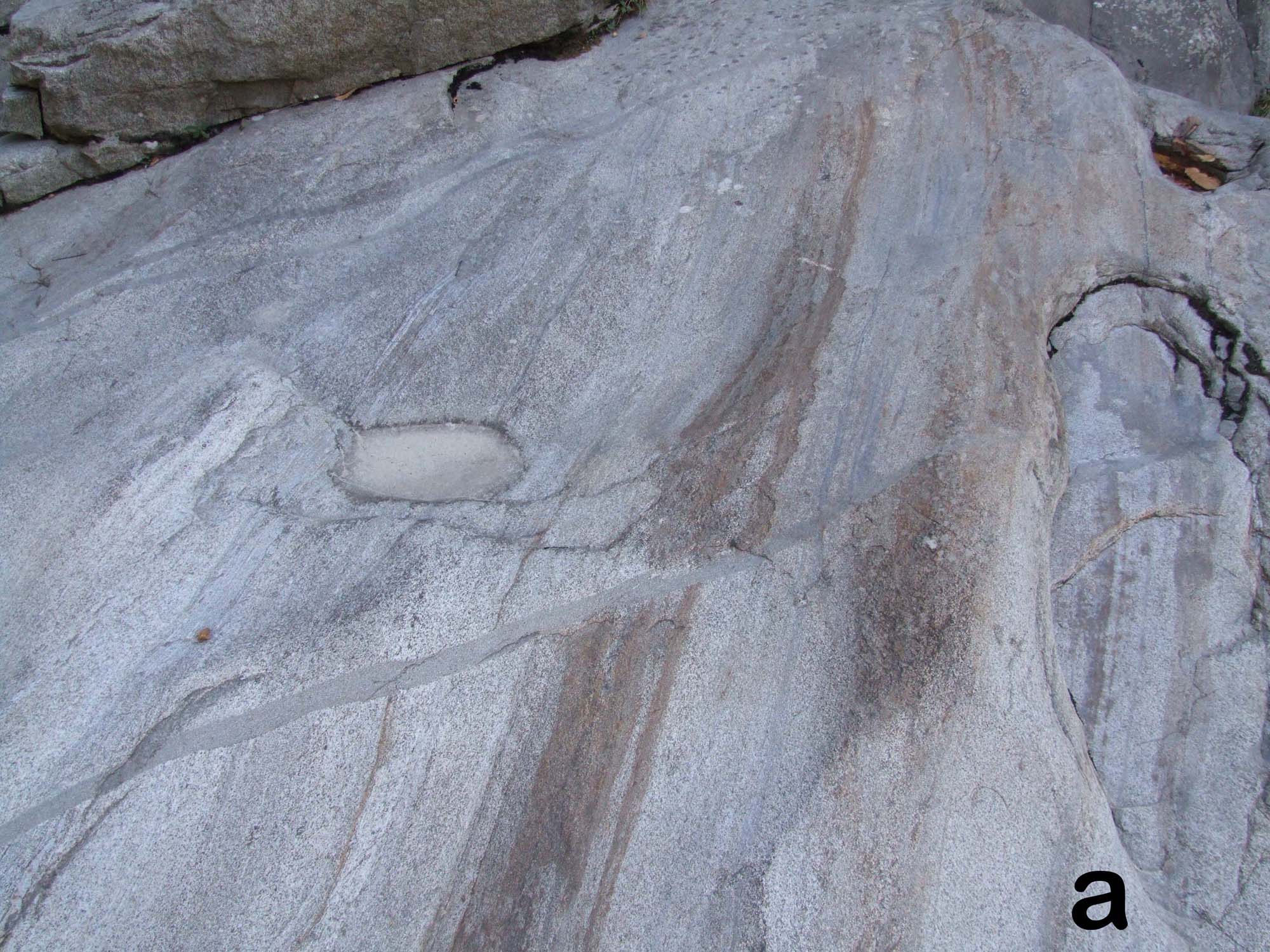
Figure A16. Thin septa, quartz-norite and charnockite
16a and b: restitic paragneiss septa in contact with garnet-bearing norite. Figure A16 c, d and e: foliated bands of quartz-norite and charnockite, abundant within the Paragneiss bearing belt, especially in proximity to paragneiss septa.
At the end of the traverse is the thickest paragneiss septum, which is about 100 m across (N 45 41 59; E 8 9 03). Before arriving at this septum, smaller septa of paragneiss are included in norite and cut by small normal faults filled by fine-grained gabbro (Fig. A16). In the septum, charnockite is present either as bands or discordant dikes (Fig. A17) within a garnet-rich metasediment in which thin corundum bands may easily be found. Biotite is present, although rare. At the eastern contact of the septum, garnet-bearing norites are present. Immediately above, bands of charnockite mingled with norite are transposed into the foliation. The composition of these granitoids is very similar to that of leucosomes observed at the roof of the Mafic Complex (Fig. A7a), suggesting that the last septum incorporated in the Mafic Complex was as fertile as the roof Kinzigite (Sinigoi et al., in prep)
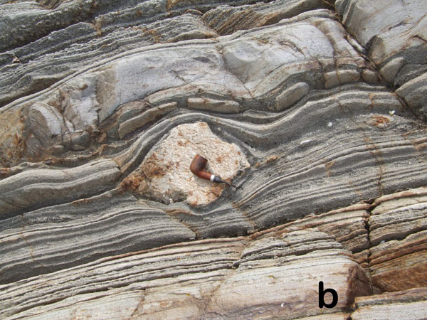
Figure A17. Shreds in norite
Shreds of paragneiss encased in norite and cut by synmagmatic faults beneath the thickest septum.
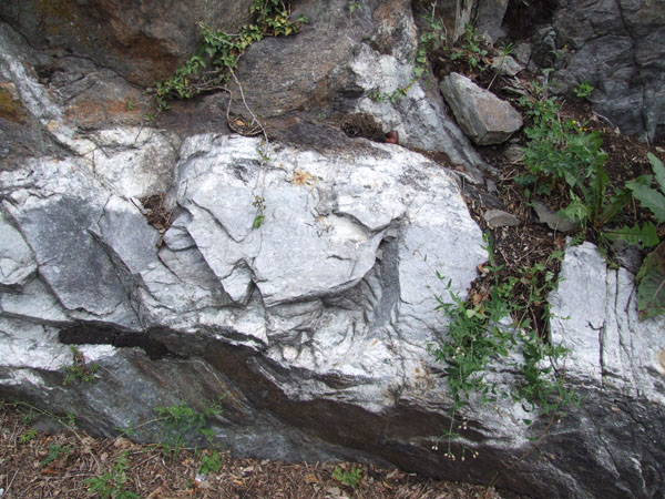
Figure A18. Charnockitic dike
Discordant dike of charnockitic granitoid cross-cutting banding and foliation of the thickest septum (at the end of traverse from stop 17 to stop 18).
Second day, in the afternoon. From the Valle Mosso granite to the volcanic rocks of the Sesia.
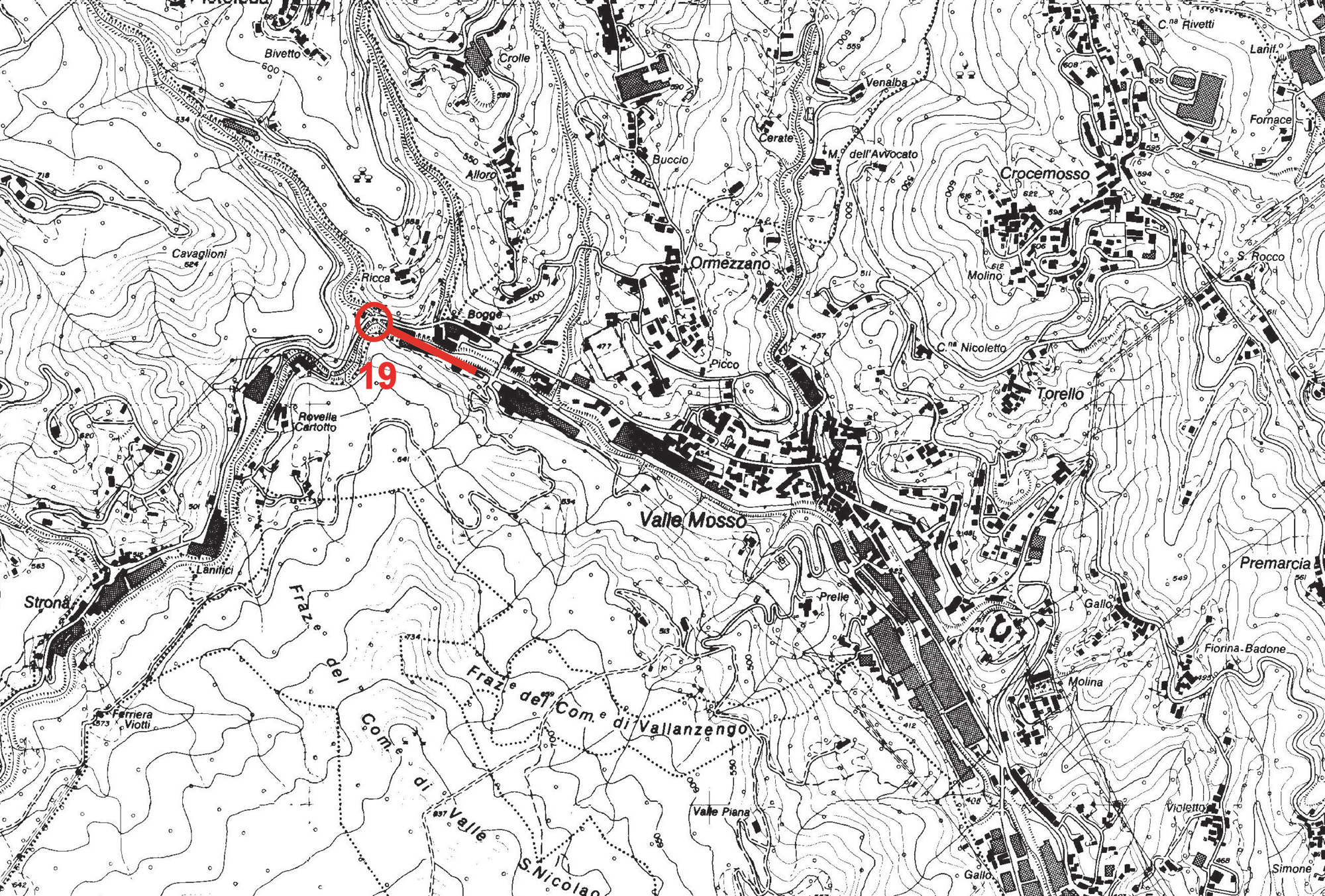
Figure A19. Valle Mosso area
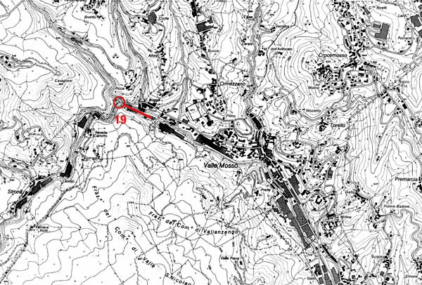
Location of stop 19, in proximity to Valle Mosso town. Topography from CTR, Regione Piemonte. Detailed geologic map in progress and not yet available).
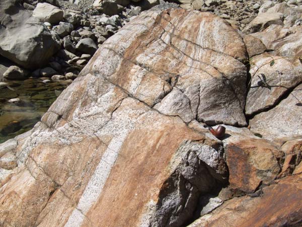
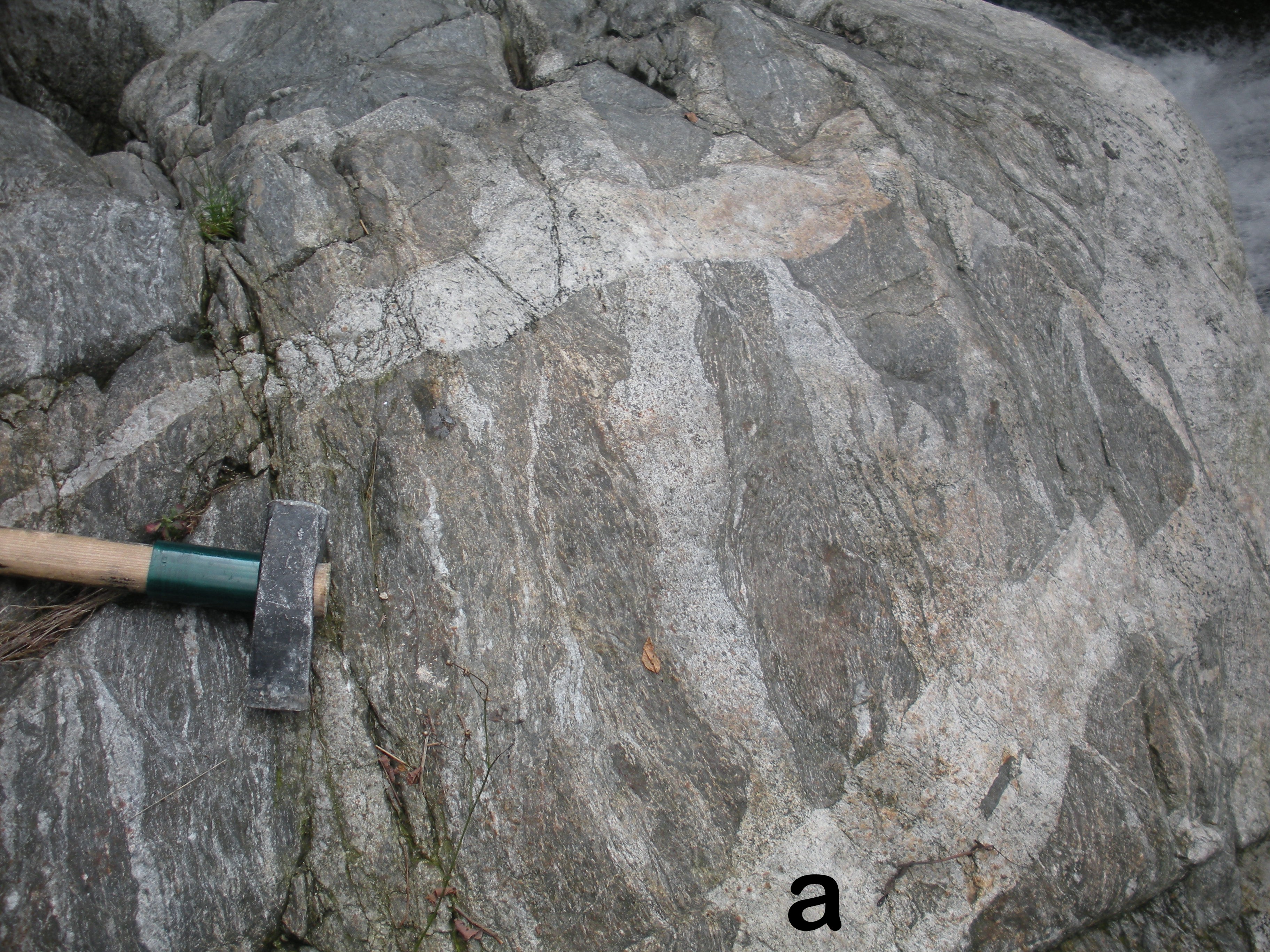
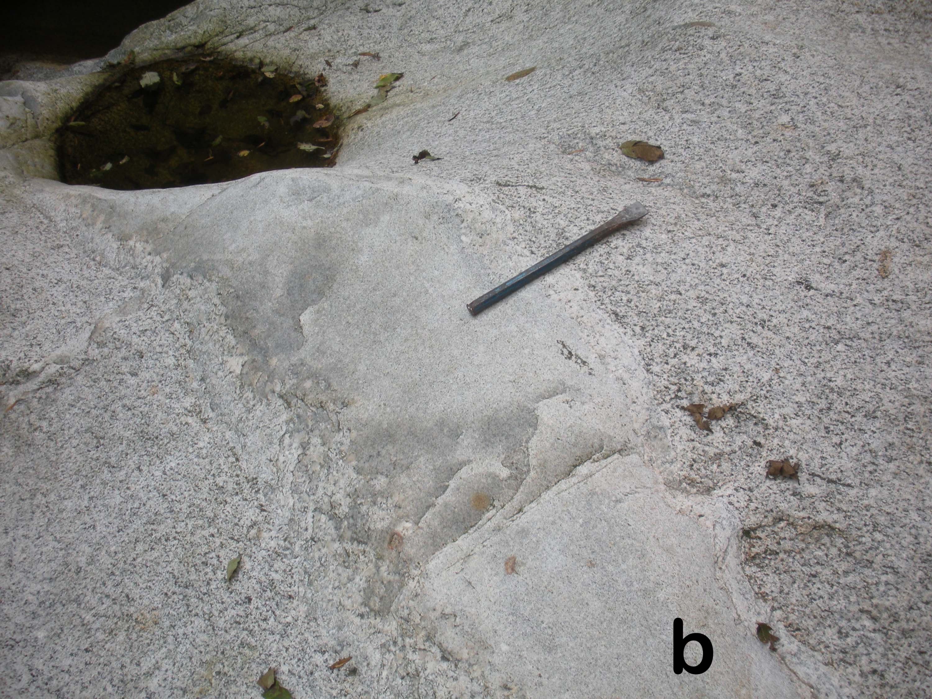
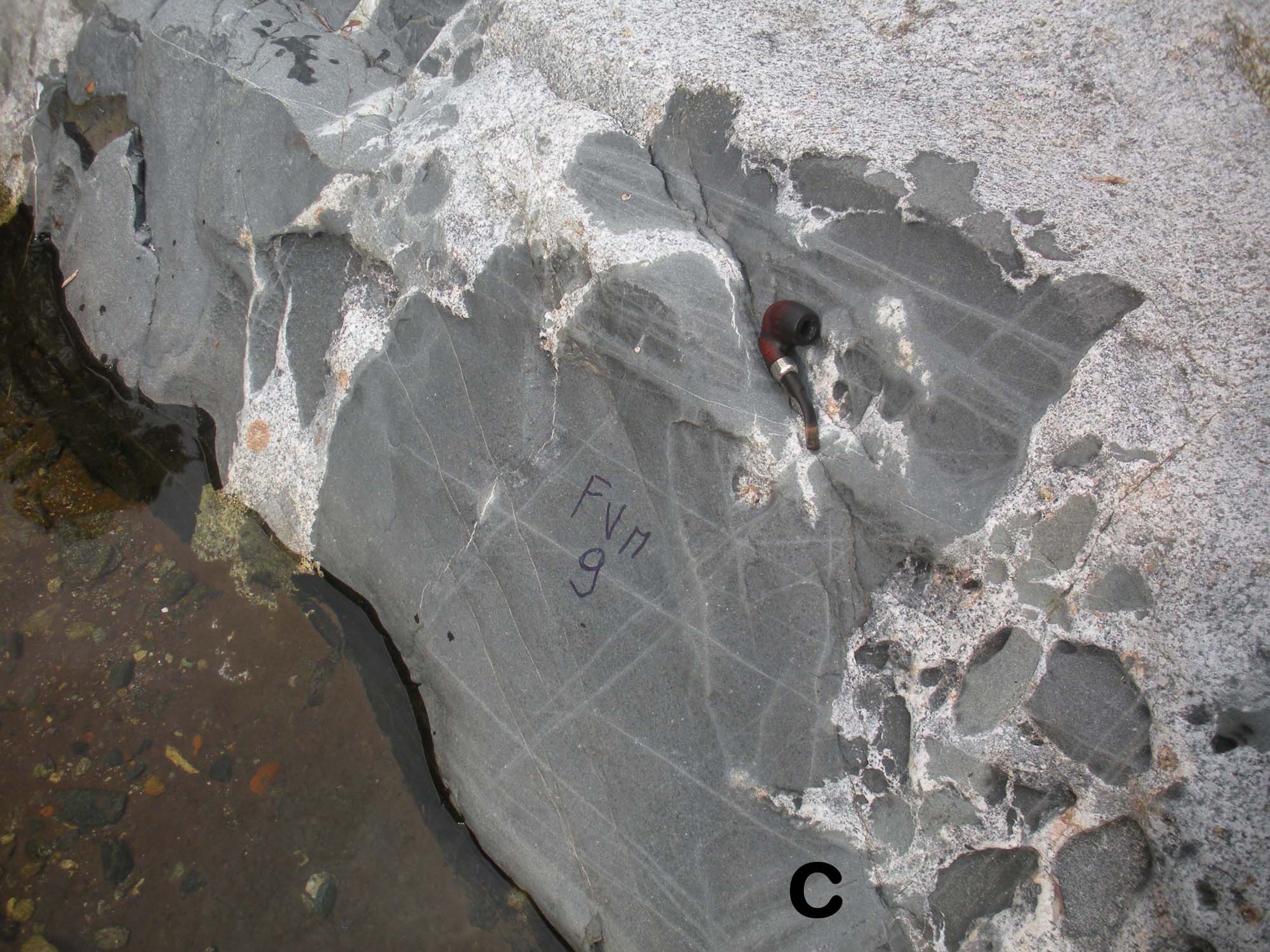
Stop 19) At the western end of Valle Mosso village, park the car close to a small church (N45 38 17, E8 07 43) and descend to the stream beneath the bridge on the main road. Walking downstream, ortho- and paragneiss in migmatite facies (Fig. A18a) are in primary contact with the base of the granitic pluton, where faintly foliated granodiorite is cross cut by aplitic and mafic dikes (Figs. A18 b and c). The outcrop is continuous for more than 200 m.
Figure A20. Orthogneiss, aplite and mafic dyke

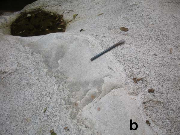
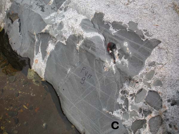
At the base of the Valle Mosso granitic pluton (Stop 19): a) orthogneiss migmatite, b) aplite dyke in granodiorite, c) mafic dyke intruded and dismembered in granodiorite.
After stop 19, the excursion will traverse the Valle Mosso pluton to reach its roof, where it is intruding volcanic rocks. The granite is monotonous, and the distinction between lower and upper Valle Mosso, defined solely on the basis of chemistry, is hardly detectable in the field. Follow the road to Ponzone (en route an easy brief stop may be made in a small quarry inside the town, at N45 39 08.9 E8 10 59.2, to see an aplitic dike cross-cutting the granite) and than turn to the right in direction of Baltigati and continue towards San Bononio.
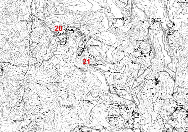
Stop 20) (N45 38 30; E8 13 13) The upper Valle Mosso granite becomes granophyric approaching the contact with volcanic rocks.
Stop 21) After San Bononio, stop the car at the hairpin turn (N45 38 13; E8 13 36) and follow the path to the West towards an abandoned quarry (less than 100 meters). Immediately after a small valley, volcanic rocks, here represented by an aphyric dacite, are clearly intruded by granite with granophyric patches. From here to the East we reenter the caldera fill.
Supplementary stop 22) If the time does allow, an additional stop may be considered to see the caldera wall, which is exposed at the northern margin of the caldera. Drive to the north-west of Borgomanero, reaching the entrance of a dirt road between Piovino and Gargallo at N 45 43 34, E 8 25 22, and follow the road for about 3 km. Park the car at a crossing (N45 43 32; E 8 23 45) and climb up hill on a wide path. Caldera fill tuffs contain stretched shreds of pumice and, immediately above, a big boulder of schist. Welded tuff reappears above the schist boulder, before reaching the basement schists at N 45 43 41, E 8 23 37.
Figure A22. Location of the caldera wall
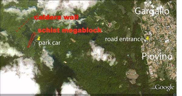
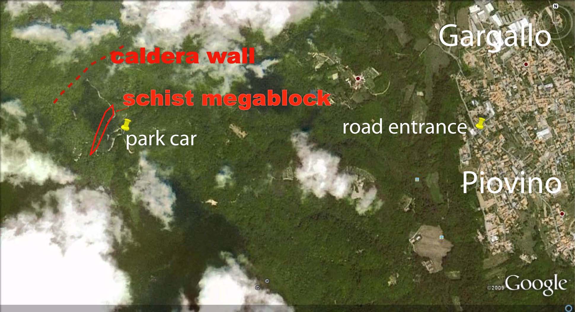
Access to the caldera wall exposure. The location of the caldera wall and of the schist block is only approximative, since mapping is in progress.