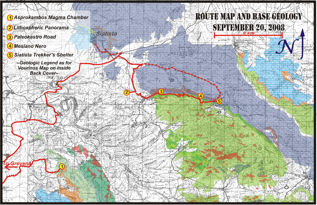
Day 6 -FINAL STOPS
The northern margin of Vourinos displays unique outcrops and views. On the Aliakmon below Asprokambos, an exceptional exposure of upper cumulates (diorites, clinopyroxenites, entrapped magma) shows a range of structures consistent with a collapsing roof of a magma chamber: syn-tectonic folding, slumping, and channeling features accompany roof pendants and ductile faults in semi-consolidated magmatic rocks.
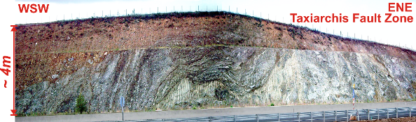
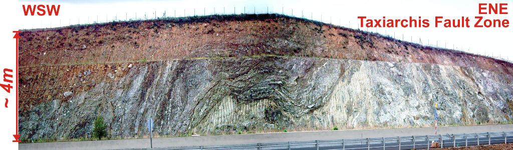
Our route passes a constrictional fault (photo below) of ophiolitic material with Mesohellenic sediments, and numerous angular unconformities within the sediments genetically related to movement on the fault zone. The fault zone exposed by highway construction, verifies a NE compressional environment into the mid-Tertiary as put forward by the late Theo Doutsos.
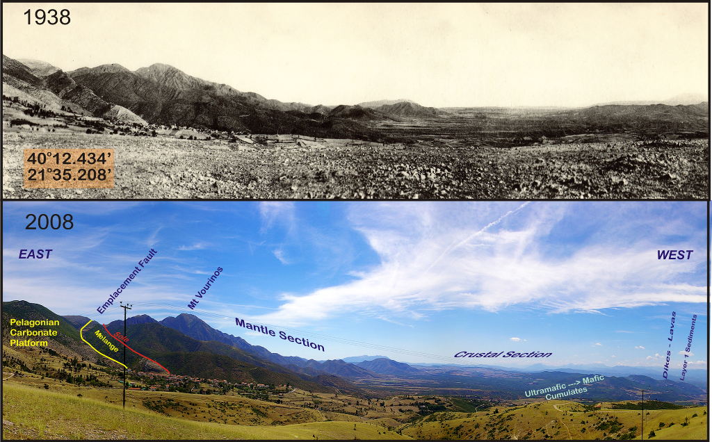
The panorama from the north, in particular that from the original site photographed by Brunn in 1938, spans the entire oceanic lithosphere preserved over Vourinos. Brunn himself was the first to note that ophiolitic rocks, in particular the cumulates and diabasic rocks of Vourinos, were alike to those of the mid-Atlantic ridge described by Ewing et al in the mid 1950’s.
From the village of Paleokastro, a route up to the valley of Mesiano Nero traces the northern emplacement zone of Vourinos. No other location along the Pelagonian margin gives a better feeling for “bulldozer” tectonics: pebbly mudstone hosts 1 - 10 m-scale blocks of serpentine, lavas, cherts, and limestone. Serpentine-rich fault breccia includes limestone fragments. Deformation within the pebbly mudstone, tectonically defined morphologies of melange blocks, and pervasive duplex and ramp structures indicate eastward topping. A ductile-fabric harzburgite crops out along the base of the ophiolite.
FINAL MOTIONS
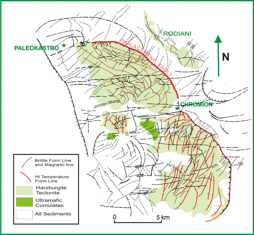
The sketch maps below denote final brittle movements of the Vourinos peridotites. The upper sketch is based on field work by L. Wright: blue lines outline major imbricates uniquely associated with the ophiolite.
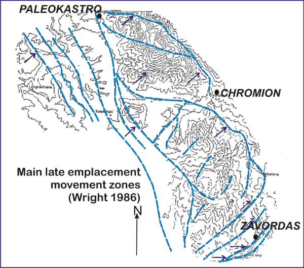
Late stage imbrication with emplacement vectors at Vourinos as determined by Wright 1986.
The lower map traces high-temperature form lines of mineral foliations (orthopyroxene and spinel) in red. Black lines are traces of magnetic lineaments: field checks show these to correlate to brittle shear zones. In particular, magnetite-rich serpentinized zones show up well under sedimentary cover. Horizontal black lines are mid-late Tertiary fault and shear systems, crossing into younger and older sediments.

Brittle structures and magnetically determined subsurface shear patterns (obscured in outcrop by sediments) of Vourinos.
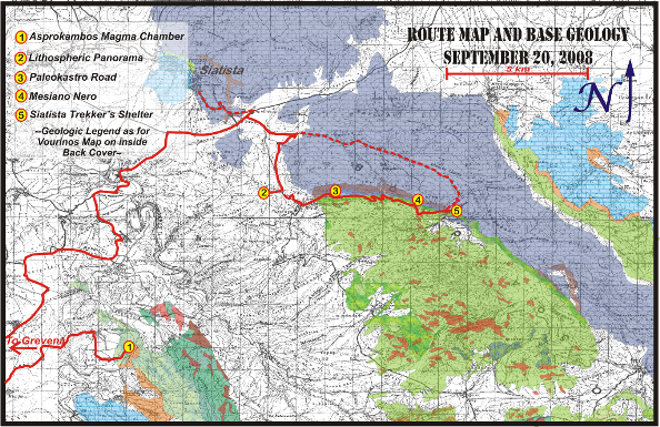
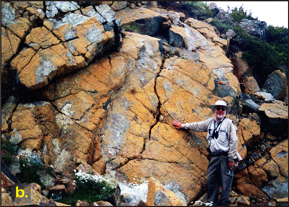
Stop 1. Vourinos Ophiolite - Asprokambos Magma Chamber
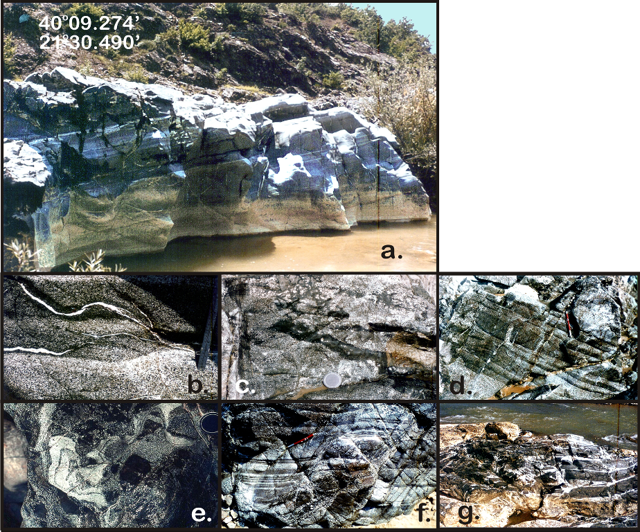
GABBRO – DIORITIC MAGMATIC CUMULATES
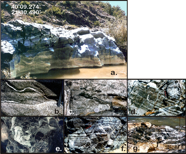
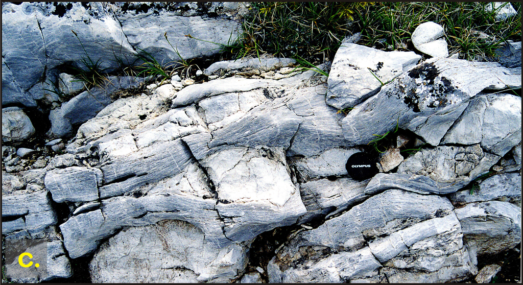
Along the Aliakmon River below Asprokambos, upper level cumulate gabbros and diorites display magmatic structures including igneous lamination and layering (photo a, b), mineral graded layers (photo b), entrapped magma (photo c), dioritic “diapirs” (photo d), igneous deformation structures such as slump folds (photo e) and igneous faults (photo f), and roof pendant structures. Further up-river, diabasic dikes penetrate and seem brecciated within felsic (noncumulate) rocks (photo g).
Consider: Unlike layered igneous intrusives (Bushveld type), ophiolitic cumulates form in an active tectonic environment. Are the features present in this exposure representative of spreading center magma chambers?
Stop 2. Vourinos Ophiolite - Lithospheric Panorama

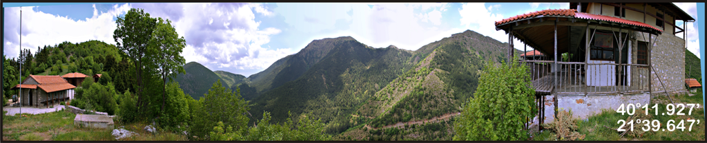
Upper panorama of Vourinos Complex by Jan Brunn, 1938. Lower panorama by Rassios, 2008.
Jan Brunn first shot the panorama of the entirety of the ophiolite section in 1938 using a bellows camera with glass plates instead of film. This was ~40 years before the acceptance of ophiolites as representatives of oceanic lithosphere. The panorama spans 12 km, from the emplacement zone to the E, through mantle, “moho”, cumulates, dikes, lavas and sedimentary section in the west.
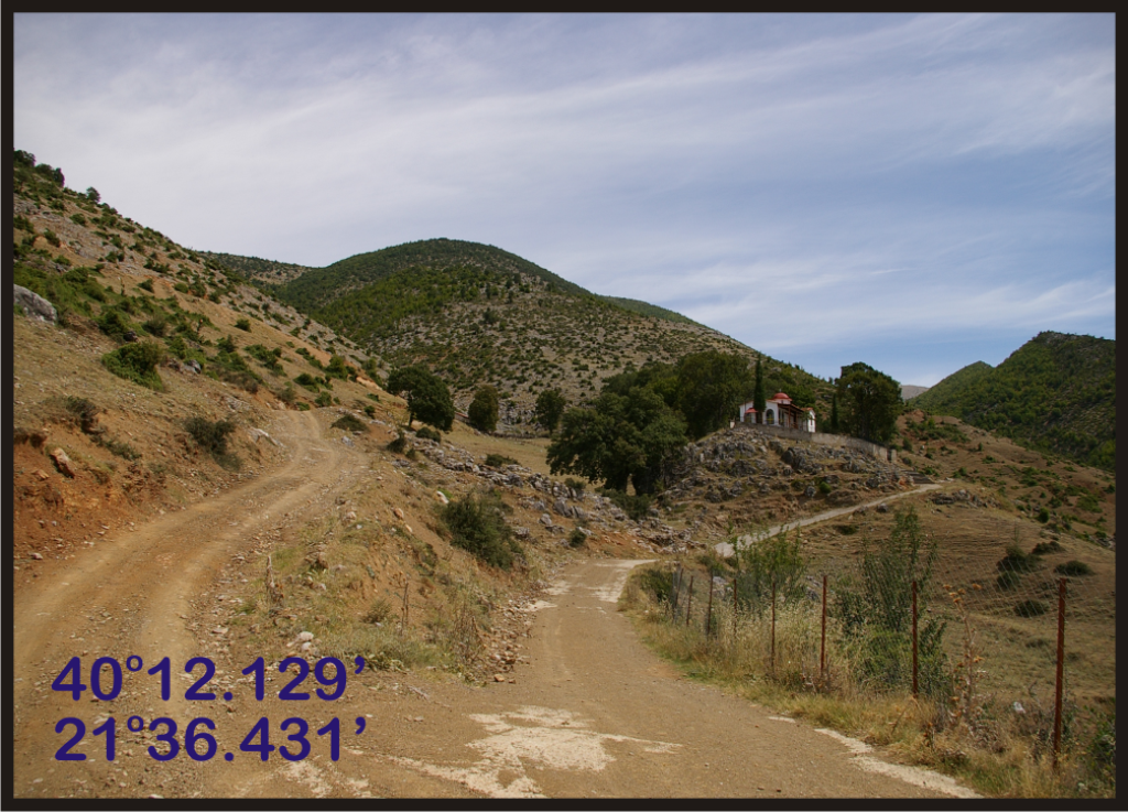
Stop 3. Vourinos Ophiolite - Paleokastro Road
NORTHERN EMPLACEMENT ZONE
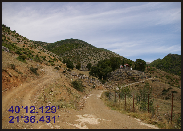
General view of track leading 4 km along Vourinos emplacement zone above Paleokastro.

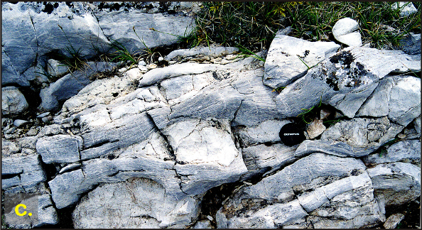
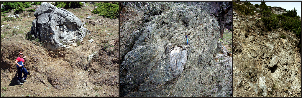
Left: Limestone in mudstone mélange. Middle: Tectonically incorporated limestone block surrounded by serpentinite in melange. Lower: Banded appearance of deformed mélange.
Several stops can be made along the road from Paleokastro Village to the Mesiano Valley. The road parallels the northern continuation of the Vourinos emplacement fault for a distance of about five km. Pelagonian Tr-Jr platform carbonates crop out along the ridge to the east; mantle harzburgite crops out on a lower ridge to the west. Between these, the Ayios Nikolas Mélange (~0.5 km wide in map exposure) includes tectonically incorporated blocks of carbonates, lava, and cherts: parallel to the road is a slice of loferitic / mylonitic carbonate about 5000 by 200 m in area. Initial outcrops include pebbly mudstones hosting blocks of lavas and Tr-Jr carbonates. In addition to fault gauge in lower temperature emplacement parallel faults, slickensides along several carbonate faces could date to original emplacement deformation.
Stop 4. Vourinos Ophiolite - Mesiano Nero

Mesiano Nero is a saddle where the ophiolite and Pelagonian basement are separated by <200 m of Ayios Nikolas Melange. The large included sliver of loferitic limestone becomes mylonitic with boudins indicative of lateral extension. The basal harzburgite is more mylonitic than elsewhere at Vourinos, and a thin mylonitic-cataclastic zone crops out along the base of the ophiolite.
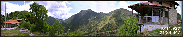
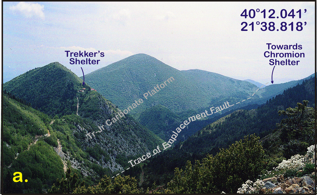
Stop 5. Vourinos Ophiolite - Siatista Trekkers Shelter
Our final site gives us a chance to view the spectacular panorama of Vourinos and the valley tracing its emplacement. The area is an environmental preserve, and we’d like to point out the contribution the paleo-suture zone plays in this unique setting. Tr-Jr Pelagonian platform carbonates to the east provide soil constitutents of Ca, K, and not much else: note the lesser amount of vegetation there. Vourinos ultramafics generate Fe, Mg, and Si and a variety of trace soil nutrients, but lack essential constituents such as Ca and N: the harzburgite mountains are also relatively barren. However, where the soils mix along the base of the valley, the vegetation is rich, and includes several endemic plant species unique to the valley.