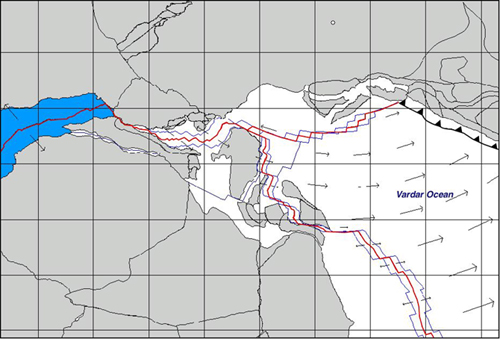
This episode comprises, as the previous one, a single stage. The time interval is located between 170.0 Ma (Uppermost Bajocian) and chron M25 (154.3 Ma, Oxfordian-Kimmeridgian boundary) and is characterized by slower spreading rates, ranging from the 45 mm/yr of the southern Central Atlantic to the 23 mm/yr of the Liguride Ocean, where 380 Km of new oceanic crust were formed between the passive margins of Eurasia and Adria. The modeled isochrons and the velocity field at the upper limit of this stage are illustrated in Figure 7. This map also shows the amount of new Tethyan crust that was created. During this time interval Iberia remained attached to Laurasia, while a wide shear zone accommodated left-lateral motion with respect to Morocco.
Figure 7. Reconstruction at 154.3 Ma (Upper Oxfordian)
Vectors represent direction and magnitude of the relative velocity field between conjugate pairs of plates. Blue line represents the modeled 172.0 Ma and 170.0 Ma isochrons. The location of the instantaneous Euler pole of relative convergence between Vardar and Eurasia is marked by a small empty circle.
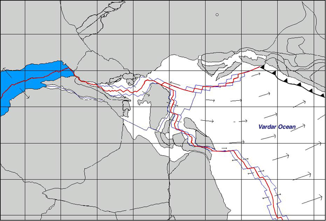
The acceleration field that determined a stage transition at chron M25 is illustrated in Figure 8. It can be described as a northward acceleration of Eurasia that was balanced by a reorientation of the transform faults in the Inner Tauride Ocean and in the Liguride Basin.
Figure 8. Acceleration field at 154.3 Ma (Upper Oxfordian)

Vectors represent direction and magnitude of the relative acceleration field of Africawith respect to Iberia and Eurasia with respect to Africa. The instantaneous Euler pole of acceleration of Eurasia with respect to Africa is marked by an empty circle.