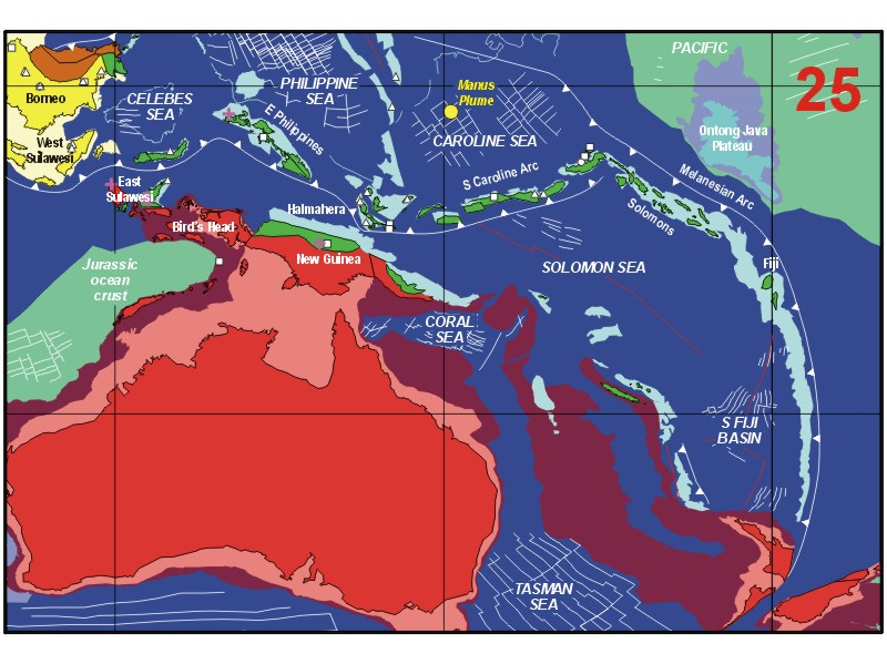
The present geometry of subduction around the north Australian margin is very complex and there are numerous slabs with very varied orientations (e.g. Cardwell and Isacks, 1978; Pegler et al., 1995; Spakman and Bijwaard, 1998). There are now about ten years of accumulated GPS observations from this complex region (e.g. Puntodewo et al., 1994; Tregoning et al., 1998; Larson et al., 1999; Rangin et al., 1999a; Kreemer et al., 2000). They show that within the region there are many plate boundaries and plates with very high rates of motion. Seismicity (McCaffrey, 1996), tomography (Spakman and Bijwaard, 1998), palaeomagnetism and the distribution of volcanic activity indicate the existence of numerous microplates, some of which formed rapidly, were destroyed during short time intervals, and in many cases rotated rapidly in similar short time intervals. Spreading rates of these small oceanic microplates are often very high, for example, the Bismarck Sea and the Woodlark Sea opened rapidly in the last few million years. Convergent rates in many areas in the region are amongst the highest on the present-day globe, as at the southern end of the Philippine Trench and at the New Britain Trench. Some ocean basins, such as the Woodlark Basin, are even subducted as they spread. Many of the small oceanic basins and plates have life expectancies of less than 15 Ma. Even volcanic arcs may have disappeared during collision as illustrated by overriding of the Halmahera Arc by the Sangihe Arc in the Molucca Sea.
In the Banda Sea region (Figure 3) seismicity indicates a complex subduction situation with an Indian Ocean slab dipping north extending to more than 600 km, and a second subducted slab dipping southwest beneath Seram which extends to at least 300 km depth (McCaffrey, 1989). The BirdÕs Head of New Guinea is now broadly moving with the Pacific Plate. There are very high rates of convergence between the BirdÕs Head and Seram by underthrusting at the Seram Trough. The Australia-Asia boundary is a complex region of disconnected fractures in the Banda Sea and there is south-dipping thrusting in the Wetar region (McCaffrey, 1988; McCaffrey et al., 1995). The present Australian-SE Asia Plate boundary appears to be on the north side of the volcanic arc extending from the Flores Sea through to the north of Wetar. The South Banda Basin formed very recently and there is increasing evidence for a Neogene age from interpretation of magnetic anomalies (Hinschberger et al., 1999) and dredging (Honthaas et al., 1998). Heatflow (van Gool et al., 1987) and dredged samples (RŽhault, 1994) also indicate a young age for the North Banda Basin. On the south side of the Banda Sea the Banda volcanic arc collided with the Australian margin in the Pliocene terminating northward subduction in the Timor sector (Audley-Charles, 1986; Harris, 1991). Plate boundaries have clearly changed rapidly in this region in the last few million years.
Figure 3. Banda Sea
Geography and principal tectonic features of the Banda Sea and surrounding regions with volcanoes from the Smithsonian database.
The Philippine Arc terminates southwards in the Molucca Sea collision zone where the opposed Halmahera and Sangihe Arcs are actively converging (Figure 4). The Molucca Sea Plate dips east under Halmahera and west under the Sangihe Arc in an inverted U-shape (McCaffrey et al., 1980). Seismicity indicates approximately 200-300 km of lithosphere subducted beneath Halmahera and the west-dipping slab can be identified to a depth of at least 600 km beneath the Sangihe Arc. Tomography suggests possibly greater lengths for the subducted slabs (Spakman and Bijwaard, 1998; Rangin et al., 1999b). North of Halmahera the Philippine Sea Plate is subducting to the west (Cardwell et al., 1980) in a young subduction zone; here too plate boundaries have moved rapidly in the last few million years.
Figure 4. Molucca Sea

Geography and principal tectonic features of the Molucca Sea and surrounding regions with volcanoes from the Smithsonian database.
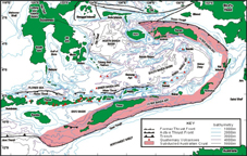
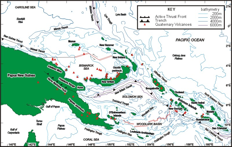
Up to five separate plates have been postulated in the region between the Manus Trench and the Pocklington Trough (Figure 5). GPS measurements indicate the existence of the South Bismarck, Woodlark and Solomon Sea Plates (Tregoning et al., 1998), and the Manus Trench and Trobriand Trough may mark former plate boundaries. Active and very rapid northward subduction of the Solomon Sea is occurring beneath the South Bismarck Plate to form the New Britain Arc. West of the Solomon Sea seismicity suggests an over-ridden double subduction zone similar to that of the Molucca Sea beneath New Guinea (Cooper and Taylor, 1987; Pegler et al., 1995). At the northern end of the New Britain Arc a complex pattern of strike-slip faults link the Bismarck Sea spreading centre to the Pacific Plate boundary. Both the Woodlark Basin and Bismarck Sea are actively spreading oceans. Once again, a notable feature of the Bismarck-Woodlark region is the rapid changes in tectonic boundaries during the last 5-6 Ma.
Figure 5. Bismarck Sea and Woodlark Basin
Geography and principal tectonic features of the Bismarck Sea and Woodlark Basin and surrounding regions with volcanoes from the Smithsonian database.