SE Asia and the SW Pacific include two major continental regions, Sundaland-Eurasia (Figure 1) and Australasia (Figure 2), separated by oceanic plates (Hamilton, 1979; Yan and Kroenke, 1993). The western Pacific is a mosaic of oceanic plates and within the very wide plate boundary zones are numerous small fragments of oceanic, arc and continental character. These include true plates, for example those formed at spreading centres, as well as microplates and tectonic blocks which have been fragmented by collision, subduction-related processes, strike-slip faulting, and extension within the convergent regions. Many authors have looked to this region for examples of processes that may have contributed to development of ancient orogenic belts (e.g. Silver and Smith, 1983; Snyder and Barber, 1997; van Staal et al., 1998),, and those working in the region require a context for the tectonic processes they observe. However, a grasp of the development of this region is extremely difficult to acquire because of the number of plates and smaller tectonic fragments and the speed and complexity of their motions. Animations can help to provide context, explanation and insights into the development of the region. They may in particular help understand the setting of magmatic activity which has in places led to economic mineral deposits but elsewhere has not. In New Guinea the origin of several of the large young centres of mineralisation remains enigmatic (e.g. Richards et al., 1990; MacDonald and Arnold, 1994; Mertig et al., 1997; Meinert et al., 1997; Macpherson and Hall, 1999). Rapid changes in the tectonic configuration of plate boundaries during the Cenozoic may have affected the nature of magmas and the character of fluids moving through the crust.
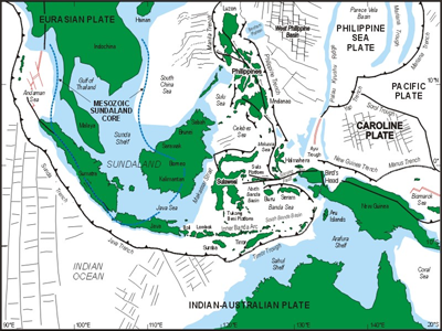
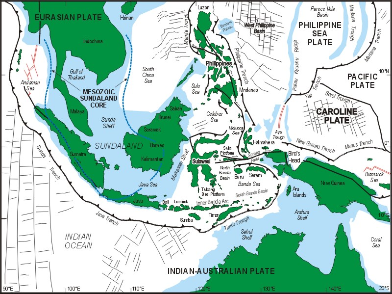
Figure 1. Region covered in the SE Asia reconstruction
Principal geographical features of the region covered in the SE Asia reconstructions. The blue shaded areas are the continental shelves of Eurasia and Australia drawn at the 200 m isobath and elevated but deeper bathymetric features in the Philippine and Caroline Sea. Red lines are active spreading centres.
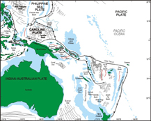
Figure 2. Principal geographical features of the region covered in the SW Pacific reconstructions.
The blue shaded areas are the continental shelf of Australia drawn at the 200 m isobath and elevated but deeper bathymetric features in the Pacific. Red lines are active spreading centres.
Click for Larger Image.