This phase comprises a single stage between 110.0 Ma (Lower Albian) and chron 34 (83.5 Ma, Santonian-Campanian boundary). A reconstruction of the velocity field at chron 34 is illustrated in Figure 17. Perhaps the most important event of this time period is represented by the establishment of a subduction zone south of Sakarya-Kirsehir, once the leading tip of this composite microplate reached the active margin of Eurasia between Armenia and Eastern Pontides. The model proposed in this paper predicts that Northern Turkey started to collide at about 87 Ma (Upper Coniacian). In order to calculate the motion of this block for subsequent times, we combined the stage pole of the surrounding oceanic plate (which was part of Africa) with an additional pole that removed the trench-normal component of velocity at the contact zone. In this way, no overlap between Northern Turkey and the Eurasian margin was allowed, and the resulting motion was simply a right-lateral translation along the trench of the leading edge and an additional clockwise rotation of the other points. Of course this mechanism required the establishment of a new zone of convergence at the southern margin of Sakarya-Kirsehir, where the Inner Tauride Ocean initiated to subduct. Geologic data from the Tuzgölü Basin of Central Turkey, Sakarya and the Pontides substantially confirm the model proposed here [Görür et al., 1984, and references therein ; Yilmaz et al., 1995]. In fact, Görür et al. [1984] describe a scenario in which north-dipping subduction of Tethyan oceanic crust under Rodophe-Pontide may have initiated during the Aptian-Albian, whereas subduction under Sakarya and Kirsehir occurred since the Cenomanian-Turonian, which is in agreement with the model proposed here.
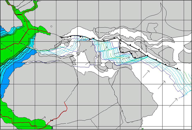
Figure 17. Reconstruction at 83.5 Ma (Santonian-Campanian boundary)

Vectors represent direction and magnitude of the relative velocity field between conjugate pairs of plates. Blue lines represent the modeled 172.0 Ma, 170.0 Ma, M25, M21, M16 and M10 isochrons. The 130.0 Ma, M4 and M0 isochrons are indicated in green. The location of the Euler pole of relative convergence between Africa and Eurasia is marked by a small empty circle.
An interesting feature of the reconstruction at chron 34 is associated with the progressive approach of the south-dipping Alpine subduction zone to the Rodophe-Pontide trench (Fig. 17). At the Santonian-Campanian boundary the length of the transform fault that connected these two systems was strongly reduced, giving rise to a complex subduction zone characterized by reversal of subduction polarity, similar to some present day zones of subduction of Southeast Asia and Western Pacific (e.g., the Solomon-San Cristobal trench system).
Flysch sedimentation became widespread in the South Alpine region from the Turonian [Castellarin, 1976 ; Bichsel and Häring, 1981 ; Bernoulli et al., 1981 ; Bernoulli and Winkler, 1990]. The direction of transport of these terrigenous turbidites suggests a northern provenance, possibly from a trench-forearc system comprising Austroalpine units. At the western end of the Alpine trench, oblique subduction of the Valais Ocean under Corsica continued at a rate of ~8 mm/yr for the whole stage. This process, as well as further spreading in the Biscay Bay, was clearly related to the continuation of counterclockwise rotation of Iberia with respect to Eurasia.
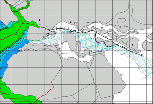
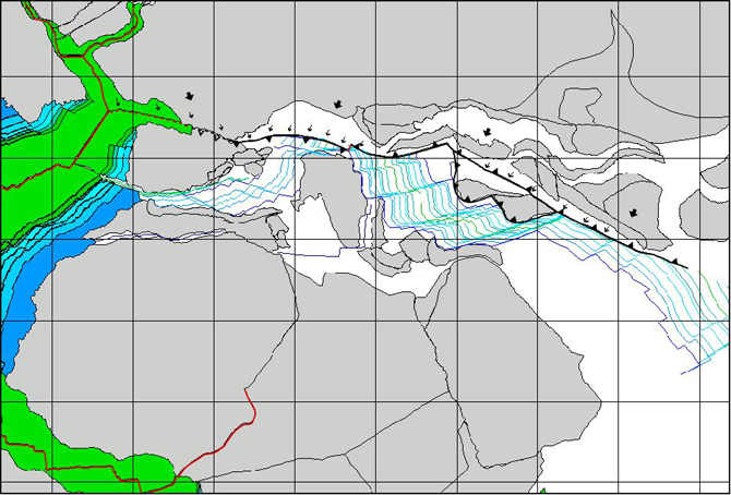
The pattern of the acceleration fields at 83.5 Ma is illustrated in Figure 18. It indicates ridge compression in the Biscay Bay, hence the extinction of the corresponding spreading center. In the Mediterranean region the whole system of subduction zones was subject to compression. Therefore, the next stage began with a plate tectonic configuration of the Tethyan realm characterized by instability of the trench systems.
Figure 18. Acceleration field Eurasia with respect to Iberia and Africa at 83.5 Ma (Santonian-Campanian boundary)
Empty barbs represent incipient subduction zone. Dotted line indicates ridge extinction.