Important plate motion changes occurred in SE Asia and the West Pacific at about 45 Ma, 25 Ma and 5 Ma. Of these the 25 Ma reorganisation is the most important and the animation begins at that time. Before then Australia had been moving north in an apparently simple way, with north-dipping subduction beneath SE Asia and the Philippine-Halmahera-Caroline arcs. East of Australia there was subduction of the Pacific plate, broadly to the west and SW, associated with slab rollback and considerable backarc extension forming the Solomon Sea and Fiji basins. Viewing of the animation should accompany the following brief summary of the development of the north Australian margin between east Indonesia and the Pacific since 25 Ma.
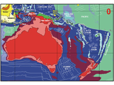
Australia and SE Asia made contact at about 25 Ma (Figure 7). Collision-related deformation in Sulawesi dates from the late Oligocene-early Miocene. Sub-ophiolite metamorphic rocks indicate late Oligocene intra-oceanic thrusting and early Miocene subduction (Hall and Wilson, 2000). Ophiolites were clearly obducted in SE Sulawesi during the early Miocene and unconformable contacts indicate emergence. There was collision between the Philippines-Halmahera-South Caroline Arc with the New Guinea margin at about 25 Ma (Dow, 1977; Jaques and Robinson, 1977; Pigram and Davies, 1987; Hill and Raza, 1999) which required a change in plate boundaries at the southern edge of the Philippine Sea Plate (Hall et al., 1995). Northward subduction of the oceanic crust ceased and a major left-lateral strike-slip boundary developed through northern New Guinea. From this time arc terranes were translated westwards along the margin within the strike-slip system and fragments of continental crust were sliced from the BirdÕs Head and moved west to collide in Sulawesi. The Ontong Java Plateau also collided with the Melanesian Arc after 25 Ma (Petterson et al., 1997, 1999). The reconstructions show the final contact at about 18 Ma but the full extent of the Ontong Java Plateau before termination of subduction is not known. The term Ôsoft collisionÕ has been used to describe shortening of the leading edge of the Ontong Java Plateau and thrusting of part of the plateau into the Solomon Islands which took place before 18 Ma. From 25 Ma the arcs extending from Melanesia to the Philippines became effectively coupled to the Pacific Plate. The arc terranes moved in a clockwise direction and the Philippine Sea and Caroline Sea Plates rotated around the western Pacific at the margin of what is effectively a great Pacific Plate as suggested by some of the mobilist pioneers (Carey, 1958; Holmes, 1965).
Figure 7. Reconstruction at 25 Ma.

The East Philippines-Halmahera-South Caroline Arc collided with the Australian Plate at the north New Guinea margin and the Ontong Java Plateau began to collide with the Melanesian Arc. On Figures 7 to 10 the filled white circles, triangles and squares are isotopic ages of igneous rocks from our database which includes Indonesia, New Guinea and the Philippines. Magenta crosses are isotopic ages from metamorphic rocks. Horizontal grid lines are the equator and 30¡S, and vertical grid lines are 120¡E, 150¡E and 180¡E.
From 25 Ma until about 12 Ma much of the sector between Sulawesi and Fiji was dominated by strike-slip faulting and local subduction. Although Australia was moving northwards, the clockwise rotation of the Philippine Sea and Caroline Sea Plates to the north meant that the boundary remained essentially zone of strike-slip. Because of the position of the rotation poles the strike-slip boundary was moving north at the same rate as Australia. Localised transpression and transtension in this zone are likely but cannot yet be reconstructed because of our inadequate knowledge of the regional geology. Very small changes in positions of Euler poles, non-rigid behaviour of fragments, and other sources of errors could allow even more complexity than already in the model which is likely to be an over-simplification.
This situation changed dramatically at about 12 Ma (Figure 8). West of New Guinea Jurassic ocean crust reached the Sunda trench and began to subduct. The great age of the ocean crust north of the NW Shelf compared to that subducting further west (mainly Cenozoic with some Cretaceous crust) caused the Sunda trench to propagate rapidly east as the Jurassic slab fell away into the mantle. The subduction hinge retreated rapidly as the slab rolled back, and the rollback induced major extension in the upper SE Asian plate. Extension had begun by 10 Ma, and led to melting (Linthout et al., 1996, 1997) which I interpret as a response to rapid decompression, extension-related metamorphism, initial arc volcanism contaminated by continental crust (Honthaas et al., 1999), arc splitting and finally backarc basin spreading forming the South Banda Sea from about 6 Ma.
Figure 8. Reconstruction at 12 Ma.

Jurassic ocean crust arrived at the trench south of Sulawesi. Eastward subduction of the Molucca Sea had begun. The New Guinea terranes moved in a wide left-lateral strike-slip zone. Subduction of the Solomon Sea was underway beneath eastern New Guinea margin to form the Maramuni Arc. To the east of New Guinea subduction began on the east side of the Solomon Sea to initiate the New Hebrides Arc.
To the east of New Guinea a new subduction zone developed on the east side of the Solomon Sea beneath the New Hebrides. It is not clear why this subduction zone developed in the opposite direction to the already subducting Pacific slab. Another important east-dipping subduction zone developed at about the same time, beneath Halmahera, when west-directed subduction of the Molucca Sea (part of the Philippine Sea Plate) was already established. It may be that the westward motion of the Philippine Sea and Caroline Sea Plates to the north of Australia were impeded by collision in the strike-slip zone in New Guinea, or at its western end in the Sulawesi-Banda region, or by initiation of subduction of the Jurassic Banda Sea. Whatever the cause, east-dipping subduction began at the New Hebrides Trench, and there was extension in the North Fiji region as the Solomon Sea slab rolled back with rotation of the New Hebrides arc (Musgrave and Firth, 1999). By 10 Ma the older southwest-directed subduction of the Solomon Sea at the Marumuni arc in eastern New Guinea was linked by a transform fault crossing the Solomon Sea to the new east-dipping subduction which produced the New Hebrides Arc. The Solomon Sea was then rapidly reduced in size by subduction on both its east and west sides. Development of the New Hebrides Arc led to a complex pattern of oceanic spreading in the North Fiji Basin (Auzende et al., 1995). There were ridge jumps, rotation of the Fiji Islands, and later rifting at the northern end of the Kermadec-Tonga Arc.
Within a short period the New Hebrides Trench propagated north to initiate subduction beneath the Solomons and the New Britain Arc. Subduction ceased along its southern edge leaving the Trobriand Trough as a relict trench. Subduction was now primarily at the northern side of the Solomon Sea beneath the New Britain Arc which was converging on the eastern New Guinea margin. This left the inverted U-shaped slab in the mantle beneath eastern New Guinea. The changing balance of forces on the Solomons Sea Plate caused spreading to initiate at or close to the former transform fault leading to spreading in the Woodlark Basin. The Woodlark rifting propagated rapidly west (Benes et al., 1994; Taylor et al., 1995; 1999) along the centre of the former arc, ripping open the Papuan peninsula and forming core complexes in advance of the propagating tip (Baldwin et al., 1993).
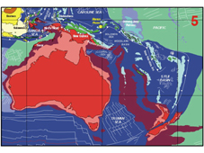
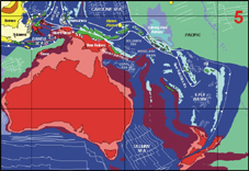
There was another regional change in plate motions at about 5 Ma (Figure 9) although the cause is obscure. South of the Bird's Head the rapid hinge retreat continued and there was movement of the trench towards the Australian margin which maintained the extension of the Banda Sea region. The active volcanic arc was split as the South Banda Sea began spreading as a backarc basin. At about 3 Ma the volcanic arc came into collision with the Australian margin in the region of Timor. Spreading ceased in the South Banda Sea and the volcanic arc became coupled to the Australian margin in the Outer Banda Arc region around Timor. After collision, new plate boundaries developed north of the arc in the Flores-Wetar Sea and to the north of the South Banda Sea.
Figure 9. Reconstruction at 5 Ma.

The arrival of Jurassic ocean crust at Sunda-Java trench caused rapid hinge rollback in eastern Indonesia, resulting in young volcanism in the Inner Banda Arc, and oceanic spreading in the Banda Sea. Bismarck Sea opening began. Slab pull forces caused spreading in the Woodlark Basin. Hinge retreat at the New Hebrides Trench was accompanied by the rotation of Fiji.
In north New Guinea the arc terranes were close to their present-day (Figure 10) positions, requiring little but rotation and minor translation (e.g. Abbott, 1995; Weiler and Coe, 2000) within a transpressional left-lateral fault zone. The limited and poorly-defined subduction at the New Guinea Trench and Manus Trench probably dates only from this time. At present much of the convergence between the Pacific and Australia is absorbed by distributed deformation over a very wide zone. The regions close to the BirdÕs Head are among the most complex and are still relatively poorly understood. The very limited knowledge of the Cenderawasih region, east of the BirdÕs Head, suggests another episode of rapid extension (Dow et al., 1985). Part of Cenderawasih Bay may have opened by ocean spreading at this stage and there is a suggestion from very young metamorphic ages in the area of the BirdÕs Neck (Bladon, 1988) of core complex formation during the last 5 Ma.
To the east of New Guinea slab-pull by the subducting Solomon Sea slab was the cause of Woodlark Basin spreading. Ironically, this subduction, which produced the Woodlark spreading, is also subducting the Woodlark Basin, and may lead to its complete elimination. It may well be difficult to infer the existence of the Woodlark Basin in another 5 Ma. To the north the Manus plume (Macpherson et al., 2000) arrived at approximately its present-day position within the New Guinea sinistral fault system at around 5 Ma (Macpherson and Hall, 2001) and the conjunction of plume and strike-slip faulting may have promoted rapid spreading in the Bismarck Sea which began at about 5 Ma (Taylor, 1979) in a setting which resembles a large pull-apart.
Figure 10. Present tectonic configuration.

Arc-continent collision in the Timor region has caused subduction reversal north of Timor and between Seram and the BirdÕs Head. East of New Guinea the Woodlark Basin spreading centre propagates west but the basin is being subducted at its eastern edge at a similar rate.