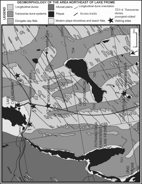
This excursion aims to give an introduction to Quaternary aeolian landscapes on a visit to the dunefields just northeast of Lake Frome (Figure 2). It will involve a brief stop to examine typical playa sediments at the southern edge of Lake Callabonna. An introduction to the identification of aeolian landforms will follow upon entering the southern Strzelecki Desert dunefield, including visits to transverse, parabolic and both active and stable longitudinal dunes. The Quaternary landscape history will be discussed, and current landscape processes observed, including badlands erosion.
Figure 2. Dune map.
Dune map.
Map of the area northeast of Lake Frome, including the four transverse dunes and their close relationship with the longitudinal dunes. Sites to be visited are marked by a star.